geo.wikisort.org - Mountains
The Koryak Mountains or Koryak Highlands (Russian: Корякское нагорье) are an area of mountain ranges in Far-Eastern Siberia, Russia, located in Chukotka Autonomous Okrug and in Kamchatka Krai, with a small part in Magadan Oblast. The highest point in the system is the 2,562-metre high (8,406 ft) Mount Ledyanaya, located in the Ukelayat Range,[2] in the central part of the mountains.[3]
| Koryak Mountains | |
|---|---|
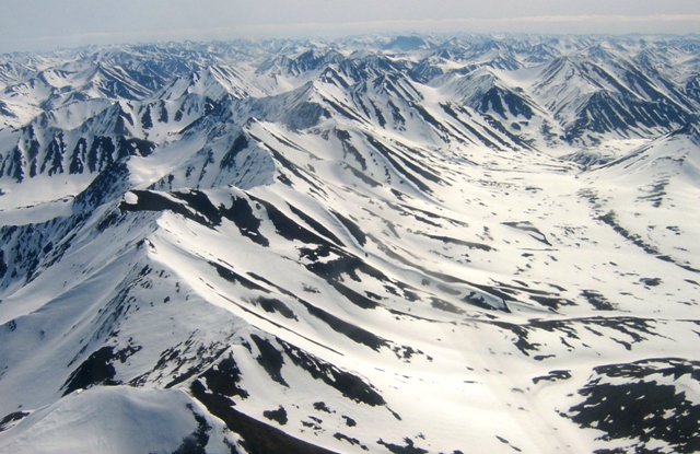 View of one of the ranges. | |
| Highest point | |
| Peak | Ledyanaya |
| Elevation | 2,562 m (8,406 ft) |
| Coordinates | 62°30′N 172°00′E |
| Dimensions | |
| Length | 880 km (550 mi) NE/SW |
| Width | 270 km (170 mi) NW/SE |
| Geography | |
 Koryak Mountains Location in the Far Eastern Federal District, Russia | |
| Location | Chukotka Autonomous Okrug / Kamchatka Krai, Russian Far East |
| Parent range | East Siberian System |
| Geology | |
| Orogeny | Alpine orogeny |
| Age of rock | Cenozoic, Mesozoic |
| Type of rock | Ophiolites[1] |
Geography
The Koryak Mountains rise south of the Anadyr River, and northeast of the Kamchatka Peninsula. The Koryak Highlands are one of the largest glacial systems in the northern part of the Russian Far East. There are numerous glaciers and ice fields in some of the ranges, with a total surface of 303.5 km2 (117.2 sq mi).[4][5]
Subranges
The system of the Koryak Mountains comprises a number of subranges,[6] including:
- Vetvey Range, highest point 1,640 metres (5,380 ft)
- Vaeg Range, highest point 1,226 metres (4,022 ft)
- Pakhachin Range, highest point 1,715 metres (5,627 ft)
- Apuk Range
- Vatyna Range
- Penzhina Range, highest point 996 metres (3,268 ft)
- Gizhigin Range, highest point 1,059 metres (3,474 ft)
- Ichigem Range, highest point 1,465 metres (4,806 ft)
- Pylgin Range, highest point 1,355 metres (4,446 ft)
- Olyutor Range, highest point 1,568 metres (5,144 ft)
- Neprokhodimy Range, highest point 1,450 metres (4,760 ft)
- Southern Mayn Range, highest point 1,265 metres (4,150 ft)
- Snegovoy Range, highest point 1,712 metres (5,617 ft)
- Pikas Range, highest point 1,106 metres (3,629 ft)
- Ukelayat Range, highest point 2,562 metres (8,406 ft)
- Komeutyuyam Range, highest point 1,142 metres (3,747 ft)
- Koyverelan Range, highest point 1,077 metres (3,533 ft)
- Rarytkin Range, at the northern end, close to Lake Krasnoye.
- Ukvushvuynen Range, highest point 1,423 metres (4,669 ft), the easternmost, close to Lake Pekulney.
Rivers
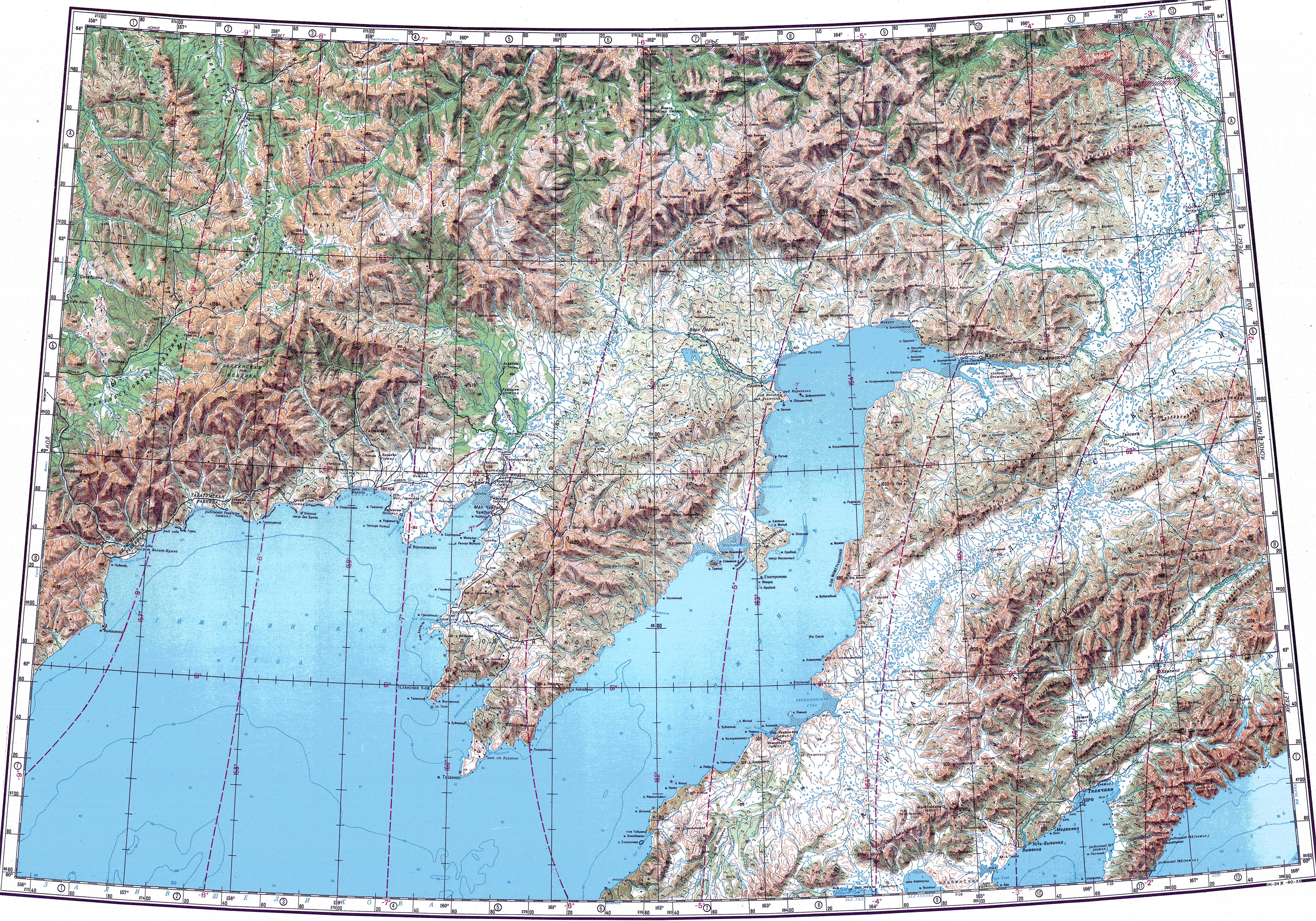
Rivers Main, Khatyrka, Velikaya and Ukelayat, as well as the Penzhina, with its Oklan and Belaya tributaries, are among the main watercourses of the Koryak Mountains.[7]
See also
- Shirshov Ridge
References
- Yldrim Dilek, Paul T. Robinson, Ophiolites in the Earth History, Geological Society, vol. 218, London, 2003
- Rundqvist N. Caprice of the wandering finger: Koryak Highlands // Walking Wide. - Yekaterinburg: Quist, 2014 .-- 576 p.
- "Koryak Highlands". Great Soviet Encyclopedia : [in 30 vols.] / Ch. ed. A.M. Prokhorov . - 3rd ed. - M .: Soviet Encyclopedia, 1969-1978
- Osipova G. B. Koryak Highlands (glacial system) glaciers and snowfields // Popular Science Encyclopedia “Water of Russia”. Archived on May 31, 2019
- Water of Russia - Корякское нагорье (ледниковая система)
- Oleg Leonidovič Kryžanovskij, A Checklist of the Ground-beetles of Russia and Adjacent Lands. p. 16
- "Топографска карта P-57_58 - Topographic USSR Chart (in Russian)". Retrieved 25 February 2022.
External links
 Media related to Koryak Mountains at Wikimedia Commons
Authority control | |
|---|---|
| General |
|
| National libraries | |
This Russian Far East location article is a stub. You can help Wikipedia by expanding it. |
На других языках
[de] Korjakengebirge
Das Korjakengebirge (russisch Корякское нагорье) befindet sich im Föderationskreis Ferner Osten im äußersten Osten von Russland (Asien).[1]- [en] Koryak Mountains
[fr] Monts Koryak
Les monts Koryak (en russe : Корякское нагорье, en caractères romans Koryakskoïe Nagor’ye ) sont une chaîne de montagnes de la Sibérie orientale, en Russie, située au sud du fleuve Anadyr, et au nord-est de la péninsule du Kamtchatka. Les rivières Main et Velikaya prennent leurs sources dans cette chaîne. Le point culminant est le Ledianaïa avec une altitude de 2 562 m[1].[it] Monti dei Coriacchi
I Monti dei Coriacchi, anche conosciuti come Altopiano dei Coriacchi (russo Корякское нагорье, Korjakskoe Nagor'e) sono una catena montuosa dell'Estremo Oriente Russo.[ru] Корякское нагорье
Коря́кское наго́рье (Коря́кский хребет[1]) — нагорье на Дальнем Востоке России, расположенное на территории Чукотского автономного округа и Камчатского края[2].Другой контент может иметь иную лицензию. Перед использованием материалов сайта WikiSort.org внимательно изучите правила лицензирования конкретных элементов наполнения сайта.
WikiSort.org - проект по пересортировке и дополнению контента Википедии