geo.wikisort.org - Mountains
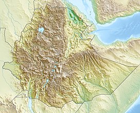
The Korath Range is a mountain range in the Southern Nations, Nationalities, and Peoples' Region of southern Ethiopia. It consists of an isolated cluster of about 20 tuff cones, many of which produced 5 km (3.1 mi) long lava flows that are dominantly basanitic and tephritic in composition. The youngest lava flow, which issued from a cone in the middle of the range, has been radiocarbon dated at 7900 BP, although a more recent radiocarbon date of between 30,000 BP and 7900-9500 BP has also been obtained.[1]
| Korath Range | |
|---|---|
 Satellite image of the Korath Range | |
| Highest point | |
| Peak | Mount Nakwa |
| Elevation | 912 m (2,992 ft) |
| Listing | List of volcanoes in Ethiopia |
| Coordinates | 5.1°N 35.88°E |
| Geography | |
| Country | Ethiopia |
| State | Southern Nations, Nationalities, and Peoples' Region |
| Geology | |
| Formed by | Tuff cones |
| Last eruption | Unknown |
The Korath Range was emplaced along the Lake Turkana Rift, a segment of the East African Rift that extends north from Kenya.[1] Mount Nakwa is the highest point of the Korath Range with a summit elevation of 912 m (2,992 ft).
See also
References
- "Korath Range". Global Volcanism Program. Smithsonian Institution. Retrieved 2021-06-18.
Текст в блоке "Читать" взят с сайта "Википедия" и доступен по лицензии Creative Commons Attribution-ShareAlike; в отдельных случаях могут действовать дополнительные условия.
Другой контент может иметь иную лицензию. Перед использованием материалов сайта WikiSort.org внимательно изучите правила лицензирования конкретных элементов наполнения сайта.
Другой контент может иметь иную лицензию. Перед использованием материалов сайта WikiSort.org внимательно изучите правила лицензирования конкретных элементов наполнения сайта.
2019-2025
WikiSort.org - проект по пересортировке и дополнению контента Википедии
WikiSort.org - проект по пересортировке и дополнению контента Википедии
