geo.wikisort.org - Mountains
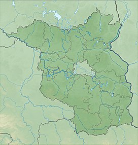
The Kmehlener Berge are a group of low hills in the south of the German state of Brandenburg within the county of Oberspreewald-Lausitz near the town of Ortrand and the village of Großkmehlen on the state border with Saxony. Their highest point, at 212.1 m above sea level (NHN),[1] is the on the Huttenberg which lies entirely within Saxony. The Kutschenberg, about 1,000 metres northeast, rises to a height of 201 m and is the highest summit and second highest point in the state of Brandenburg.
| Kmehlener Berge | |
|---|---|
| Highest point | |
| Peak | Huttenberg |
| Elevation | 212.1 m above NHN |
| Geography | |
| State | Oberspreewald-Lausitz, Brandenburg, |
| Range coordinates | 51°22′01″N 13°43′59″E |
- Map services of the Federal Agency for Nature Conservation
На других языках
[de] Kmehlener Berge
Die Kmehlener Berge sind eine Hügelgruppe im Süden Brandenburgs im Landkreis Oberspreewald-Lausitz nahe der Stadt Ortrand und der Gemeinde Großkmehlen an der Grenze zu Sachsen. Die höchste Erhebung mit 212,1 m ü. NHN[1] ist der vollständig auf sächsischem Gebiet liegende Huttenberg. Der etwa 1000 m nordöstlich davon gelegene Kutschenberg ist mit 201 m der höchste Gipfel und die zweithöchste Erhebung im Bundesland Brandenburg.- [en] Kmehlener Berge
Текст в блоке "Читать" взят с сайта "Википедия" и доступен по лицензии Creative Commons Attribution-ShareAlike; в отдельных случаях могут действовать дополнительные условия.
Другой контент может иметь иную лицензию. Перед использованием материалов сайта WikiSort.org внимательно изучите правила лицензирования конкретных элементов наполнения сайта.
Другой контент может иметь иную лицензию. Перед использованием материалов сайта WikiSort.org внимательно изучите правила лицензирования конкретных элементов наполнения сайта.
2019-2025
WikiSort.org - проект по пересортировке и дополнению контента Википедии
WikiSort.org - проект по пересортировке и дополнению контента Википедии
