geo.wikisort.org - Mountains
Khao Chang Phueak is a mountain in Thailand's Thong Pha Phum National Park.[1][2] It is in Pilok Subdistrict, Thong Pha Phum District, Kanchanaburi Province. Khao Chang Phueak is 1,249 meters (4,098 ft) in elevation[3] and it is the third highest mountain in Kanchanaburi.[4]
| Khao Chang Phueak | |
|---|---|
 | |
| Highest point | |
| Elevation | 1,249 m (4,098 ft) |
| Listing | List of mountains in Thailand |
| Coordinates | 14°43′35″N 98°23′18″E |
| Geography | |
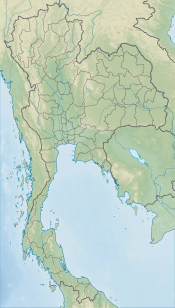 Khao Chang Phueak Location in Thailand | |
| Location | Kanchanaburi, Thailand |
| Parent range | Tenasserim Hills |

An eight-kilometer (5.0 mi) trail ascend to the mountain's summit. Visitors who intend to hike the trail must first register with Thong Pha Phum National Park officials, and the number of visitors to Khao Chang Phueak is limited to 60 persons per day.[4]
References
- "Khao Chang Phueak". peakery.com. Retrieved 2021-08-26.
- "Thong Pha Phum National Park". Tourism Authority of Thailand (TAT). Retrieved 20 November 2016.
- "Thailand's 15 most stunning mountains you need to climb before you die". bk.asia-city.com. 2017-01-28. Retrieved 2021-08-26.
- "Khao Chang Phuak". www.ceediz.com. Retrieved 2021-08-26.
Текст в блоке "Читать" взят с сайта "Википедия" и доступен по лицензии Creative Commons Attribution-ShareAlike; в отдельных случаях могут действовать дополнительные условия.
Другой контент может иметь иную лицензию. Перед использованием материалов сайта WikiSort.org внимательно изучите правила лицензирования конкретных элементов наполнения сайта.
Другой контент может иметь иную лицензию. Перед использованием материалов сайта WikiSort.org внимательно изучите правила лицензирования конкретных элементов наполнения сайта.
2019-2026
WikiSort.org - проект по пересортировке и дополнению контента Википедии
WikiSort.org - проект по пересортировке и дополнению контента Википедии