geo.wikisort.org - Mountains
Kemmelberg (English: Kemmel Hill, French: Mont Kemmel) is a hill formation in Flanders, Belgium. It is located less than a kilometer from the village of Kemmel, part of the municipality of Heuvelland in West Flanders.

History
The earliest settlements on the Kemmelberg date back 2.500 years, when Celtic tribes of the Hallstatt culture populated the area. The hill takes its name from Camulos, the Celtic god of war.

During World War I, it was the location of one of the war's most ferocious battles. Because of its strategic importance, it was fiercely fought in the Fourth Battle of Ypres. On 25 April 1918, German imperial forces, hoping to force a breakthrough to the North Sea, started attacking the French troops on the Kemmelberg with gas grenades. At 6 a.m. the German Alpenkorps seized and captured the Kemmelberg, causing allied troops to withdraw from all the hills in the region. Thousands of French soldiers were slaughtered. Several streets and army barracks in Germany were named after this event (Kemmel-Privatweg in Magdeburg, Kemmelkaserne in Murnau). Friedrich Bertram Sixt von Armin and Prince Franz of Bavaria were commanders, but Karl Höfer was celebrated as hero of Kemmelberg - the Held vom Kemmelberge.[1] It was recaptured during the Battle of the Peaks of Flanders in late September 1918, as a precursor to the Armistice of 11 November 1918.
Two war cemeteries are located to the northeast of the hill, the Kemmel Number 1 French Commonwealth War Graves Commission Cemetery and the Klein Vierstraat British Cemetery with the remains of World War I soldiers. At the top of the Kemmelberg there is a commemorative war memorial, the Monument aux soldats français, constructed in 1932 and inaugurated by French general and war hero Lacappelle. The memorial column is 17 meter high and depicts the Roman victory goddess Victoria. In the area, the monument is colloquially called "The Angel".
A NATO air defence command centre was based in an underground bunker on the southern edge of the hill in the 1950s. This now operates as a visitors centre.[2]
Cycling
Kemmelberg-East | |
|---|---|
| Location | Heuvelland |
| Start | Kemmel |
| Gain in altitude | 122 m (400 ft) |
| Length of climb | 3.0 km (1.9 mi) |
| Maximum elevation | 156 m (512 ft) |
| Average gradient | 4 % |
| Maximum gradient | 22 % |
Kemmelberg-West | |
|---|---|
| Location | Heuvelland |
| Start | Kemmel |
| Gain in altitude | 109 m (358 ft) |
| Length of climb | 2.5 km (1.6 mi) |
| Maximum elevation | 156 m (512 ft) |
| Average gradient | 4.4 % |
| Maximum gradient | 22 % |
Kemmelberg-South | |
|---|---|
| Location | Heuvelland |
| Start | Kemmel |
| Gain in altitude | 109 m (358 ft) |
| Length of climb | 1.4 km (0.87 mi) |
| Maximum elevation | 156 m (512 ft) |
| Average gradient | 7.8 % |
| Maximum gradient | 17 % |
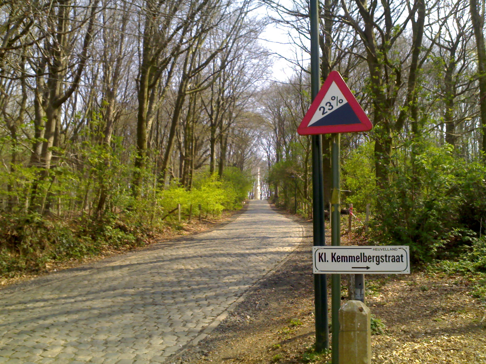
The steep cobbled roads over the hill frequently feature in cycling races, especially in the Flemish spring classics. The climb is often a decisive location in Gent–Wevelgem, but is also regularly included in the Four Days of Dunkirk, the Three Days of De Panne, Three Days of West Flanders and the Tour de l'Eurométropole. In 1950 the Kemmelberg was included in the route of the World Championship, won by Belgian local and cycling icon Briek Schotte.
Gallery
 Monument for the French soldiers
 Kemmelberg after the fights of 1918
 Bodies on the Kemmelberg
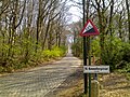 The hill's steep incline on its western ascent
 Kemmelberg today, with the Belvedere visible near its top


References
- Andreas Dornheim: Röhms Mann fürs Ausland
- "Command Bunker Kemmel". Archived from the original on 2017-10-04. Retrieved 2017-10-04.
External links
- Die Eroberung des Kemmel - Bericht des deutschen Hauptquartiers aus dem Jahre 1918
- Fotos der Eroberung des Kemmelberges
| Authority control |
|
|---|
На других языках
[de] Kemmelberg
Der Kemmelberg, auch kurz der Kemmel genannt, ist eine Erhebung nahe dem Ort Kemmel in der Gemeinde Heuvelland (Provinz Westflandern) in Belgien.[1] Der bewaldete Berg erreicht eine Höhe von 159 m und ist damit die höchste Erhebung der Provinz Westflandern. Er gehört zu einer Kette flämischer Berge. In der Nähe der Bergspitze befindet sich ein frühgotischer Turm. Am westlichen Berghang kennzeichnet ein Obelisk die Stelle einer Grabanlage für französische Soldaten, auf dem Gipfel selbst steht ein Kriegsdenkmal. Die Anhöhe und ihre Umgebung ist heute ein landschaftlich reizvolles und beliebtes Ausflugsziel. Der bis zu 23 % steile mit Kopfstein gepflasterte Anstieg ist ein Höhepunkt des Radsportklassikers Gent–Wevelgem.- [en] Kemmelberg
[fr] Mont Kemmel
Le mont Kemmel (Kemmelberg) est le point culminant de la province de Flandre-Occidentale, en Belgique. Son altitude est de 154 m. Le sommet est matérialisé par une borne géodésique de l'Institut géographique militaire, mise en place en octobre 1951, à proximité du domaine militaire. Il se situe sur la commune de Heuvelland, à 1,5 km du village de Kemmel.Другой контент может иметь иную лицензию. Перед использованием материалов сайта WikiSort.org внимательно изучите правила лицензирования конкретных элементов наполнения сайта.
WikiSort.org - проект по пересортировке и дополнению контента Википедии