geo.wikisort.org - Mountains
Karbonkelberg is a small peak forming part of the Table Mountain National Park in Cape Town, South Africa.
| Karbonkelberg | |
|---|---|
 View from the west of Duiker Point below the Karbonkelberg | |
| Highest point | |
| Elevation | 653 m (2,142 ft) |
| Listing | List of mountains in South Africa |
| Coordinates | 34°2′S 18°19′E |
| Geography | |
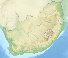 Karbonkelberg Hout Bay, South Africa | |
Geography
It forms a prominent landmark overlooking the harbour at Hout Bay.[1] An unusual feature is that sand has been blown up it by the wind, causing a dune-like feature. This has been popular with local residents to surf down it on polished boards or sheets. Its cliff on the southern side is also a famous climbing spot.
In the North it is bordered by Table Mountain National Park, comprising the Orangekloof Nature reserve and the lower slopes of Table Mountain beyond.
It is bordered by the Atlantic and Little Lions Head, Kapteins Peak and The Sentinel.
The peak is popular for short treks and mountainbiking.[2]
See also
- Cliff
References
- Karbonkelberg, South Africa Map Archived 2010-03-06 at the Wayback Machine
- Marine and coastal management
External links
 Media related to Karbonkelberg at Wikimedia Commons
- "Karbonkelberg photos". UCT Mountain & Ski Club South Africa. Archived from the original on 1 October 2006. Retrieved 3 March 2010.
На других языках
- [en] Karbonkelberg
[es] Karbonkelberg
Karbonkelberg es un pequeño pico que forma parte del parque nacional Montaña de la Mesa en Ciudad del Cabo, Sudáfrica. Constituye un prominente lugar muy conocido que domina al puerto en Hout Bay. Una característica inusual es que la arena ha sido volada por el viento, causando una característica de un parecido a una duna. Esta ha sido popular con los residentes locales para deslizarse en tablas pulidas o láminas.Текст в блоке "Читать" взят с сайта "Википедия" и доступен по лицензии Creative Commons Attribution-ShareAlike; в отдельных случаях могут действовать дополнительные условия.
Другой контент может иметь иную лицензию. Перед использованием материалов сайта WikiSort.org внимательно изучите правила лицензирования конкретных элементов наполнения сайта.
Другой контент может иметь иную лицензию. Перед использованием материалов сайта WikiSort.org внимательно изучите правила лицензирования конкретных элементов наполнения сайта.
2019-2026
WikiSort.org - проект по пересортировке и дополнению контента Википедии
WikiSort.org - проект по пересортировке и дополнению контента Википедии