geo.wikisort.org - Mountains
Kahauloa Crater is a tuff cone located in Hawaii. It sits between Koko Crater and Hanauma Bay.[1] The Koko Head Shooting Complex operates in its crater.[2]
| Kahauloa Crater | |
|---|---|
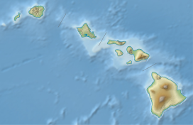 Kahauloa Crater Kahauloa within the Hawaiian Islands | |
| Highest point | |
| Elevation | 92 ft (28 m) |
| Coordinates | 21°16′35″N 157°41′23″W |
| Geography | |
| Location | Honolulu County, Hawaii, United States |
| Geology | |
| Mountain type | Tuff cone |
| Last eruption | Unknown |
Geology
Kahauloa Crater formed out of eruptions by the Koʻolau Range during its rejuvenating stage. These eruptions are known as the Honolulu Volcanic Series, which also created other nearby tuff cones such as the famous Diamond Head.
Pyroclastic units in Hanauma Bay indicate that both the craters of Hanauma and Kahauloa likely had overlapping eruptions at one point.[3]
See also
References
- "Kahauloa Topo Map in Honolulu". TopoZone. Retrieved 2020-08-04.
- Brilliant, Dave. "History | Koko Head Public Shooting Range Hawaii". Retrieved 2020-08-04.
- Rottas, K. M.; Houghton, B. F. (September 2012). "Structure, stratigraphy, and eruption dynamics of a young tuff ring: Hanauma Bay, O'ahu, Hawai'i". Bulletin of Volcanology. 74 (7): 1683–1697. doi:10.1007/s00445-012-0624-y. ISSN 0258-8900.
This Hawaiʻi state location article is a stub. You can help Wikipedia by expanding it. |
Текст в блоке "Читать" взят с сайта "Википедия" и доступен по лицензии Creative Commons Attribution-ShareAlike; в отдельных случаях могут действовать дополнительные условия.
Другой контент может иметь иную лицензию. Перед использованием материалов сайта WikiSort.org внимательно изучите правила лицензирования конкретных элементов наполнения сайта.
Другой контент может иметь иную лицензию. Перед использованием материалов сайта WikiSort.org внимательно изучите правила лицензирования конкретных элементов наполнения сайта.
2019-2026
WikiSort.org - проект по пересортировке и дополнению контента Википедии
WikiSort.org - проект по пересортировке и дополнению контента Википедии