geo.wikisort.org - Mountains
Jetnamsklumpen (Norwegian) or Jitnemensnuhkie (Southern Sami) is the highest point of Jetnamfjellet, a mountain on the border of the municipalities of Røyrvik (Trøndelag county) and Hattfjelldal (Nordland county) in Norway. The 1,513-metre (4,964 ft) tall mountain is located in the Børgefjell National Park, and it is the highest point in Trøndelag county.[2]
| Jetnamsklumpen (Norwegian) Jitnemensnuhkie (Southern Sami) | |
|---|---|
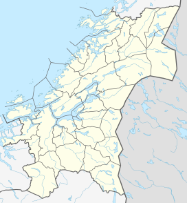 Jetnamsklumpen Location of the mountain 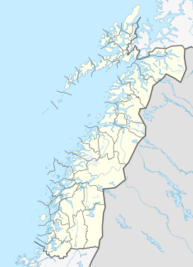 Jetnamsklumpen Jetnamsklumpen (Nordland)  Jetnamsklumpen Jetnamsklumpen (Norway) | |
| Highest point | |
| Elevation | 1,513 m (4,964 ft) |
| Listing | 13 at List of highest points of Norwegian counties |
| Coordinates | 65.1311°N 14.1917°E[1] |
| Geography | |
| Location | Trøndelag and Nordland, Norway |
| Topo map | 1925 II Børgefjellet (west) and 2025 III Ranseren (east) |
The eastern point of the large Jetnamsfjellet mountain, about 6 kilometres (3.7 mi) east of Jetnamsklumpen is considerably lower, at 1,206 metres (3,957 ft), but it is a quadripoint for four counties: Trøndelag and Nordland in Norway, and Jämtland and Västerbotten in Sweden.
Name
The first element is from the Southern Sami language word "jitneme" which means "area covered with snow", and the last element is the finite form of Norwegian language word "klump" which means "clump" or "round mountain".
See also
References
- "Jetnamsklumpen, Røyrvik (Trøndelag)" (in Norwegian). yr.no. Retrieved 2018-04-26.
- Store norske leksikon. "Jetnamsklumpen" (in Norwegian). Retrieved 2011-09-12.
This article about a mountain, mountain range, or peak in Trøndelag is a stub. You can help Wikipedia by expanding it. |
This article about a mountain, mountain range, or peak in Nordland is a stub. You can help Wikipedia by expanding it. |
Другой контент может иметь иную лицензию. Перед использованием материалов сайта WikiSort.org внимательно изучите правила лицензирования конкретных элементов наполнения сайта.
WikiSort.org - проект по пересортировке и дополнению контента Википедии