geo.wikisort.org - Mountains
Jerez Peak (Bulgarian: връх Херес, romanized: vrah Heres, IPA: [ˈvrɤx ˈxɛrɛs]) is the ice-covered peak rising to 1400 m at the south extremity of Ravelin Ridge on Clarence Island in the South Shetland Islands, Antarctica. It is connected to Mount Llana by Soyka Saddle, and surmounts Treskavets Glacier to the northeast and Highton Glacier to the southeast.

The peak is named after the Spanish mariner Gregorio Jerez who made the second sighting of Roché Island (South Georgia, named by him Isla San Pedro) in 1756.
Location
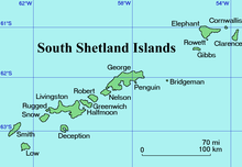
Jerez Peak is located at 61°13′47″S 54°06′21″W, which is 2 km north-northeast of Mount Llana and 5 km south of Humble Point. British mapping in 1972 and 2009.
Maps
- British Antarctic Territory. Scale 1:200000 topographic map. DOS 610 Series, Sheet W 61 54. Directorate of Overseas Surveys, Tolworth, UK, 1972.
- South Shetland Islands: Elephant, Clarence and Gibbs Islands. Scale 1:220000 topographic map. UK Antarctic Place-names Committee, 2009.
- Antarctic Digital Database (ADD). Scale 1:250000 topographic map of Antarctica. Scientific Committee on Antarctic Research (SCAR). Since 1993, regularly upgraded and updated.
References
- Bulgarian Antarctic Gazetteer. Antarctic Place-names Commission. (details in Bulgarian, basic data in English)
- Jerez Peak. SCAR Composite Gazetteer of Antarctica.
External links
- Jerez Peak. Copernix satellite image
This article includes information from the Antarctic Place-names Commission of Bulgaria which is used with permission.
This Clarence Island (South Shetland Islands) location article is a stub. You can help Wikipedia by expanding it. |
На других языках
[de] Jerez Peak
Der Jerez Peak (englisch; bulgarisch Връх Херес .mw-parser-output .Latn{font-family:"Akzidenz Grotesk","Arial","Avant Garde Gothic","Calibri","Futura","Geneva","Gill Sans","Helvetica","Lucida Grande","Lucida Sans Unicode","Lucida Grande","Stone Sans","Tahoma","Trebuchet","Univers","Verdana"}Wrach Cheres) ist ein 1400 m hoher und vereiste Berg auf Clarence Island im Archipel der Südlichen Shetlandinseln. Er ragt 3 km nordnordöstlich des Mount Llana und 5 km südlich des Humble Point am südlichen Ende des Ravelin Ridge auf. Der Treskawez-Gletscher liegt nordöstlich und der Highton-Gletscher südöstlich von ihm. Er ist über den Soyka Saddle mit dem Mount Llana verbunden.- [en] Jerez Peak
Другой контент может иметь иную лицензию. Перед использованием материалов сайта WikiSort.org внимательно изучите правила лицензирования конкретных элементов наполнения сайта.
WikiSort.org - проект по пересортировке и дополнению контента Википедии