geo.wikisort.org - Mountains
Jebel Dair (also Jabal ad-Dayr or Dair Mountain) (Arabic: جبل الدائر) is an igneous mountain in central Sudan. It rises over 1000m above the surrounding terrain and 1451m above sea level. The flanks of the mountain apparently have been denuded of vegetation, although water exists in some of the meandering stream channels within the darker, vegetated wadis.
This article does not cite any sources. (December 2009) |
| Jebel Dair | |
|---|---|
 | |
| Highest point | |
| Elevation | 1,451 m (4,760 ft) |
| Coordinates | 12°26′N 30°39′E |
| Geography | |
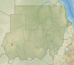 Jebel Dair Sudan | |
It can be seen as the dark, fractured structure near the center of the photograph to the right. The mountain flanks are the broad reddish-tan ring around it. A small muddy reservoir can be seen near the northwest corner of the photograph, and sand dunes to the northwest.
With the exception of Jebel Dair, most of the region is fairly flat. It is hot and semiarid, and marginally suited for subsistence agriculture, as well as for commercial crops of peanuts, sesame, and gum arabic. Drainage patterns dominate the landscape in central Sudan west of the White Nile River. Several major wadis, intermittently flowing watercourses, merge west and northwest of the mountain. The sand dunes nearby capture the wide variation in annual precipitation in the region, which makes agricultural activity tenuous.
This Sudan location article is a stub. You can help Wikipedia by expanding it. |
На других языках
[de] Ad-Dair
Ad-Dair, arabisch جبل الدائر, DMG Dschabal ad-Dā'ir, Alternativschreibungen: Jebel Dair, Dschebel Dair, Gebel Dair, Ed-Dair; ist ein Tafelberg am Nordrand der Nuba-Berge im sudanesischen Bundesstaat Süd-Kordofan.- [en] Jebel Dair
Другой контент может иметь иную лицензию. Перед использованием материалов сайта WikiSort.org внимательно изучите правила лицензирования конкретных элементов наполнения сайта.
WikiSort.org - проект по пересортировке и дополнению контента Википедии