geo.wikisort.org - Mountains
Iron Ore Hill (2001 pop.: ) is a Canadian rural community in Carleton County, New Brunswick, 5 kilometers northwest of Woodstock.
| Iron Ore Hill | |
|---|---|
 Iron Ore Hill Carleton County, New Brunswick, Canada | |
| Highest point | |
| Elevation | 216 feet (66 m) |
| Coordinates | 46°14′N 67°37′W |
| Geography | |
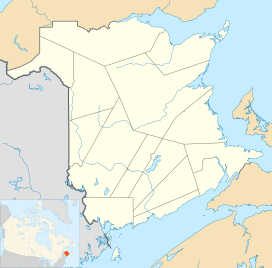
| Location | Carleton County, New Brunswick, Canada |
| Parent range | Smyrna Mills Formation |
| Topo map | USGS Mount Shasta |
| Geology | |
| Mountain type | Shield |
| Climbing | |
| First ascent | 1836 |
| Easiest route | Iron Ore Hill Road |
History
The community is located on the slopes of Iron Ore Hill, named from deposits of iron ore and manganese located in the area.[1] The deposit was discovered in 1836.[2][3] Iron was mined near here from 1848 to 1884. A reported 70,000 tons iron ore was smelted during that time.[4] The iron produced was transported to the Woodstock Iron Works to be smelted.[2]
Notable people
See also
- List of communities in New Brunswick
References
- Geological Survey of Canada; R.W. Ells, B.A. (1876). "Report on the ore deposits of Carleton County, New Brunswick". Report of Progress. pp. 97–98.
- New Brunswick. General Assembly. Legislative Council (1864). "Report on Mines and Minerals: Woodstock Iron Works". Journal of the Legislative Council of the Province of New Brunswick ... pp. 55–59.
- Maine Geological Survey; Charles Thomas Jackson (1839). First[-third] Annual Report on the Geology of the State of Maine. Smith & Robinson, printers to the state. xli.
- "Woodstock Manganese". Retrieved 25 February 2014.
External links
This New Brunswick location article is a stub. You can help Wikipedia by expanding it. |
Текст в блоке "Читать" взят с сайта "Википедия" и доступен по лицензии Creative Commons Attribution-ShareAlike; в отдельных случаях могут действовать дополнительные условия.
Другой контент может иметь иную лицензию. Перед использованием материалов сайта WikiSort.org внимательно изучите правила лицензирования конкретных элементов наполнения сайта.
Другой контент может иметь иную лицензию. Перед использованием материалов сайта WikiSort.org внимательно изучите правила лицензирования конкретных элементов наполнения сайта.
2019-2026
WikiSort.org - проект по пересортировке и дополнению контента Википедии
WikiSort.org - проект по пересортировке и дополнению контента Википедии