geo.wikisort.org - Mountains
The Irchel is an elevation in the Canton of Zürich, located at the Rhine between the Töss and Thur rivers, on the territory of Buch am Irchel, Berg am Irchel and Freienstein-Teufen, separating the Andelfingen and Bülach districts. It is an outlying ridge of the Jura, rising to 694 m, lying east of the Lägern. Historically, it was part of the Germanic Limes. The name is from a Helvetic word for "stag".
- Irchel is also the name of a hill in the city of Zürich, and of a campus of Zürich University located there.
| Irchel | |
|---|---|
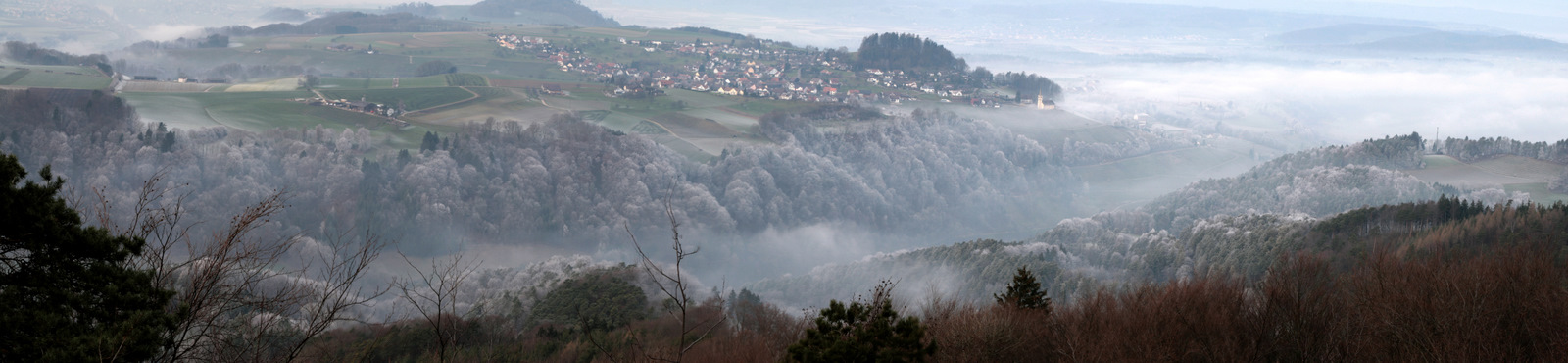
 view from the Hochwacht towards Eglisau and Buchberg | |
| Highest point | |
| Elevation | 694 m (2,277 ft) |
| Prominence | 260 m (850 ft)[1] |
| Isolation | 14.9 km (9.3 mi)[2] |
| Coordinates | 47°32′22″N 08°36′26″E |
| Geography | |
 Irchel Location in Switzerland | |
| Location | Zürich, Switzerland |
| Climbing | |
| Easiest route | Trail |
peaks:
- Hochwacht 668.4 m
- Forenirchel 656.4 m
- Buechemer-Irchel Höhe 694 m
View of the Rhine valley and Buchberg (SH) from the Irchel
See also
- List of most isolated mountains of Switzerland
References
- Retrieved from the Swisstopo topographic maps. The key col is located at Henggart at 434 metres.
- Retrieved from the Swisstopo topographic maps. The nearest point of higher elevation is east of the Lägern.
Wikimedia Commons has media related to Irchel.
This article about a mountain, mountain range, or peak located in the canton of Zürich is a stub. You can help Wikipedia by expanding it. |
На других языках
[de] Irchel
Der Irchel ist ein Höhenzug im Kanton Zürich in der Schweiz mit Gipfeln bis 694 m ü. M. Er liegt zwischen Töss und Thur am Rhein.- [en] Irchel
Текст в блоке "Читать" взят с сайта "Википедия" и доступен по лицензии Creative Commons Attribution-ShareAlike; в отдельных случаях могут действовать дополнительные условия.
Другой контент может иметь иную лицензию. Перед использованием материалов сайта WikiSort.org внимательно изучите правила лицензирования конкретных элементов наполнения сайта.
Другой контент может иметь иную лицензию. Перед использованием материалов сайта WikiSort.org внимательно изучите правила лицензирования конкретных элементов наполнения сайта.
2019-2026
WikiSort.org - проект по пересортировке и дополнению контента Википедии
WikiSort.org - проект по пересортировке и дополнению контента Википедии