geo.wikisort.org - Mountains
Higravtindan or Higravstindan is the tallest mountain on the island of Austvågøya in the Lofoten archipelago in Nordland county, Norway. It is located on the border of Hadsel Municipality and Vågan Municipality. The village of Laupstad and the European route E10 highway are located about 3 kilometres (1.9 mi) west of the mountain and the village of Liland is located about 3 kilometres (1.9 mi) southwest of the mountain. There is a glacier located on the east side of the mountain.[2]
| Higravtindan | |
|---|---|
 | |
| Highest point | |
| Elevation | 1,146 m (3,760 ft) |
| Prominence | 1,146 m (3,760 ft) |
| Isolation | 32.7 to 32.9 km (20.3 to 20.4 mi) |
| Coordinates | 68.3570°N 14.7923°E[1] |
| Geography | |
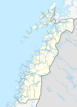 Higravtindan Location of the mountain  Higravtindan Higravtindan (Norway) | |
| Location | Nordland, Norway |
| Topo map | N1131 I Austvågøya |
References
- "Higravtindan, Hadsel (Nordland)" (in Norwegian). yr.no. Retrieved 2018-12-20.
- Thorsnæs, Geir, ed. (2016-07-04). "Higravtindan". Store norske leksikon (in Norwegian). Kunnskapsforlaget. Retrieved 2018-12-20.
This article about a mountain, mountain range, or peak in Nordland is a stub. You can help Wikipedia by expanding it. |
На других языках
- [en] Higravstinden
[fr] Higravstinden
Le Higravstinden est le plus haut sommet de l'archipel des Lofoten. Il se situe sur l'île d'Austvågøya.Текст в блоке "Читать" взят с сайта "Википедия" и доступен по лицензии Creative Commons Attribution-ShareAlike; в отдельных случаях могут действовать дополнительные условия.
Другой контент может иметь иную лицензию. Перед использованием материалов сайта WikiSort.org внимательно изучите правила лицензирования конкретных элементов наполнения сайта.
Другой контент может иметь иную лицензию. Перед использованием материалов сайта WikiSort.org внимательно изучите правила лицензирования конкретных элементов наполнения сайта.
2019-2026
WikiSort.org - проект по пересортировке и дополнению контента Википедии
WikiSort.org - проект по пересортировке и дополнению контента Википедии