geo.wikisort.org - Mountains
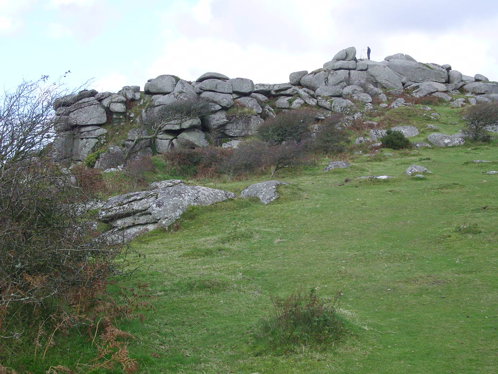
Helman Tor (Cornish: Torr Helman)[1] is a granite hill in mid Cornwall, UK with several separated tors, and is designated as a (non-statutory) County Geology Site (with similar criteria to a County Wildlife Site. The hill also has a Scheduled Ancient Monument. Helman Tor is also the name of the nature reserve managed by the Cornwall Wildlife Trust.[2] It lies on the Saints' Way, a long-distance footpath completed in 1986.[3] It is adjacent to Red Moor Site of Special Scientific Interest and Breney Common Special Area of Conservation.
| Helman Tor | |
|---|---|
| Torr Helman | |
 | |
| Highest point | |
| Elevation | 209 m (686 ft) |
| Coordinates | 50°25′19″N 4°43′46″W |
| Geography | |
| OS grid | SX 062 615 |

It is the northern end of a granite ridge.[4] There are at least three rocking stones (logan stone) on the ridge.
There is a prehistoric hill fort and a stone hut circle settlement on the site.[5] There is evidence of walls constructed in Neolithic period, around 6,000 years ago, as well as some level platforms, thought to be house sites, one platform has a network of postholes. There is also remains of a field system. These are similar to those at Carn Brea and limited excavation was carried out by Roger Mercer.[4]
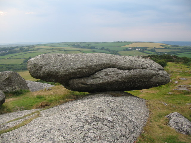
There is a second Logan stone in the highest pile beside the trig point (triangulation point). A third logan stone is further down the ridge to the south, outside the reserve.
References
- "MAGA - Cornish Language Partnership". Archived from the original on 12 January 2017. Retrieved 17 January 2013.
- "Helman Tor Nature Reserve (including Breney Common and Red Moor Memorial Nature Reserve)". Cornwall Wildlife Trust. 2012. Archived from the original on 5 April 2013. Retrieved 20 October 2012.
- Ordnance Survey Landranger 200; Newquay, Bodmin & surrounding area, 1:50 000. 1988
- "Helman Tor". Historic Environment Service, Cornwall Council. 7 May 2009. Retrieved 20 October 2012.
- Historic England. "Earlier prehistoric hillfort, stone hut circle settlement and field system at Helman Tor (1007306)". National Heritage List for England. Retrieved 20 October 2012.
External links
- Access to Monuments - Helman Tor
- Helman Tor at UKClimbing.com
This article about a location in the former borough of Restormel, Cornwall is a stub. You can help Wikipedia by expanding it. |
Другой контент может иметь иную лицензию. Перед использованием материалов сайта WikiSort.org внимательно изучите правила лицензирования конкретных элементов наполнения сайта.
WikiSort.org - проект по пересортировке и дополнению контента Википедии