geo.wikisort.org - Mountains
Heilhornet is a mountain in the municipality of Bindal in Nordland, Norway. It has a height of 1,058 metres (3,471 ft) and is a landmark visible from the sea lane.[2][3] The Norwegian County Road 17 runs along the western base of the mountain.
| Heilhornet | |
|---|---|
 Heilhornet (right) viewed from Tyskenghatten | |
| Highest point | |
| Elevation | 1,058 m (3,471 ft) |
| Coordinates | 65.0768°N 12.1392°E[1] |
| Geography | |
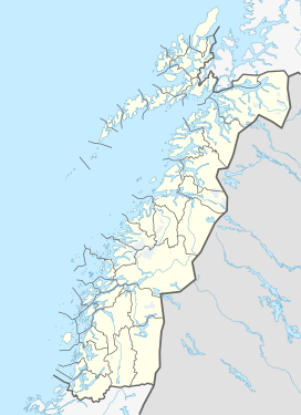 Heilhornet Location of the mountain  Heilhornet Heilhornet (Norway) | |
| Location | Nordland, Norway |
References
- "Heilhornet, Bindal (Nordland)" (in Norwegian). yr.no. Retrieved 2019-02-25.
- Bolstad, Erik (ed.). "Heilhornet". Store norske leksikon (in Norwegian). Oslo: Norsk nettleksikon. Retrieved 18 August 2017.
- Evensen, Knut Harald, ed. (2010). NAF Veibok 2010–2012 (in Norwegian) (29 ed.). Oslo: Norges Automobil-Forbund. pp. 467, 468.
This article about a mountain, mountain range, or peak in Nordland is a stub. You can help Wikipedia by expanding it. |
Текст в блоке "Читать" взят с сайта "Википедия" и доступен по лицензии Creative Commons Attribution-ShareAlike; в отдельных случаях могут действовать дополнительные условия.
Другой контент может иметь иную лицензию. Перед использованием материалов сайта WikiSort.org внимательно изучите правила лицензирования конкретных элементов наполнения сайта.
Другой контент может иметь иную лицензию. Перед использованием материалов сайта WikiSort.org внимательно изучите правила лицензирования конкретных элементов наполнения сайта.
2019-2026
WikiSort.org - проект по пересортировке и дополнению контента Википедии
WikiSort.org - проект по пересортировке и дополнению контента Википедии