geo.wikisort.org - Mountains
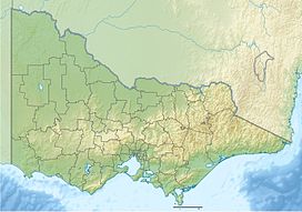
Hayes Hill is a small scoria cone in Donnybrook, approximately 30 km north of Melbourne, Victoria, Australia.[1] It is on the eastern edge of the Newer Volcanics Province.
| Hayes Hill | |
|---|---|
| Highest point | |
| Elevation | 280 m (920 ft) |
| Coordinates | 37°32′21″S 145°00′18″E |
| Geography | |
| Location | Victoria, Australia |
Hayes Hill is considered a regionally significant geological site as a source of the lava flows that follow the ancestral Merri and Darebin Creeks and Yarra River through the northern suburbs of Melbourne into the CBD.[2][3]
References
- Hanks, Walter (1955), "Newer Volcanic vents and lava fields between Wallan and Yuroke, Victoria", Proceedings of the Royal Society of Victoria, 67 (1): 1–16
- Rosengren, Neville J. (1994), Eruption points of the newer volcanics province of Victoria : an inventory and evaluation of scientific significance, National Trust of Australia (Victoria) : Geological Society of Australia, Victorian Division, retrieved 27 June 2020
- "Hayes Hill". Victorian Resources Online. Agriculture Victoria. Retrieved 27 June 2020.
Текст в блоке "Читать" взят с сайта "Википедия" и доступен по лицензии Creative Commons Attribution-ShareAlike; в отдельных случаях могут действовать дополнительные условия.
Другой контент может иметь иную лицензию. Перед использованием материалов сайта WikiSort.org внимательно изучите правила лицензирования конкретных элементов наполнения сайта.
Другой контент может иметь иную лицензию. Перед использованием материалов сайта WikiSort.org внимательно изучите правила лицензирования конкретных элементов наполнения сайта.
2019-2025
WikiSort.org - проект по пересортировке и дополнению контента Википедии
WikiSort.org - проект по пересортировке и дополнению контента Википедии
