geo.wikisort.org - Mountains
Gilbert Peak is the third highest peak in the U.S. state of Utah,[1] with an elevation of 13,448 feet (4,099 m).[1] It lies on the spine of the central Uinta Mountains, on the border between Uinta-Wasatch-Cache National Forest and Ashley National Forest in northeastern Utah, and on the border between Summit County and Duchesne County. It is the highpoint of Summit County,[2] and lies within the boundaries of the High Uintas Wilderness.
| Gilbert Peak | |
|---|---|
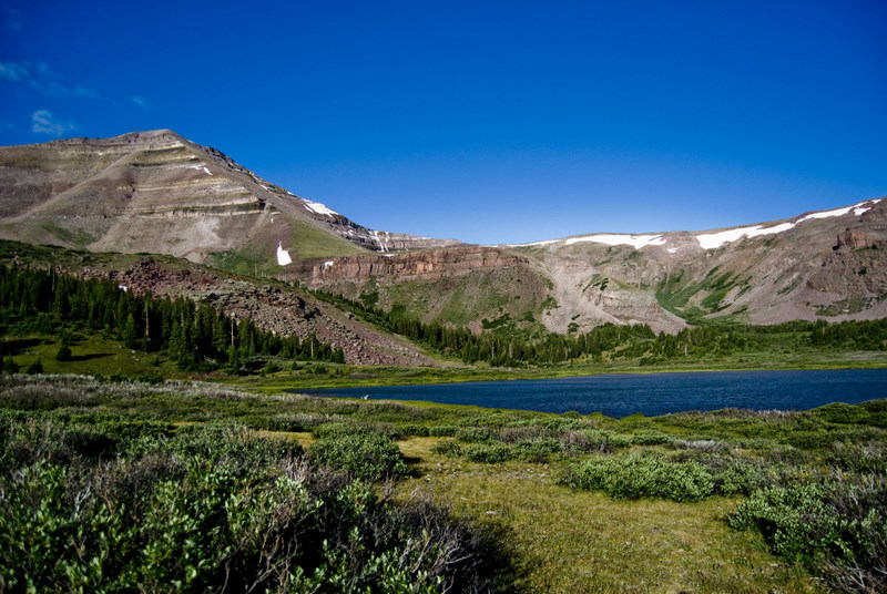 Gilbert Peak viewed from the northeast in the West Fork Beaver Creek drainage. | |
| Highest point | |
| Elevation | 13,448 ft (4,099 m) NAVD 88[1] |
| Prominence | 1,554 ft (474 m)[1] |
| Coordinates | 40°49′25″N 110°22′40″W[1] |
| Geography | |
 Gilbert Peak Location in Utah | |
| Location | Duchesne County and Summit County, Utah, U.S. |
| Parent range | Uinta Mountains |
| Topo map | USGS Kings Peak |
References
- "Gilbert Peak, Utah". Peakbagger.com. Retrieved 2016-10-06.
- "Gilbert Peak UT". listsofjohn.com. Retrieved 2016-10-06.
External links
![]() Media related to Gilbert Peak (Utah) at Wikimedia Commons
Media related to Gilbert Peak (Utah) at Wikimedia Commons
- U.S. Geological Survey Geographic Names Information System: Gilbert Peak
- Gilbert Peak at summitpost.com
- Gilbert Peak Data at peakbagger.com
| Authority control |
|
|---|
This article about a location in Utah is a stub. You can help Wikipedia by expanding it. |
Текст в блоке "Читать" взят с сайта "Википедия" и доступен по лицензии Creative Commons Attribution-ShareAlike; в отдельных случаях могут действовать дополнительные условия.
Другой контент может иметь иную лицензию. Перед использованием материалов сайта WikiSort.org внимательно изучите правила лицензирования конкретных элементов наполнения сайта.
Другой контент может иметь иную лицензию. Перед использованием материалов сайта WikiSort.org внимательно изучите правила лицензирования конкретных элементов наполнения сайта.
2019-2026
WikiSort.org - проект по пересортировке и дополнению контента Википедии
WikiSort.org - проект по пересортировке и дополнению контента Википедии