geo.wikisort.org - Mountains
Gearhart Mountain is a 8,041-foot (2,451 m) high mountain in Lake County and Klamath County, Oregon, in the United States. It is located in the Gearhart Mountain Wilderness of the Fremont–Winema National Forest, northeast of the Sprague River valley and the town of Bly.
| Gearhart Mountain | |
|---|---|
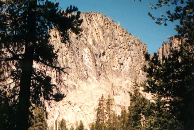 Gearhart Mountain viewed from wilderness trail | |
| Highest point | |
| Elevation | 8,041 ft (2,451 m)[1] |
| Prominence | 3,430 ft (1,050 m)[2] |
| Parent peak | Drake Peak |
| Isolation | 40.85 mi (65.74 km)[2] |
| Coordinates | 42°29′00″N 120°51′35″W[1] |
| Geography | |
 Gearhart Mountain Location in the state of Oregon | |
| Location | Lake County and Klamath County, Oregon |
See also
References
This Klamath County, Oregon state location article is a stub. You can help Wikipedia by expanding it. |
This Lake County, Oregon state location article is a stub. You can help Wikipedia by expanding it. |
Текст в блоке "Читать" взят с сайта "Википедия" и доступен по лицензии Creative Commons Attribution-ShareAlike; в отдельных случаях могут действовать дополнительные условия.
Другой контент может иметь иную лицензию. Перед использованием материалов сайта WikiSort.org внимательно изучите правила лицензирования конкретных элементов наполнения сайта.
Другой контент может иметь иную лицензию. Перед использованием материалов сайта WikiSort.org внимательно изучите правила лицензирования конкретных элементов наполнения сайта.
2019-2026
WikiSort.org - проект по пересортировке и дополнению контента Википедии
WikiSort.org - проект по пересортировке и дополнению контента Википедии