geo.wikisort.org - Mountains
The Font Roja Natural Park (Valencian: Parc Natural del Carrascar de la Font Roja, Spanish: Parque Natural del Carrascal de la Fuente Roja) is a natural park situated in Alcoy, in the autonomous community of Valencia, Spain.
| Font Roja Natural Park | |
|---|---|
| Parque Natural del Carrascal de la Fuente Roja (in Spanish) | |
IUCN category II (national park) | |
 View of the park 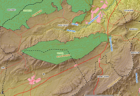 Map of the Font Roja Natural Park | |
| Location | Alcoy, Valencian Community, Spain |
| Nearest city | Valencian Community: Alcoy, Ibi |
| Coordinates | 38°38′51″N 0°32′46″W |
| Area | 2.450 ha |
| Established | 1987 |
| Governing body | Generalitat Valenciana |
The Font Roja natural park was declared on April 13, 1987 natural park by the Generalitat Valenciana. It is located in the comarca of Alcoià, in the North of the province of Alicante, between the towns of Alcoy and Ibi. This natural park is one of the best preserved natural areas of the Valencian Community. The protected natural area covers 2.298 hectares and comprises mountainous alignment of El Alto de San Antonio (L'Alt de Sant Antoni), El Carrascar of the Font Roja (El Carrascar de la Font Roja) and La Teixereta. The summit of the Sierra del Menejador, with 1,356 m of height, is the highest elevation of the park.
See also
- Serra Mariola Natural Park
- Barchell Castle
External links
- Font Roja Natural Park (Spanish, Valencian)
Authority control | |
|---|---|
| General |
|
| National libraries | |
This article about a location in the Valencian Community, Spain, is a stub. You can help Wikipedia by expanding it. |
This protected areas-related article is a stub. You can help Wikipedia by expanding it. |
Другой контент может иметь иную лицензию. Перед использованием материалов сайта WikiSort.org внимательно изучите правила лицензирования конкретных элементов наполнения сайта.
WikiSort.org - проект по пересортировке и дополнению контента Википедии