geo.wikisort.org - Mountains
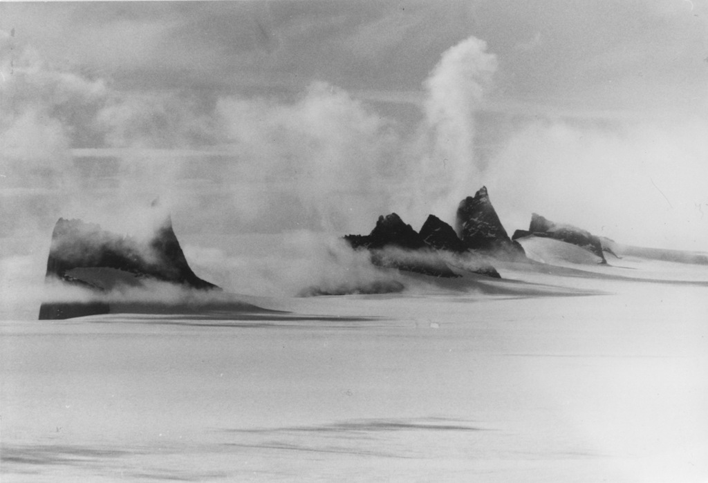
Fenriskjeften Mountain is a large bare rock mountain which in plan resembles a hairpin, forming the southern portion of the Drygalski Mountains in Queen Maud Land, Antarctica. It was plotted from air photos by the Third German Antarctic Expedition (1938–39), mapped from surveys and air photos by the Sixth Norwegian Antarctic Expedition (1956–60), and because of its shape named Fenriskjeften (Fenrir's jaw), after the wolf in Norse mythology.[1]
See also
- Fenristunga
References
- "Fenriskjeften Mountain". Geographic Names Information System. United States Geological Survey. Retrieved 2012-03-20.
![]() This article incorporates public domain material from the United States Geological Survey document: "Fenriskjeften Mountain". (content from the Geographic Names Information System)
This article incorporates public domain material from the United States Geological Survey document: "Fenriskjeften Mountain". (content from the Geographic Names Information System)
На других языках
[de] Fenriskjeften
Der Fenriskjeften (norwegisch für Kiefer des Fenris) ist ein großes, unvereistes und felsiges Bergmassiv im ostantarktischen Königin-Maud-Land. In der Aufsicht ähnelt es einer Haarnadel und bildet den südlichen Teil der Drygalskiberge in der Orvinfjella. Das südliche Ende dieses Massivs wird gebildet durch die Mundlauga.- [en] Fenriskjeften Mountain
Текст в блоке "Читать" взят с сайта "Википедия" и доступен по лицензии Creative Commons Attribution-ShareAlike; в отдельных случаях могут действовать дополнительные условия.
Другой контент может иметь иную лицензию. Перед использованием материалов сайта WikiSort.org внимательно изучите правила лицензирования конкретных элементов наполнения сайта.
Другой контент может иметь иную лицензию. Перед использованием материалов сайта WikiSort.org внимательно изучите правила лицензирования конкретных элементов наполнения сайта.
2019-2026
WikiSort.org - проект по пересортировке и дополнению контента Википедии
WikiSort.org - проект по пересортировке и дополнению контента Википедии