geo.wikisort.org - Mountains
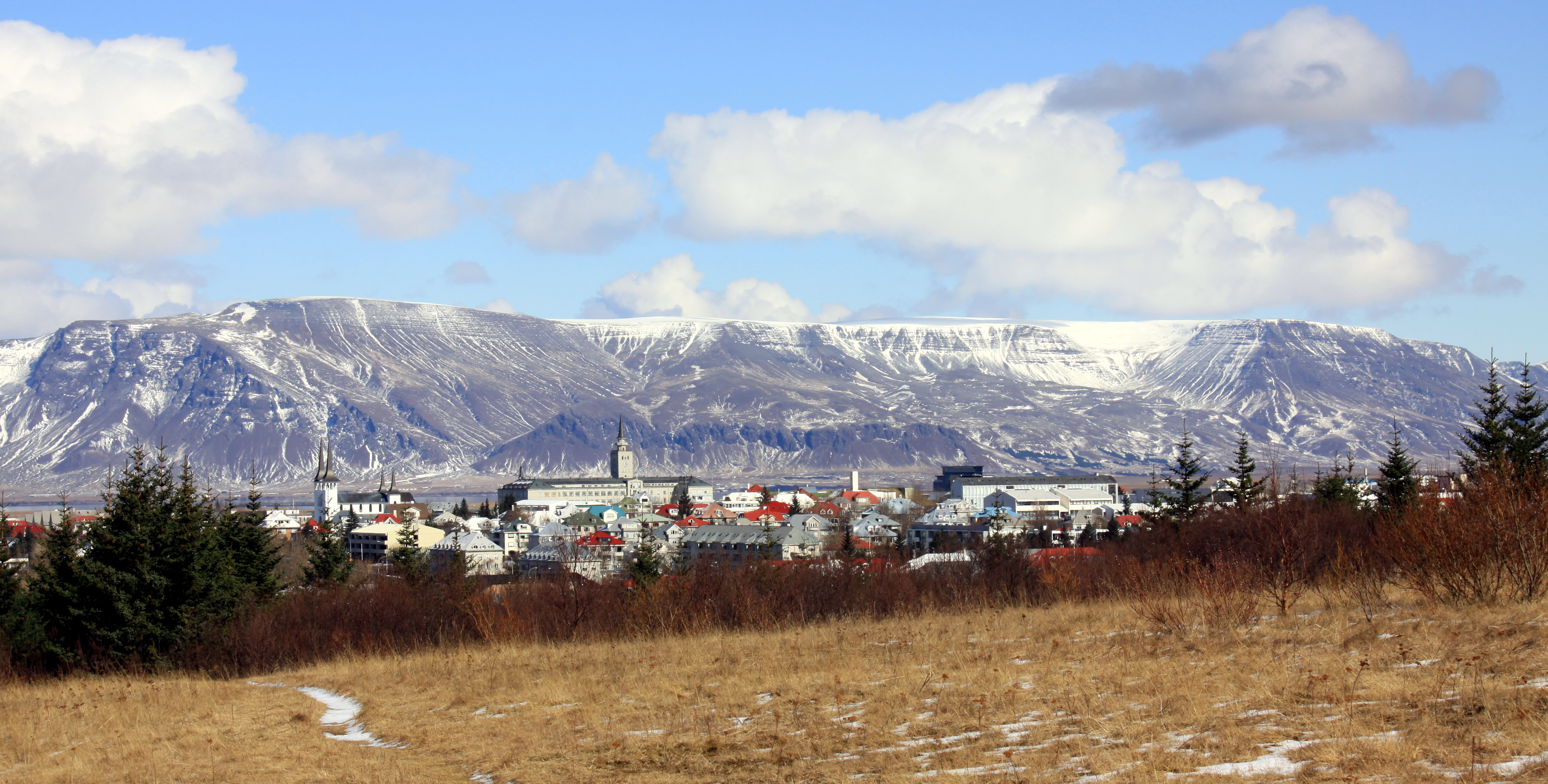
Esja, in Icelandic called Esjan, which means "the Esja" (pronounced [ˈɛːsjan]), is a 914 m (2,999 ft) mountain situated in the south-west of Iceland, about 10 km to the north of Iceland's capital city Reykjavík.
This article needs additional citations for verification. (August 2021) |
| Esja | |
|---|---|
 The mountain range Esja | |
| Highest point | |
| Elevation | 914 m (2,999 ft) |
| Coordinates | 64°15′N 21°38′W |
| Geography | |
 Esja 10 km north of Reykjavík, Iceland | |
| Climbing | |
| Easiest route | hiking |
Esja is not a single mountain, but a volcanic mountain range, made from basalt and tuff.

Etymology
The name is likely related to an archaic word, esja, meaning rock flake or carving stone.[1]
In the Kjalnesinga saga, there is a rich widow among Irish settlers named Esja, but it is likely that the woman's name is derived from the mountain and not vice versa.
Esja can be used as a given name in Iceland.
Formation
Esja was built up at the end of the Pleistocene with the beginning of the Ice Age. During the warm periods lava flowed, and in the cold periods ridges of tuff were built up under the glacier. The western part of the mountain range is the oldest (about 3.2 million years) and the eastern part is the youngest (about 1.8 million years). The movements of the plate boundaries cutting diagonally through Iceland are continually pushing the strata to the west and away from the active volcanic zone.[2] Intrusions, i.e. large magma channels coming from the old central volcanoes at Kjalarnes and Stardalur [ˈstarˌtaːlʏr̥], found entrances into the strata.[2] The result was a series of large lava fields, one above the other, which the Ice Age glacier ground down.[2] It left only the highest summits, like the mountain ranges of Esja or Akrafjall [ˈaːkraˌfjatl̥].
Physical features
This section does not cite any sources. (August 2021) |
The easternmost summits of the mountain range, called Móskarðshnúkar, are of an unusually light colour. An Icelandic writer in the 19th century, so goes the story, hoped to see the sun there after a long period of rain. But when he looked closer, it was only the mountaintops with their colours. In reality, it is the rhyolite stone, often to be found in Icelandic nature near old (and also active) central volcanoes.
Hiking and climbing
Within easy reach of the capital, Esja is a very popular recreation area for hikers and climbers. The best known hiking paths lead to the summits Þverfellshorn [ˈθvɛrˌfɛlsˌhɔ(r)tn̥] (780 m) and Kerhólakambur [ˈcʰɛrˌhouːlaˌkʰampʏr̥] (851 m). Þverfellshorn is also easily accessible by public transport.
The path is divided into sections, marked with signs along the way. Each sign gives an indication of the difficulty of the path ahead with a grade system ranging from 1 boot (easy) to 3 boots (challenging). At the third sign experienced climbers can choose to climb directly to the peak, instead of following the path which goes off to the right.[3] After approximately 6.6 kilometers of walking and 597 meters altitude gain is a big rock called Steinn.[3] It is here that most inexperienced climbers choose to go down again, as the path becomes increasingly difficult from there.[3]
The highest point, at 914 m, is called Hábunga [ˈhauːˌpuŋka].[3] From Þverfellshorn, reaching Hábunga requires another three-kilometer trek northeast, across a rocky plateau with no directional signs or clear path. As of August 2011, Hábunga was marked only by a large cairn with a wooden stick at the top.
There is danger of avalanches in wintertime. The last fatality was in 2020.[4]

References
- Ásgeir Blöndal Magnússon (1989). Íslensk orðsifjabók.
- Hvernig myndaðist Esjan? Vísindavefurinn, 9 December 2008 (in Icelandic)
- Esjan - leiðir og saga Ferlir.is (in Icelandic)
- Man died in avalanche Rúv.is
| Authority control |
|
|---|
На других языках
[de] Esja
Die Esja [.mw-parser-output .IPA a{text-decoration:none}ˈɛːsja] ist ein Gebirgszug im Südwesten Islands, ca. 10 km nördlich der Hauptstadt Reykjavík. Es handelt sich um ein aus unterschiedlichsten vulkanischen Produkten sowie Sedimenten aufgeschichtetes Gebirgsmassiv, dessen höchster Punkt eine Höhe von 914 m erreicht.- [en] Esjan
[fr] Esja
L'Esja ou Esjan est un massif de montagnes volcaniques basaltiques situé dans le Sud-Ouest de l'Islande, dominant la capitale islandaise Reykjavik située au sud-ouest. Il culmine à 914 mètres d'altitude au Hábunga.[it] Esjan
L’Esjan, anche noto come Esja, è una catena montuosa vulcanica montagna che raggiunge l'altezza massima di 914 metri, che si trova a circa 10 chilometri a nord della capitale islandese Reykjavík.[ru] Эсья
Эсья (исл. Esja, или Esjan) — гора, расположенная в юго-западной части Исландии, примерно в 10 километрах к северу от столицы Исландии Рейкьявика. Высота над уровнем моря — 909 метров.Другой контент может иметь иную лицензию. Перед использованием материалов сайта WikiSort.org внимательно изучите правила лицензирования конкретных элементов наполнения сайта.
WikiSort.org - проект по пересортировке и дополнению контента Википедии