geo.wikisort.org - Mountains
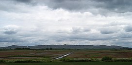
The Eola Hills are a range of hills northwest of Salem, Oregon, United States.[2] They stretch from the community of Eola about 10 miles (16 km) north to Yamhill County.
| Eola Hills | |
|---|---|
 Eola Hills | |
| Highest point | |
| Elevation | 1,170 ft (360 m)[1] |
| Geography | |
| Country | United States |
| State | Oregon |
| County | Yamhill County |
| Range coordinates | 45°4′31.425″N 123°7′25.362″W |
| Topo map | USGS Mission Bottom |
They are divided from the Salem Hills by the Willamette River at Eola.
See also
- Eola-Amity Hills AVA
- Bethel Heights Vineyard, one of the first vineyards planted on the Eola Hills
References
- "Eola Hills". ListsOfJohn.com. Retrieved 2012-11-18.
- "Eola Hills". Geographic Names Information System. United States Geological Survey, United States Department of the Interior.
Текст в блоке "Читать" взят с сайта "Википедия" и доступен по лицензии Creative Commons Attribution-ShareAlike; в отдельных случаях могут действовать дополнительные условия.
Другой контент может иметь иную лицензию. Перед использованием материалов сайта WikiSort.org внимательно изучите правила лицензирования конкретных элементов наполнения сайта.
Другой контент может иметь иную лицензию. Перед использованием материалов сайта WikiSort.org внимательно изучите правила лицензирования конкретных элементов наполнения сайта.
2019-2025
WikiSort.org - проект по пересортировке и дополнению контента Википедии
WikiSort.org - проект по пересортировке и дополнению контента Википедии
