geo.wikisort.org - Mountains
Pico del Terril, commonly known as El Terril or Terril, is the highest altitude of the Province of Seville, Andalusia, Spain, with a height of 1129 meters above sea level. It is located on the border between the municipalities of Algámitas and Pruna,[2] at the top of the hill known as "El Monigote" which is the highest in the Sierra del Tablón. It neighbors the Peñón de Algámitas.
| El Terril | |
|---|---|
 | |
| Highest point | |
| Elevation | 1,129 m (3,704 ft)[1] |
| Prominence | 493 m (1,617 ft)[1] |
| Coordinates | 36°59′56″N 5°10′24″W[1] |
| Geography | |
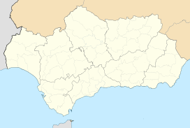 El Terril Location in Andalusia | |
| Location | Algámitas and Pruna, Province of Seville, Andalusia, Spain |
References
- "Terril, Spain". Peakbagger.com. Retrieved 2021-07-08.
- Instituto Geográfico Nacional - Reseña Vértice Geodésico - Pico Terril - PDF. Consultado 2020-06-09.
This article about a location in Andalusia, Spain, is a stub. You can help Wikipedia by expanding it. |
На других языках
- [en] El Terril
[es] Pico del Terril
El pico del Terril es la máxima altitud de la provincia española de Sevilla en Andalucía, con 1129 msnm. Se localiza en la línea límite entre los términos de las localidades de Algámitas y Pruna,[1] en la cumbre del cerro conocido por "El Monigote" que es el más elevado de la Sierra del Tablón. Tiene como vecino al Peñón de Algámitas.Текст в блоке "Читать" взят с сайта "Википедия" и доступен по лицензии Creative Commons Attribution-ShareAlike; в отдельных случаях могут действовать дополнительные условия.
Другой контент может иметь иную лицензию. Перед использованием материалов сайта WikiSort.org внимательно изучите правила лицензирования конкретных элементов наполнения сайта.
Другой контент может иметь иную лицензию. Перед использованием материалов сайта WikiSort.org внимательно изучите правила лицензирования конкретных элементов наполнения сайта.
2019-2026
WikiSort.org - проект по пересортировке и дополнению контента Википедии
WikiSort.org - проект по пересортировке и дополнению контента Википедии