geo.wikisort.org - Mountains
Drum (Welsh pronunciation: [ˈdrɨm]) (Welsh: Y Drum = the ridge) is a summit in the Carneddau mountains in north Wales, 2 km north-east of Foel-fras. It is 771 m (2,526 ft) high. It is also known as Carnedd Penyborth-Goch.
| Drum (Carnedd Penyborth-Goch) | |
|---|---|
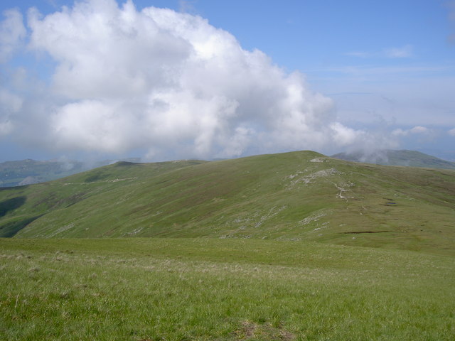 Carnedd y Ddelw (Left) and Drum (Wales) (Right) from Foel-fras. | |
| Highest point | |
| Elevation | 771 m (2,530 ft) |
| Prominence | 48 m (157 ft) |
| Listing | Hewitt, Nuttall |
| Naming | |
| English translation | ridge [1] |
| Language of name | Welsh |
| Pronunciation | Welsh: [ˈdrɨm] |
| Geography | |
| Location | Conwy / Gwynedd, Wales |
| Parent range | Snowdonia |
| OS grid | SH708695 |
| Listed summits of Drum (Wales) | ||||
| Name | Grid ref | Height | Status | |
|---|---|---|---|---|
| Carnedd y Ddelw | 686 m (2,257 ft) | Nuttall | ||
| Pen y Castell | 623 m (2,044 ft) | sub Hewitt, Nuttall | ||
Its eastern slopes are drained by the Afon Tafolog, a tributary of Afon Roe which flows through the village of Rowen before joining the River Conwy.[2]
See also
- Blue Joker, an experimental airborne early-warning radar, tested from a site high on the mountain in 1956
References
- Mark H. Nodine (14 June 2003). "Drum". Welsh-English Lexicon. Archived from the original on 25 October 2007.
- Nuttall, John & Anne (1999). The Mountains of England & Wales - Volume 1: Wales (2nd edition ed.). Milnthorpe, Cumbria: Cicerone. ISBN 1-85284-304-7.
This Conwy County Borough location article is a stub. You can help Wikipedia by expanding it. |
This Gwynedd location article is a stub. You can help Wikipedia by expanding it. |
Текст в блоке "Читать" взят с сайта "Википедия" и доступен по лицензии Creative Commons Attribution-ShareAlike; в отдельных случаях могут действовать дополнительные условия.
Другой контент может иметь иную лицензию. Перед использованием материалов сайта WikiSort.org внимательно изучите правила лицензирования конкретных элементов наполнения сайта.
Другой контент может иметь иную лицензию. Перед использованием материалов сайта WikiSort.org внимательно изучите правила лицензирования конкретных элементов наполнения сайта.
2019-2026
WikiSort.org - проект по пересортировке и дополнению контента Википедии
WikiSort.org - проект по пересортировке и дополнению контента Википедии