geo.wikisort.org - Mountains
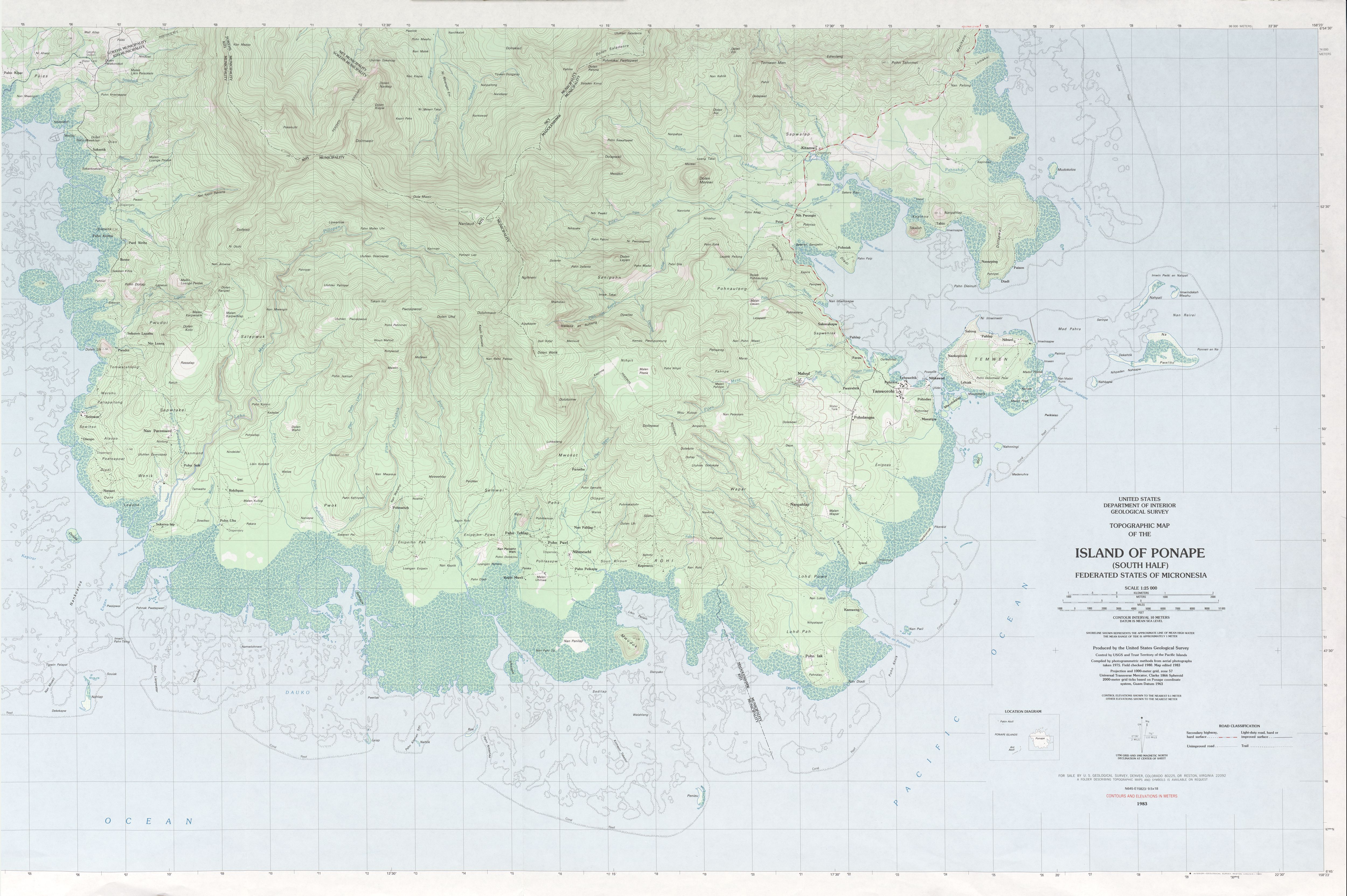
Dolohmwar or Totolom is the third highest point of the Federated States of Micronesia, with an altitude of 760 metres (2,595 ft). Mount Nanlaud 1.9 km to the north-northwest is the highest point at 2,566 feet (782 m).[3] Between the two is Ngihneni,[4] within a meter or two of Nanlaud. All three are clearly depicted on the definitive USGS 1:25,000 scale topographic survey.[2]
| Dolohmwar | |
|---|---|
 Dolohmwar Federated States of Micronesia | |
| Highest point | |
| Elevation | 760 m (2,490 ft)[1] |
| Prominence | 791 m (2,595 ft) |
| Coordinates | 6°51′25″N 158°13′57″E |
| Geography | |
| Location | Pohnpei, FSM |
| Topo map | [2] |
| Geology | |
| Mountain type | Hill |
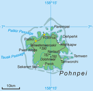
Dolohmwar is located on the island and in the state of Pohnpei.
See also
- Geography of the Federated States of Micronesia
References
- "Dolohmwar" on Peakery.com Archived March 31, 2012, at the Wayback Machine Retrieved 1 October 2011
- "Ponape South". US Geological Survey. 1983. Retrieved 22 Jan 2017.
- "Mount Nanlaud". GeoNames. Retrieved 12 May 2013.
- "Ngihneni--This site provides the coordinates for Nanlaud, not Ngihneni, as per the USGS topo". Retrieved 22 Jan 2017.
External links
- (in English) Dolohmwar, Micronesia, GeoNames.org.
This Federated States of Micronesia location article is a stub. You can help Wikipedia by expanding it. |
На других языках
[de] Dolohmwar
Dolohmwar ist der höchste Berg der Föderierte Staaten von Mikronesien mit einer Höhe von 791 m. Er liegt auf der Insel Pohnpei.[1]- [en] Dolohmwar
[fr] Dolohmwar
Dolohmwar est une montagne des États fédérés de Micronésie, le point culminant du pays. Elle se situe à une altitude de 791 mètres sur l'île de Pohnpei dans l'État de Pohnpei. Son sommet est situé à la frontière entre les municipalités de Madolenihmw et de Kitti.Текст в блоке "Читать" взят с сайта "Википедия" и доступен по лицензии Creative Commons Attribution-ShareAlike; в отдельных случаях могут действовать дополнительные условия.
Другой контент может иметь иную лицензию. Перед использованием материалов сайта WikiSort.org внимательно изучите правила лицензирования конкретных элементов наполнения сайта.
Другой контент может иметь иную лицензию. Перед использованием материалов сайта WikiSort.org внимательно изучите правила лицензирования конкретных элементов наполнения сайта.
2019-2026
WikiSort.org - проект по пересортировке и дополнению контента Википедии
WikiSort.org - проект по пересортировке и дополнению контента Википедии