geo.wikisort.org - Mountains
Doli Gutta is a peak in the northern part of the Deccan Plateau. It is located at the border of Mulugu district[2] in Telangana and Bijapur district in Chhattisgarh, India.[1]
| Doli Gutta | |
|---|---|
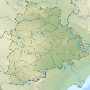 Doli Gutta Location of Doli Gutta peak | |
| Highest point | |
| Elevation | 965 m (3,166 ft) |
| Listing | List of Indian states and territories by highest point |
| Coordinates | 18°20′31″N 80°44′29″E[1] |
| Geography | |
| Location | Mulugu district, Telangana, India / Bijapur district, Chhattisgarh, India |
| Parent range | Deccan Plateau |
| Climbing | |
| Easiest route | Hike / scramble |
Highest point in Telangana
At 965 m Doli Gutta is the highest peak in the state of Telangana since the Chintoor and Vararamachandrapuram mandals of erstwhile Khammam district — where Pedda Konda rose to a height of 1360 m— were transferred to Andhra Pradesh.[1] Although naturally part of Telangana, on 11 July 2014, the Lok Sabha approved a bill transferring seven mandals of Khammam district (Kukunoor, Velairpadu, Bhurgampadu, Chintoor, Kunavaram, Vararamachandrapuram and Bhadrachalam) back to Andhra Pradesh, in order to facilitate the Polavaram Irrigation project.[3][4]
See also
- Geography of Telangana
- List of mountains in India
- List of mountains by elevation
References
- "Wikimapia - Doli Gutta (965m) - Telangana Chhattisgarh border. Possibly highest point in Telangana".
- "About district - Mulugu district". New Districts Formation Portal. Retrieved 7 October 2021.
- "The Andhra Pradesh Reorganisation (Amendment) Bill, 2014" Accessed 13 July 2014
- "Protests against Centre, Andhra Pradesh in Khammam over Polavaram Bill". Deccan Chronicle, 12 July 2014. Accessed 13 July 2014.
External links
Текст в блоке "Читать" взят с сайта "Википедия" и доступен по лицензии Creative Commons Attribution-ShareAlike; в отдельных случаях могут действовать дополнительные условия.
Другой контент может иметь иную лицензию. Перед использованием материалов сайта WikiSort.org внимательно изучите правила лицензирования конкретных элементов наполнения сайта.
Другой контент может иметь иную лицензию. Перед использованием материалов сайта WikiSort.org внимательно изучите правила лицензирования конкретных элементов наполнения сайта.
2019-2026
WikiSort.org - проект по пересортировке и дополнению контента Википедии
WikiSort.org - проект по пересортировке и дополнению контента Википедии