geo.wikisort.org - Mountains
The Desert of Wales, or Green Desert of Wales, is a large area in central Wales, so called because of its lack of roads and towns and its inaccessibility. The term was invented by English travel writers in the nineteenth century and has no equivalent in the Welsh language. The area corresponds roughly to the upland area called Elenydd in Welsh.
Extent
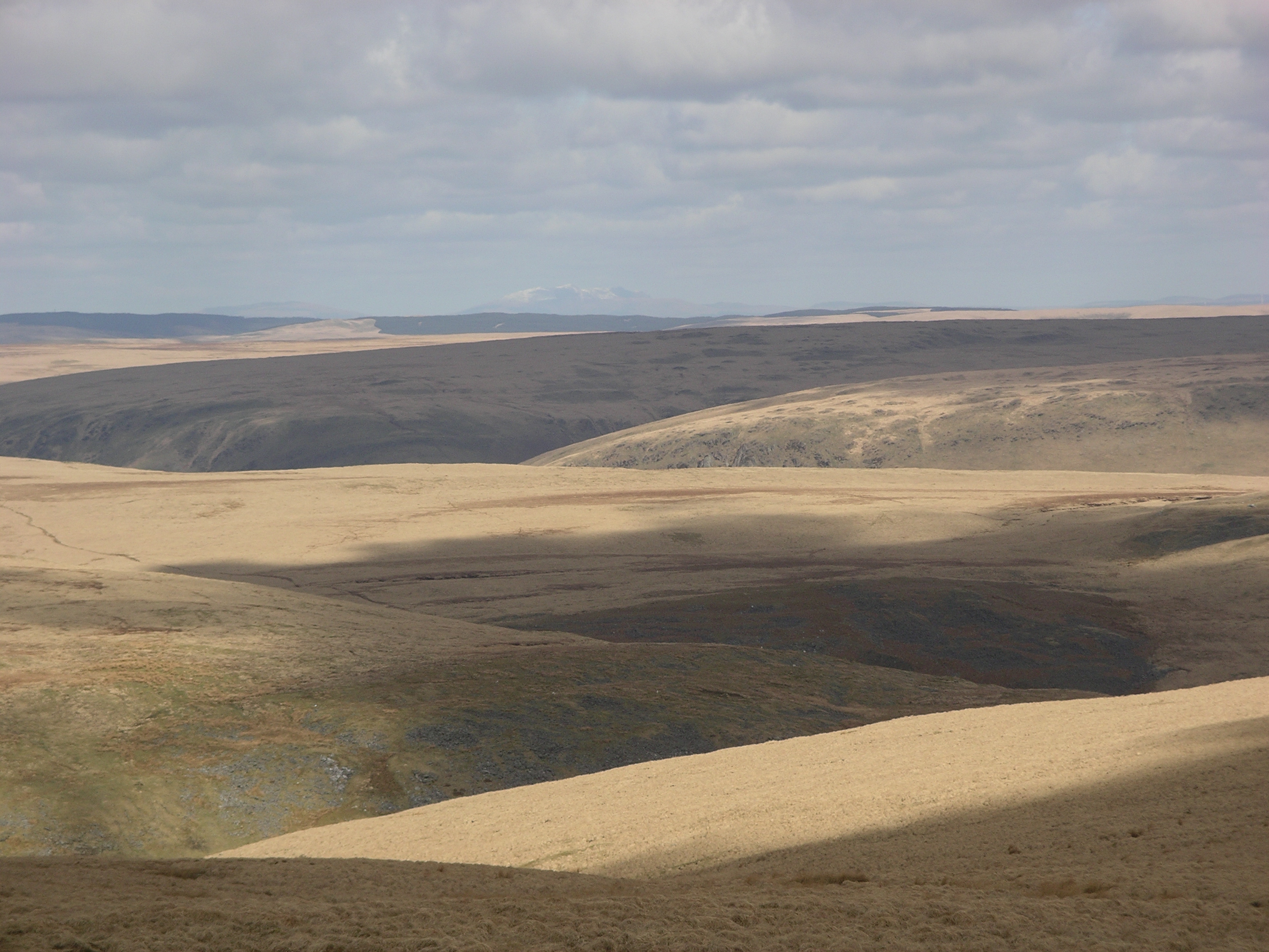
In this case the word "desert" can be used to describe two aspects of the region. Firstly, it may describe the lack of biodiversity due to overgrazing of sheep and human clearing, which, over time, has destroyed the native temperate rainforest.[1] Secondly, the word 'desert' may describe the lack of human settlement or infrastructure in the region. Therefore, the word 'desert' is not used in the sense of an arid desert. The area has high rainfall and much of it is covered by peat overlain with purple moor grass and heather moorland, or by plantations of non-native conifers. The soil tends to be acidic.[2] There is no exact definition of the extent of the Desert of Wales, but it is bordered to the east by the A470 and the town of Rhayader, to the south by the A483 from Builth Wells to Llanwrda, to the west by the A482 from Llanwrda to Pumpsaint, and from there northwards by a series of country roads up to Tregaron. The northern boundary is generally taken to be the A44 between Ponterwyd and Llangurig, although the substantial area of moorland to the north of this road, including the reservoirs of Nant y Moch and Llyn Clywedog, has similar topography.
The term 'Cambrian Desert' is also used to describe the region.[3]
History
The term Desert of Wales has been used to describe the area at least as far back as 1836 when the following was written by Joseph Downes:
Affording us water and trees, and yielding a dim and remote picture, wrapped in purple sunset haze, of some fine country far far down, where a chasm of hills gave egress to the water, it appeared quite an oasis to us travellers of this Desert of Wales.[4]
Travel is limited to narrow roads, forestry tracks, footpaths and bridleways. It is a sparsely populated area, consisting largely of rolling hills, gorges and steep valleys with ancient native Welsh oak forest.
Ruins
The ruins of Strata Florida Abbey are located on the road from Tregaron.
Wildlife
The area supported the last native red kites in the United Kingdom until their reintroduction and widespread revival in the 1980s.[2]
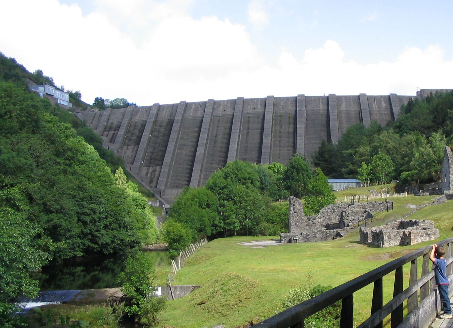
Water resources
The area has many lakes and reservoirs, some of which supply drinking water to towns and cities in the English West Midlands (Elan Valley group of reservoirs), to the towns of northern Ceredigion (Teifi Pools), and to towns all along the River Severn valley (Llyn Clywedog).
Drainage
It is drained by the Afon Claerwen, Afon Teifi, Afon Cothi, Afon Tywi, Afon Irfon, Elan Valley, Afon Gwy, Afon Ystwyth, Afon Mynach, Afon Rheidol
Rivers draining the Welsh Desert | ||||||||||||||||
|---|---|---|---|---|---|---|---|---|---|---|---|---|---|---|---|---|
| ||||||||||||||||
See also
- Elenydd
References
- Monbiot, George (2013). Feral. London: Penguin. pp. 64–65. ISBN 978-0-141-97558-0.
- Ceredigion, A Wealth of History by Gerald Morgan
- Monbiot, George (2013). Feral. London: Penguin. p. 64. ISBN 978-0-141-97558-0.
- Downes, Joseph (1836). The Mountain Decameron, Volume 3. London: Richard Bentley. p. 90. Retrieved 15 August 2021.
Other sources
- Morgan, Gerald (2005). Ceredigion, A Wealth of History. Ceredigion, Wales: Gomer. ISBN 1-84323-348-7.
- Cliffe, John Henry (1860). Notes and Recollections of an Angler: Rambles Among the Mountains, Valleys, and Solitudes of Wales. London: Hamilton, Adams, & Co.
External links
Другой контент может иметь иную лицензию. Перед использованием материалов сайта WikiSort.org внимательно изучите правила лицензирования конкретных элементов наполнения сайта.
WikiSort.org - проект по пересортировке и дополнению контента Википедии