geo.wikisort.org - Mountains
Darfur Dome or Darfur Volcanic Province is an area of about 100x400 km in Western Sudan. As well as its best-known and central feature, Deriba Crater, it encompasses the surrounding Marra Mountains (Jebel Marra) and Tagabo Hills, both formed around 16–10 Ma., and the Meidob Hills, formed around 6.8 Ma.[1]

There are currently two competing theories concerning Darfur Dome’s formation. The conventional view is that magmatism is the product of a rising mantle plume, with active volcanism being triggered by stress resolution along the Central African Fault Zone.[1][2] Evidence for a plume origin includes domal uplift, gravity anomalies, and low seismic velocity zones in the mantle,[1][2][3][4][5][6] though there is disagreement over whether these indicate a discreet, narrow plume under the Darfur region[1][2][3] or a broad superplume with conduits feeding several African hotspots.[4][5][6]
Recently, some scientists have argued for a tectonic origin in which lithospheric extension, asthenospheric shear, and small-scale convection have enabled passive melting of shallow source material.[7][8][9][10] This interpretation is supported by high seismic shear wave velocities which indicate shallow, cold downwellings[7] as well as normal heat-flow and low helium isotope ratios.[8][9]
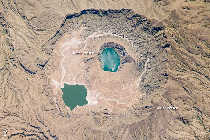
 Deriba Caldera
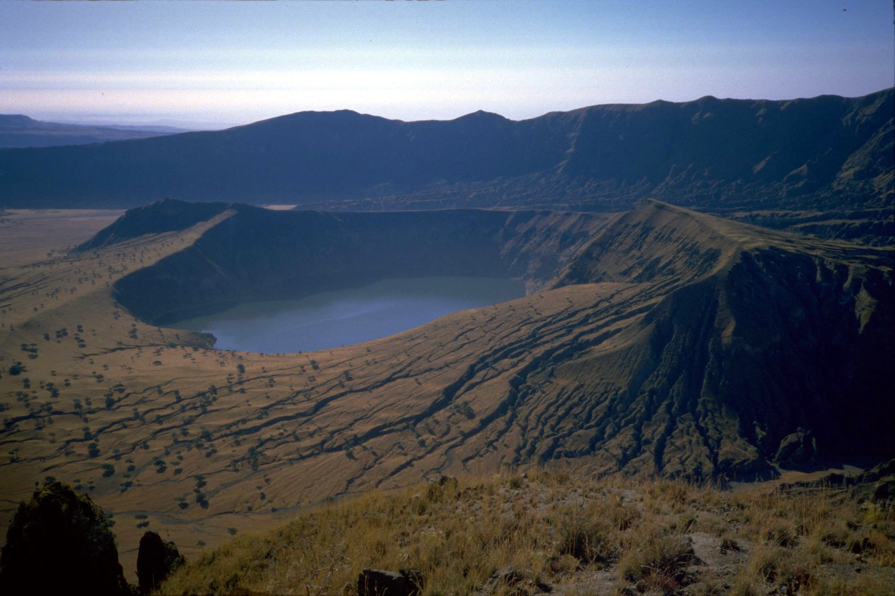
 Jebel Marra Deriba Lakes
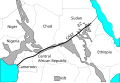 Central Africa showing CASZ.

Notes
- Franz, G.; Pudlo, D.; Urlacher, G; Haussmann, U; Broven, A.; Wemmer, K. (1994). "The Darfur Dome, western Sudan: the product of a subcontinental mantle plume". Geologische Rundschau. 83 (3): 614–623. Bibcode:1994GeoRu..83..614F. doi:10.1007/BF01083232. S2CID 198144219.
- Franz, G.; Steiner, G.; Volker, F.; Pudlo, D.; Hammerschmidt, K. (1999). "Plume related alkaline magmatism in central Africa—the Meidob Hills (W Sudan)". Chemical Geology. 157 (1–2): 27–47. Bibcode:1999ChGeo.157...27F. doi:10.1016/S0009-2541(98)00195-8.
- Burke, K. (1996). "The African plate". South African Journal of Geology. 99 (4): 339–410.
- Ebinger, C.J.; Sleep, N.H. (1998). "Cenozoic magmatism throughout east Africa resulting from impact of a single plume". Nature. 395 (6704): 788–791. Bibcode:1998Natur.395..788E. doi:10.1038/27417. S2CID 4379613.
- Zhao, D (2007). "Seismic images under 60 hotspots: Search for mantle plumes". Gondwana Research. 12 (4): 335–355. Bibcode:2007GondR..12..335Z. doi:10.1016/j.gr.2007.03.001.
- Steinberger, B. (2000). "Plumes in a convecting mantle: Models and observations for individual hotspots". Journal of Geophysical Research. 105 (B5): 11127–11152. Bibcode:2000JGR...10511127S. doi:10.1029/1999JB900398.
- King, S.D.; Ritsema, J. (2000). "African hot spot volcanism: Small-scale convection in the upper mantle beneath cratons". Science. 290 (5494): 1137–1140. Bibcode:2000Sci...290.1137K. doi:10.1126/science.290.5494.1137. PMID 11073447.
- Sebai, A.; Stutzmann, E.; Montagner, J-P.; Sicilia, D.; Beucler, E. (2006). "Anisotropic structure of the African upper mantle from Rayleigh and Love wave tomography". Physics of the Earth and Planetary Interiors. 155 (1–2): 48–62. Bibcode:2006PEPI..155...48S. doi:10.1016/j.pepi.2005.09.009.
- Montagner, J-P.; Marty, B.; Stutzmann, E.; Sicilia, D.; Cara, M.; Pik, R.; Lévêque, J-J.; Roult, G.; Beucler, E.; Debayle, E. (2007). "Mantle upwellings and convective instabilities revealed by seismic tomography and helium isotope geochemistry beneath eastern Africa". Geophysical Research Letters. 34 (21). Bibcode:2007GeoRL..3421303M. doi:10.1029/2007GL031098.
- Sicilia, D.; Montagner, J-P.; Cara, M.; Stutzmann, E.; Debayle, E.; Lépinea, J-C.; Lévêque, J-J.; Beucler, E.; Sebai, A.; Roult, G.; Ayele, A.; Sholan, J.M. (2008). "Upper mantle structure of shear-waves velocities and stratification of anisotropy in the Afar Hotspot region". Tectonophysics. 462 (1–4): 164–177. Bibcode:2008Tectp.462..164S. doi:10.1016/j.tecto.2008.02.016.
This tectonics article is a stub. You can help Wikipedia by expanding it. |
This Sudan location article is a stub. You can help Wikipedia by expanding it. |
Другой контент может иметь иную лицензию. Перед использованием материалов сайта WikiSort.org внимательно изучите правила лицензирования конкретных элементов наполнения сайта.
WikiSort.org - проект по пересортировке и дополнению контента Википедии