geo.wikisort.org - Mountains
![]() Czantoria Wielka (help·info) or Wielka Czantoria (Czech: Velká Čantoryje) is a mountain on the border of Poland and the Czech Republic, in the Silesian Beskids mountain range. It reaches a height of 995 metres (3,264 ft). Parts of the mountain on both sides are designated a protected area.[1]
Czantoria Wielka (help·info) or Wielka Czantoria (Czech: Velká Čantoryje) is a mountain on the border of Poland and the Czech Republic, in the Silesian Beskids mountain range. It reaches a height of 995 metres (3,264 ft). Parts of the mountain on both sides are designated a protected area.[1]
| Czantoria Wielka | |
|---|---|
| Velká Čantoryje | |
 Mountain viewed from the south | |
| Highest point | |
| Elevation | 995 m (3,264 ft) |
| Prominence | 311 m (1,020 ft) |
| Isolation | 12 km (7.5 mi) |
| Coordinates | 49°40′43.695″N 18°48′16.954″E |
| Geography | |
 Czantoria Wielka Location in Silesian Voivodeship, on the border with Czech Republic  Czantoria Wielka Czantoria Wielka (Poland) | |
| Location | Poland–Czech Republic border |
| Parent range | Silesian Beskids |
| Climbing | |
| Easiest route | Hike |
Geography
The peak of Czantoria Wielka is located on the tripoint of municipal territories of Ustroń and Wisła (Silesian Voivodeship, Poland) and Nýdek (Moravian-Silesian Region, Czech Republic). The mountain lies in the historical region of Cieszyn Silesia.
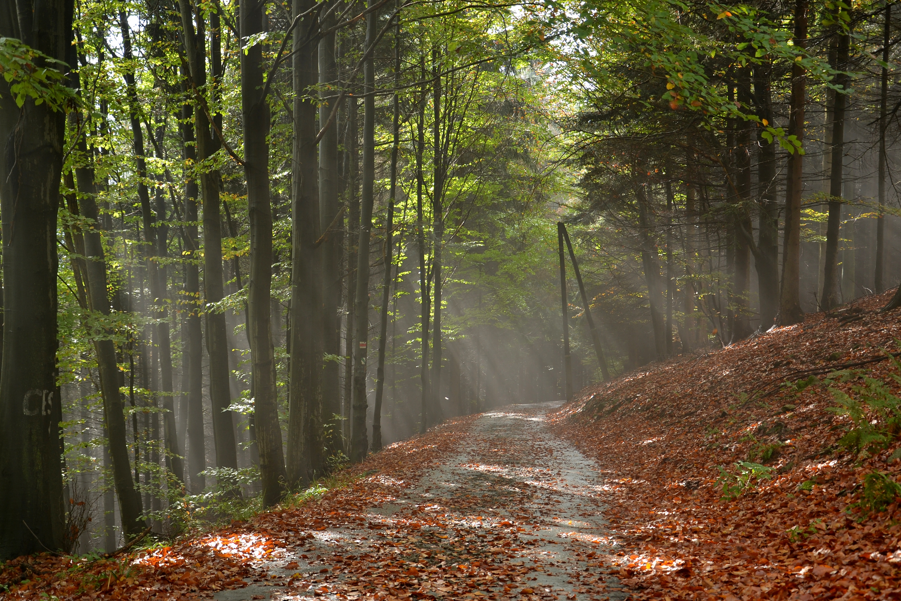
It is distinct for its steep slopes in the east and the west. Mostly coniferous trees grow on its slopes. It is the largest peak of the Czech part of the Silesian Beskids. There is a 29 m-high lookout tower on the mountain[2] and mountain hut on the Czech side of the mountain.
History
The mountain hut was constructed in 1904 by the German tourist association Beskidenverein, and was named Erzherzogin Isabella Schutzhaus in honor of Archduchess Isabella of Austria.[3] In 1920 the new border between the states of Poland and Czechoslovakia was established running across the mountain (thus creating Zaolzie region). After World War II and expropriation of German property, the hut was nationalized by the Czechoslovak government. A smaller mountain hut was built on the Polish side in 1962.
Tourism
In 1965–1967 a chairlift was constructed on the Polish side, it has been renovated several times since. Reaching the mountain via chairlift takes roughly 6 minutes.[3] The mountain can be hiked from both sides of the border, though the Polish side offers easier access to the summit from Ustroń. The Knight's hiking trail from the Czech side runs through the municipality of Nýdek.
Gallery
 Mountain hut
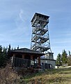 Observation tower
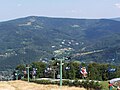 Czantoria chairlift
 Knights' hiking trail
 A big part of Cieszyn Silesia seen from the mountain


References
- "Čantoria National Nature Reserve". Retrieved 2015-01-06.
- "Website of the lookout tower". Archived from the original on 2010-09-28. Retrieved 2015-01-04.
- Cicha, Irena (2007). Beskidzkie gronie nad Olzą i Wisłą. Czeski Cieszyn: Vydavatelství Regio. pp. 191, 197. ISBN 978-80-254-0261-0.
External links
 Media related to Czantoria at Wikimedia Commons
| Authority control: National libraries |
|---|
На других языках
[de] Velká Čantoryje
Velká Čantoryje (polnisch Czantoria Wielka, deutsch früher Großer Czantory-Berg) ist der höchste Gipfel im tschechischen Teil der Schlesischen Beskiden. Der Berg erhebt sich etwa 10 Kilometer östlich der Stadt Třinec aus der Jablunkauer Furche (Jablunkovská brázda), die das Gebirge von den Mährisch-Schlesischen Beskiden trennt. Der Kamm der Čantoryje bildet die Staatsgrenze zwischen Tschechien und Polen. Über den Kamm dieses mächtigen Bergmassivs verläuft auch die Wasserscheide der Flüsse Oder und Weichsel. Das Massiv der Čantoryje hat zwei Gipfel; Mała Czantoria (Kleine Czantory, 865 m) und Velká Čantoryje (Große Czantory, 995 m), wobei die Kleine Czantory bereits in Polen liegt.- [en] Czantoria Wielka
Другой контент может иметь иную лицензию. Перед использованием материалов сайта WikiSort.org внимательно изучите правила лицензирования конкретных элементов наполнения сайта.
WikiSort.org - проект по пересортировке и дополнению контента Википедии