geo.wikisort.org - Mountains
Creu de Santos or Xàquera is the highest mountain of the Serra de Cardó range, Catalonia, Spain. The Serra de Cardó is part of the Massís de Cardó, Catalan Pre-Coastal Range. This mountain has an elevation of 941 metres above sea level.[1]
| Creu de Santos | |
|---|---|
| Xàquera | |
 View of the Creu de Santos (or Xàquera) summit | |
| Highest point | |
| Elevation | 941 m (3,087 ft) |
| Prominence | 697 m (2,287 ft) |
| Isolation | 18.15 km (11.28 mi) to Tossal d'Engrilló |
| Listing | Mountains in Catalonia |
| Coordinates | 40°56′25.88″N 0°35′9.77″E |
| Geography | |
 Creu de Santos Location  Creu de Santos Creu de Santos (Catalonia) | |
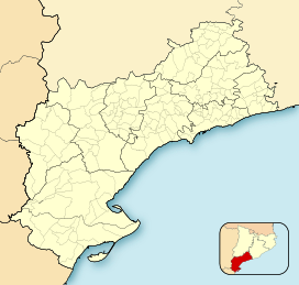
| Location | Tivenys, Benifallet, and Rasquera, Catalonia, Spain |
| Parent range | Serra de Cardó |
| Climbing | |
| Easiest route | Walk |
See also
References
- "Mapa Topogràfic de Catalunya". Institut Cartogràfic de Catalunya. Retrieved May 22, 2010..
This Province of Tarragona location article is a stub. You can help Wikipedia by expanding it. |
Текст в блоке "Читать" взят с сайта "Википедия" и доступен по лицензии Creative Commons Attribution-ShareAlike; в отдельных случаях могут действовать дополнительные условия.
Другой контент может иметь иную лицензию. Перед использованием материалов сайта WikiSort.org внимательно изучите правила лицензирования конкретных элементов наполнения сайта.
Другой контент может иметь иную лицензию. Перед использованием материалов сайта WikiSort.org внимательно изучите правила лицензирования конкретных элементов наполнения сайта.
2019-2026
WikiSort.org - проект по пересортировке и дополнению контента Википедии
WikiSort.org - проект по пересортировке и дополнению контента Википедии