geo.wikisort.org - Mountains
Coñocranra (possibly from Quechua quñuq warm, lukewarm, ranra stony, stony place)[1][2][3] is a mountain of Peru located in the Ancash Region, Santa Province. It is the highest mountain in the Cordillera Negra at (5181 m).
This article needs additional citations for verification. (September 2014) |
| Coñocranra | |
|---|---|
 | |
| Highest point | |
| Elevation | 5,181 m (16,998 ft) |
| Prominence | 1,086 m (3,563 ft)https://peakvisor.com/peak/conocranra.html |
| Coordinates | 8°50′35″S 78°00′23″W |
| Geography | |
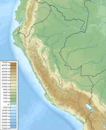 Coñocranra Peru | |
| Location | Ancash Region, Peru |
| Parent range | Andes |
| Geology | |
| Mountain type | Stratovolcano |
From its summit is the scenery of the Andes mountain range around. To the west, is the profile of the coast, usually in a misty background. To the east, is the Cordillera Blanca where the highest peaks of Peru can be seen, especially Huascarán (6768 m). Between the two mountain ranges, runs the Santa River, which gives life to the Callejón de Huaylas. Then the two mountain ranges come close to giving birth to the Canyon del Pato. Finally the Santa River, after cutting the Cordillera Negra, flows into the Pacific Ocean.
References
- Leonel Alexander Menacho López, Yachakuqkunapa Shimi Qullqa, Anqash Qhichwa Shimichaw (Ministerio de Educación), Wordbook Ancash Quechua-Spanish: Quñuq. - Caliente.
- Mg. Silvestre F. Cadillo Agüero, Curso Electivo Quechua Médico (Guía de enseñanza y aprendizaje), Universidad de San Martín de Porres, Facultad de Medicina, Lima - Peru, 2012: 11. INDICACIONES DESPUÉS DEL PARTO 11. ... quñuq yakuwan. (Quechua) - ... con agua tibia (Spanish) (Translation: ... with lukewarm water.) 5.2 Vocabularios sustantivales: ranra - pedregal
- Teofilo Laime Ajacopa, Diccionario Bilingüe Iskay simipi yuyayk'ancha, La Paz, 2007 (Quechua-Spanish dictionary): ranra, rumi rumi - adj. Pedregoso, -sa. Lleno de piedras. ranra ranra, rumi rumi. - s. Pedregal. Sitio cubierto de piedras sueltas.
This Ancash Region geography article is a stub. You can help Wikipedia by expanding it. |
На других языках
[de] Coñocranra
Der Coñocranra, Quechua-Name: Quñuqranra, ist mit einer Höhe von 5187 m die höchste Erhebung der Cordillera Negra, einem Gebirgszug der peruanischen Westkordillere, in der Region Ancash im Westen von Peru.- [en] Coñocranra
[es] Coñocranra
El Coñocranra es la montaña más elevada de la Cordillera Negra con 5.181 msnm, según la Carta Geográfica Nacional del Perú.[1]Другой контент может иметь иную лицензию. Перед использованием материалов сайта WikiSort.org внимательно изучите правила лицензирования конкретных элементов наполнения сайта.
WikiSort.org - проект по пересортировке и дополнению контента Википедии