geo.wikisort.org - Mountains
Command Ridge is the highest point of Nauru, with an elevation of 65 metres (213 ft).
| Command Ridge | |
|---|---|
 Command Ridge Nauru | |
| Highest point | |
| Elevation | 65 m (213 ft)[1] |
| Prominence | 65 m (213 ft)[1] |
| Listing | Country high point |
| Coordinates | 0°31′52″S 166°55′00″E[1] |
| Geography | |
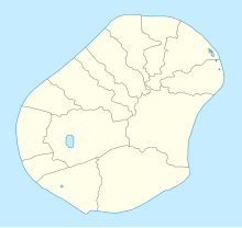
| Location | Aiwo District, Nauru |
| Geology | |
| Mountain type | Hill (Limestone) |
Passing close to Command Ridge is the boundary between Aiwo and Buada districts.
History
Nauru was once occupied by the Japanese during World War II. Command Ridge contained their communications bunker on Nauru, and some remnants of it remain, including rusted WWII guns/artillery. The bunker itself contains Japanese writing on the walls [2]

See also
- Geography of Nauru
References
- "Nauru High Point" on Peakbagger Retrieved 24 September 2011
- "Command Ridge | Nauru Attractions".
External links
- (in English) Adventure Details: Command Ridge, Topoworld.com.
- (in English) Command Ridge, Lonelyplanet.com
This Nauruan location article is a stub. You can help Wikipedia by expanding it. |
На других языках
- [en] Command Ridge
[fr] Command Ridge
Le Command Ridge, en nauruan Janor[2], est une colline de Nauru qui constitue le point culminant de ce pays avec 71 mètres d'altitude[1].[ru] Комманд-Ридж
Комманд-Ридж — гора, высочайшая точка Науру. Высота — 71 метр (233 фута)[1].Текст в блоке "Читать" взят с сайта "Википедия" и доступен по лицензии Creative Commons Attribution-ShareAlike; в отдельных случаях могут действовать дополнительные условия.
Другой контент может иметь иную лицензию. Перед использованием материалов сайта WikiSort.org внимательно изучите правила лицензирования конкретных элементов наполнения сайта.
Другой контент может иметь иную лицензию. Перед использованием материалов сайта WikiSort.org внимательно изучите правила лицензирования конкретных элементов наполнения сайта.
2019-2026
WikiSort.org - проект по пересортировке и дополнению контента Википедии
WikiSort.org - проект по пересортировке и дополнению контента Википедии