geo.wikisort.org - Mountains
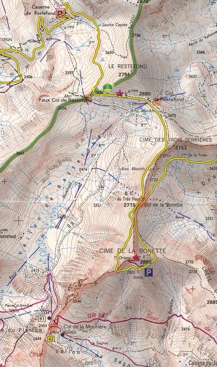
Cime de la Bonette (el. 2,860 metres or 9,383 feet) is a mountain in the French Alps, near the border with Italy. It is situated within the Mercantour National Park on the border of the departments of Alpes-Maritimes and Alpes-de-Haute-Provence, between the Ubaye Valley and the valley of the Tinée River.
| Cime de la Bonette | |
|---|---|
 Cime de la Bonette, viewed from the northern ascent of the Col de la Bonette pass from Jausiers | |
| Highest point | |
| Elevation | 2,860 m (9,380 ft) |
| Coordinates | 44°19′18″N 06°48′25″E |
| Geography | |
 Cime de la Bonette France | |
| Parent range | Mercantour National Park |
"Cime" means "summit" in French.
The summit is surrounded by road from the Col de la Bonette, which reaches 2,802 metres (9,193 ft), and is the second highest paved through route in the Alps. It is also the highest point reached by the Tour de France.[1]
See also
- Col de Restefond
- List of highest paved roads in Europe
- List of mountain passes
References
- Woodland, Les (2003). The Yellow Jersey Companion to the Tour de France. London: Yellow Jersey Press. p. 261. ISBN 0-224-06318-9.
External links
На других языках
- [en] Cime de la Bonette
[fr] Cime de la Bonette
La cime de la Bonette est un sommet situé au sein du massif du Mercantour-Argentera, entre les Alpes-de-Haute-Provence et les Alpes-Maritimes, dominant au nord la vallée de l'Ubaye et au sud la Tinée.[it] Cima della Bonette
La Cima della Bonette (Cime de la Bonette in francese) è una montagna delle Alpi alta 2860 m s.l.m., situata nelle Alpi Occidentali (Alpi Marittime) in Francia.Текст в блоке "Читать" взят с сайта "Википедия" и доступен по лицензии Creative Commons Attribution-ShareAlike; в отдельных случаях могут действовать дополнительные условия.
Другой контент может иметь иную лицензию. Перед использованием материалов сайта WikiSort.org внимательно изучите правила лицензирования конкретных элементов наполнения сайта.
Другой контент может иметь иную лицензию. Перед использованием материалов сайта WikiSort.org внимательно изучите правила лицензирования конкретных элементов наполнения сайта.
2019-2026
WikiSort.org - проект по пересортировке и дополнению контента Википедии
WikiSort.org - проект по пересортировке и дополнению контента Википедии