geo.wikisort.org - Mountains
The Bureya Range (Russian: Буреинский хребет, Bureinskiy Khrebet) is a mountain range in the Khabarovsk Krai and Jewish Autonomous Oblast in the southern part of the Russian Far East.
| Bureya Range | |
|---|---|
| Russian: Буреинский хребет | |
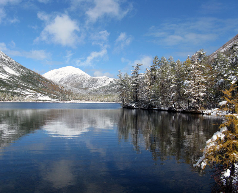 View of Korbokhon lake at the northern end of the range | |
| Highest point | |
| Peak | Unnamed |
| Elevation | 2,167 m (7,110 ft) |
| Dimensions | |
| Length | 400 km (250 mi) |
| Geography | |
 Location in Khabarovsk Krai | |
| Country | Russia |
| Region | Khabarovsk Krai Jewish Autonomous Oblast |
| Range coordinates | 50°0′0″N 133°0′0″E |
| Geology | |
| Orogeny | Alpine orogeny |
| Type of rock | Granite, gneiss, sedimentary and effusive rocks |
The Dusse-Alin Tunnel on the Baikal Amur Mainline crosses the range to enter the Amgun River valley. The Bastak Nature Reserve, a protected area, is located in the southeastern corner of the range.
Geography
The Bureya Range consists of a number of separate ridges with a total length of about 400 km and with a maximum height of 2,167 metres (7,110 ft).[1] To the northeast it connects with the Badzhal Range. The range forms the drainage divide of the Bureya, Amgun and Urmi rivers. The sources of the Selemdzha River are located at the northern end, where other three ranges meet the Bureya mountain chain, the Dusse-Alin from the south, the Ezop Range from the west and the Yam-Alin from the north.[2] The Dusse-Alin and Yam-Alin are a northern prolongation of the Bureya Range.[3]
Mount Studencheskaya is located in the southern part of the Bureya Range. At 1,421 metres (4,662 ft), it is the highest point of the Jewish Autonomous Oblast.[4]
Flora
The slopes of the range are covered by conifer and deciduous forests.[1]
See also
References
- Bureya Range // Great Soviet Encyclopedia : (in 30 vols.) / Ch. ed. A.M. Prokhorov . - 3rd ed. - M .: Soviet Encyclopedia, 1969-1978.
- Google Earth
- Ям-Алинь — Great Soviet Encyclopedia : (in 30 vols.) - Ch. ed. A.M. Prokhorov. - 3rd ed. - M .: Soviet Encyclopedia, 1969-1978.
- Еврейская автономная область - Географическое положение и рельеф
External links
- Brucite deposits of the lesser Khingan / southern Bureya range
- Geochemical characteristics of precious metal-bearing carbonaceous sequences from the eastern Bureya Massif
На других языках
[de] Burejagebirge
Das Burejagebirge (russisch Буреинский хребет, Bureinski chrebet, nach dem gleichnamigen Fluss, von ewenkisch biraja für „Fluss“) liegt im Fernen Osten Russlands.- [en] Bureya Range
[it] Monti della Bureja
I monti della Bureja (in russo: Буреинский хребет?, Bureinskij chrebet) sono una catena montuosa dell'Estremo Oriente russo, nel kraj di Chabarovsk.[ru] Буреинский хребет
Буреи́нский хребет — горный хребет на территории Хабаровского края в южной части Дальнего Востока России длиной около 400 км при максимальной высоте 2167 м. Состоит из сложенных гранитами, гнейсами, осадочными породами и эффузивными породами кряжей и среднегорных хребтов Дуссе-Алинь, Ям-Алинь, Эзоп.Другой контент может иметь иную лицензию. Перед использованием материалов сайта WikiSort.org внимательно изучите правила лицензирования конкретных элементов наполнения сайта.
WikiSort.org - проект по пересортировке и дополнению контента Википедии