geo.wikisort.org - Mountains
Borja (1,077 metres (3,533 ft)) is a mountain in central Bosnia (Bosnia and Herzegovina), between the town of Teslić and the village of Maslovare. It spreads in the southeast – northwest, and from Uzlomac is divided on saddle Solila, through which passes main road M-4 (Banja Luka – Matuzići – Doboj, which exits on the M-17 (as corridor Vc). The biggest part of this mountain lies in the municipalities of Teslić and Kotor Varoš.[1][2][3][4]

Over 1,000 meters above sea level at Borja are Runjavica (1,077 m), Pavlov vrh (Paul's peak, 1029 m), Komin (1,029 m) and Kuke (Hooks, 1.016 m). On the peaks of the mountain chain Očauš – Borja – Uzlomac is a watershed between basins of Bosnia and Vrbas.
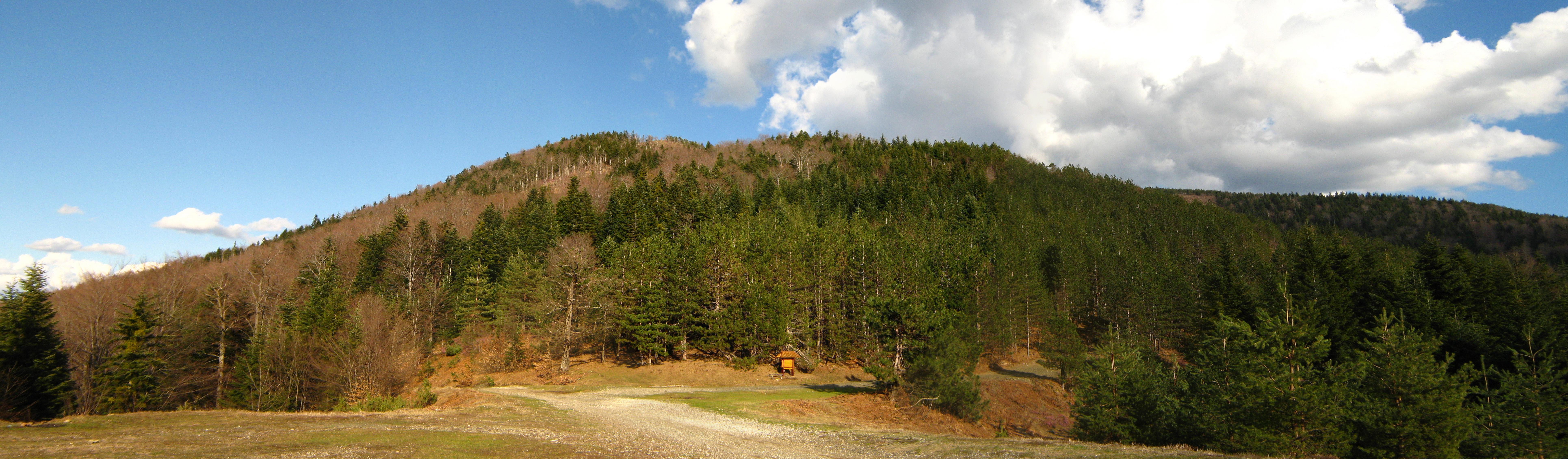
Borja is rich in dense coniferous–deciduous forest communities. Dominant coniferous species are white and black pine, after which it was named (the name Borja can be roughly translated as "pine woods"). The dense forests are inhabited by many wild animals, including endemic Bosnian mammals.
The mountain is abundant with springs and streams. The best known spring is Hajdučke vode, located near the recreation center with the same name. There is a rich variety of minerals, of which only the coal was mined. The coal mine was opened in 1916 under Austro-Hungarian rule . It was closed during the 1950s.
Flora and fauna
Fauna
In a two-year survey of the butterflies of Borja, 63 species were identified, representing 34% of all butterfly species ever identified in Bosnia and Herzegovina.[5] However, due to the lack of research in the area, 36 species were registered at Borja for the first time. Species were found from the families Hesperiidae, Lycaenidae, Nymphalidae, Papilionidae, and Pieridae.
See also
- Teslić
- Kotor Varoš
- Maslovare
- Obodnik
- Vrbanja (river)
References
- Vojnogeografski institut, Izd. (1955): Prnjavor (List karte 1:100.000, Izohipse na 20 m). Vojnogeografski institut, Beograd.
- Spahić M. et al. (2000): Bosna i Hercegovina (1:250.000). Izdavačko preduzeće „Sejtarija“, Sarajevo.
- kartabih
- Mučibabić B., Ur. (1998): Geografski atlas Bosne i Hercegovine. Geodetski zavod BiH, Sarajevo, ISBN 9958-766-00-0.
- Dukić, Branislava (2019-12-31). "Butterfly fauna (Hesperoidea & Papilionoidea) of mountain Borja, Bosnia and Herzegovina". Glasnik Šumarskog fakulteta Univerziteta u Banjoj Luci (29): 85–92. doi:10.7251/GSF1929085D. ISSN 2303-694X.
На других языках
[de] Borja (Gebirge)
Borja (kyrillisch: Борја) ist der Name eines zu den Ausläufern des Dinarischen Gebirges zählenden Höhenzuges in Bosnien und Herzegowina sowie einer gleichnamigen Ortschaft der hier gelegenen Stadt Teslić.- [en] Borja (mountain)
[fr] Borja (montagne)
Borja est une montagne culminant à 1 077 m d'altitude en Bosnie-Herzégovine, entre Teslić et le village de Maslovare. Elle s'étend selon un axe sud-est – nord-ouest, et à partir d'Uzlomac se divise au niveau du col Solila, à travers laquelle passe la route principale M-4 (Banja Luka - Matuzići - Doboj).[ru] Боря (гора)
Боря — гора в Республике Сербской. Находится на территориях общин Котор-Варош и Теслич. Её высота составляет 1 078 метров над уровнем моря. С юго-запада, юга и востока от горы течет Велика-Усора, а северо-запада, севера и северо-востока протекает Мала-Усора. С горы в них стекают ручьи и источники. Северо-западные склоны Бори соприкасаются с горой Узломац.Другой контент может иметь иную лицензию. Перед использованием материалов сайта WikiSort.org внимательно изучите правила лицензирования конкретных элементов наполнения сайта.
WikiSort.org - проект по пересортировке и дополнению контента Википедии