geo.wikisort.org - Mountains
The Bockkarkopf is a mountain, 2,609 m high, and part of the main ridge of the Allgäu Alps. It is the ninth highest peak in the Allgäu Alps and is located between the Wilder Mann to the southwest and the Hochfrottspitze to the northeast. The busy Heilbronn Way (Heilbronner Weg) runs over the pyramidal peak.
| Bockkarkopf | |
|---|---|
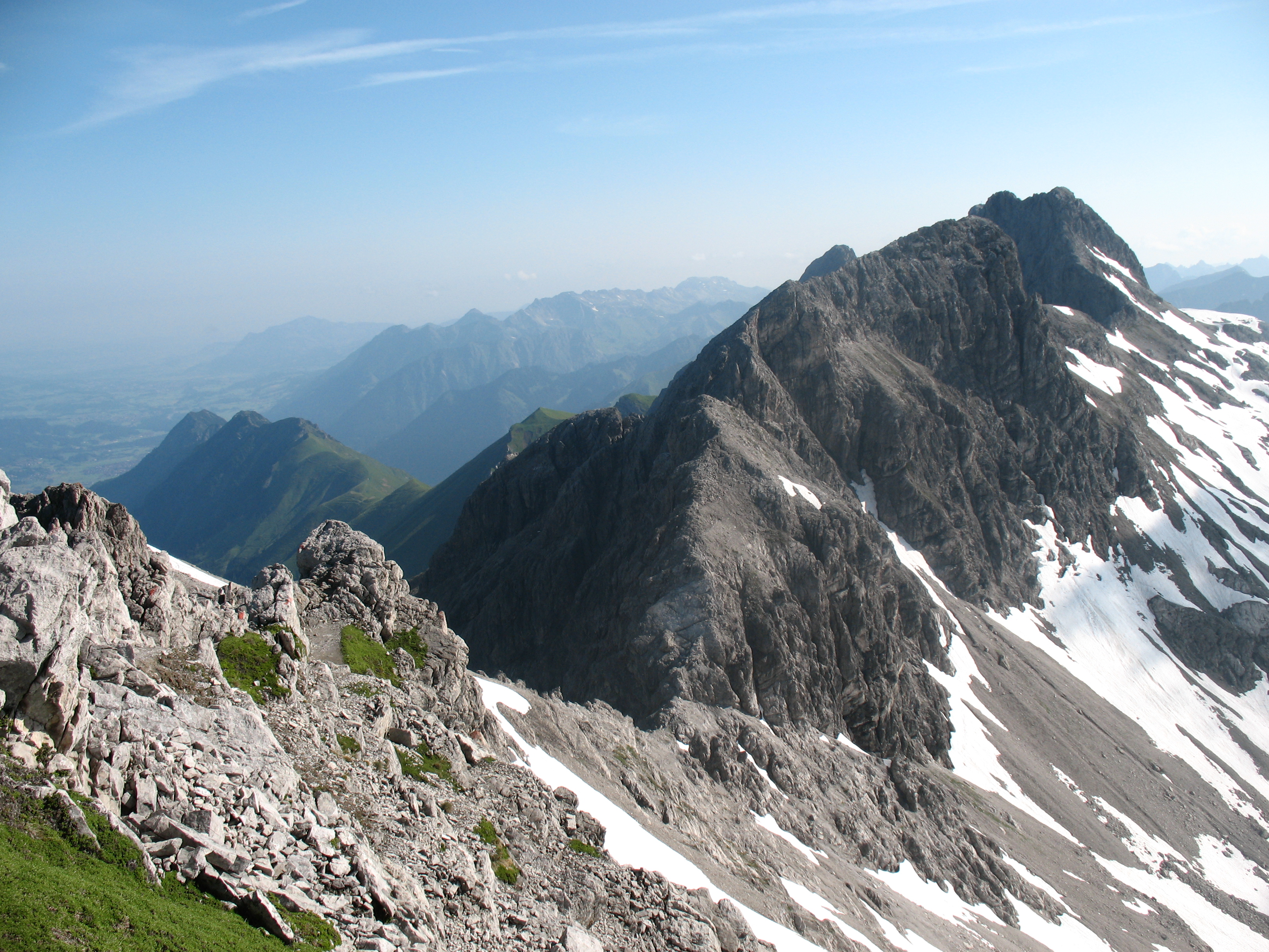 The Bockkarkopf from the Steinschartenkopf | |
| Highest point | |
| Elevation | 2,609 m (8,560 ft) |
| Prominence | 105 m ↓ Bockkarscharte → Hochfrottspitze |
| Isolation | 0.8 km → Hochfrottspitze |
| Coordinates | 47°17′28″N 10°17′06″E |
| Geography | |
 Bockkarkopf Bavaria, Germany / Tirol, Austria | |
| Parent range | Central ridge, Allgäu Alps |
| Climbing | |
| Normal route | over the Heilbronn Way |
The Bavarian border with Tyrol runs over the summit.
Ascent

The Bockkarkopf is usually only climbed from the Heilbronn Way. As a destination in itself it can be climbed in a circular tour from the Waltenberger Haus via the Hintere Bockkar and the Socktalscharte. The return journey to the mountain hut follows via the Bockkarscharte and the Vordere Bockkar. The tour can also be done in reverse.
Sources
- Dieter Seibert: Allgäuer Alpen Alpin, Alpenvereinsführer. München, Bergverlag Rudolf Rother 2004. ISBN 3-7633-1126-2
- Alpenvereinskarte 1:25.000, Blatt 2/1, Allgäuer- Lechtaler Alpen, West
External links
This Bavaria location article is a stub. You can help Wikipedia by expanding it. |
На других языках
[de] Bockkarkopf
Der Bockkarkopf ist als 2609 m hoher Berg Teil des Hauptkamms der Allgäuer Alpen. In den Allgäuer Alpen ist er der neunthöchste Gipfel und befindet sich zwischen dem Wilden Mann im Südwesten und der Hochfrottspitze im Nordosten. Über den pyramidenartigen Gipfel führt der vielbegangene Heilbronner Weg.- [en] Bockkarkopf
[fr] Bockkarkopf
Le Bockkarkopf est une montagne culminant à 2 609 m d'altitude dans les Alpes d'Allgäu. Il en est le neuvième sommet le plus élevé, situé entre le Wilder Mann au sud-ouest et le Hochfrottspitze au nord-est. Le chemin de Heilbronn (de) mène à son sommet pyramidal.Другой контент может иметь иную лицензию. Перед использованием материалов сайта WikiSort.org внимательно изучите правила лицензирования конкретных элементов наполнения сайта.
WikiSort.org - проект по пересортировке и дополнению контента Википедии