geo.wikisort.org - Mountains
Besselvassheia is a mountain in the municipality of Frøya in Trøndelag county, Norway. The 76-metre (249 ft) tall mountain is the highest point on the island of Frøya. It lies about 4 kilometres (2.5 mi) west of the village of Sistranda and about 4 kilometres (2.5 mi) northwest of the village of Hammarvika.
| Besselvassheia | |
|---|---|
 View of Besselvassheia (2011) | |
| Highest point | |
| Elevation | 76 m (249 ft) |
| Coordinates | 63.7148°N 08.7396°E[1] |
| Geography | |
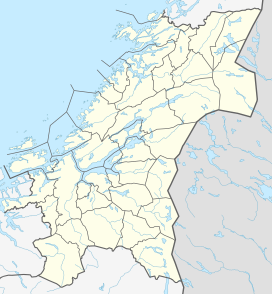 Besselvassheia Location of the mountain  Besselvassheia Besselvassheia (Norway) | |
| Location | Trøndelag, Norway |
| Climbing | |
| Easiest route | via Stuttvassdalen |
Name
The mountain was unnamed until the autumn of 2009 when it was given the name Besselvassheia, after the nearby lake Besselvatnet.[2]
The well-known Norwegian Soccer trainer Drillo, also known for his interest in geography, told a local resident, Frank Angelvik, that the highest point of Frøya was unnamed.[3] Together with Halgeir Hammer, a local guide, the naming contest was announced in September 2009. Some of the names that were runners-up were: Frøyberget, Frøytuva, Halgeirtoppen, Halgeirguten, and Besselberget.
References
- "Besselvassheia, Frøya (Trøndelag)" (in Norwegian). yr.no. Retrieved 2018-02-19.
- "Strålende varsel før topptur" [Summit's brilliant herald]. Hitra-Frøya.no. 2009-11-07. Archived from the original on 2011-07-19. Retrieved 2011-01-23.
Søndag arrangerer lokalavisa turmarsj til Besselvassheia. Frøyas høyeste topp, som nylig ble navngitt av Hitra-Frøyas lesere, er 76 meter hø... On Sunday, the local newspaper organized a hike to Freyja's highest peak (recently named Besselvassheia by the Hitra-Frøya readers), which is 76 feet tall...
- "Drillo - og vi - nysgjerrig på hva toppen skal hete" [Drillo (and the rest of us) are wondering what the top will be called]. Hitra-Frøya.no. 2009-09-18. Archived from the original on 2011-07-19. Retrieved 2011-01-23.
I Oslo sitter det en kjent geografi-nerd og vet det samme som oss - at Frøyas høyeste topp ikke har noe navn. In Oslo, there is a known geography nerd who knows the same thing that we do, that Freyja's highest peak has no name.
External links
- Besselvassheia...nå høyeste punkt (in Norwegian)
Другой контент может иметь иную лицензию. Перед использованием материалов сайта WikiSort.org внимательно изучите правила лицензирования конкретных элементов наполнения сайта.
WikiSort.org - проект по пересортировке и дополнению контента Википедии