geo.wikisort.org - Mountains
Bayanaul Range (Kazakh: Баянауыл тауы; Russian: Баянаульские горы) is a range of mountains in Bayanaul District, Pavlodar Region, Kazakhstan.[2]
| Bayanaul Range | |
|---|---|
| Баянауыл тауы | |
 Landscape of the range | |
| Highest point | |
| Peak | Akbet |
| Elevation | 1,022 m (3,353 ft) |
| Coordinates | 50°50′36″N 75°39′46″E[1] |
| Dimensions | |
| Length | 40 km (25 mi) E / W |
| Width | 20 km (12 mi) N / S |
| Geography | |
 Location in Kazakhstan | |
| Location | Bayanaul District Pavlodar Region, Kazakhstan |
| Range coordinates | 50°48′N 75°37′E |
| Parent range | Kazakh Uplands |
| Geology | |
| Orogeny | Alpine orogeny |
| Age of rock | Silurian and Devonian |
| Type of rock | Granite, quartzite, porphyritic rock |
| Climbing | |
| Easiest route | From Bayanaul |
Bayanaul, the administrative center of Bayanaul District, lies at the feet of the eastern slopes of the mountains. A large sector of the range is part of the Bayanaul National Park, a 68,453 hectares (169,150 acres) protected area established in 1985.[1][3]
Geography
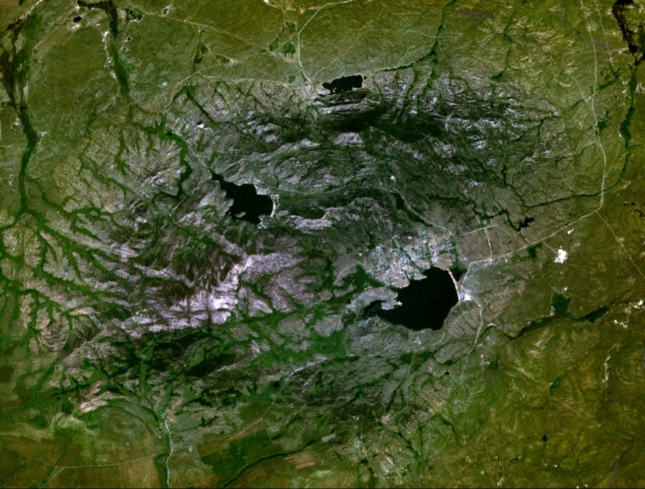
The Bayanaul Range is one of the subranges of the Kazakh Upland system (Saryarka). It rises in the northeastern sector of the highlands. The Bayanaul stretches from east to west for about 40 kilometers (25 mi) with mountaintops averaging between 600 meters (2,000 ft) and 1,000 meters (3,300 ft). The highest point is Akbet, a 1,026 meters (3,366 ft) high summit. The uppermost levels of the mountains are generally rocky and their slopes are deeply dissected by valleys and ravines. No major rivers have their sources in the range. Most flow into the surrounding steppe, their waters ending up in distant salt lakes or dispersed in the sands.[2][4][1]
The main lakes in the range are Sabyndykol, the largest one, as well as Zhasybai, Toraigyr and Byrzhankol, the latter located in the western part of the range. There are also numerous rock formations within the mountain area.[4][1]
 |
 |
Flora
Below the rocky summits the slopes are covered by forests where larch and birch predominate. There is as well steppe vegetation made up of coarse feathergrass and forb grassland areas.[2][5]
See also
- Geography of Kazakhstan
References
- Google Earth
- Kanysh Satpaev. Encyclopedia / Editor-in-Chief B. O. Jakyp. — Almaty "Kazakh Encyclopedia", 2011. ISBN 9965-893-74-8
- Баянаульский национальный парк
- "M-43 Topographic Chart (in Russian)". Retrieved 14 October 2022.
- Каденова А. Б. и др. Флора и растительность Баянаульского государственного национального природного парка. — Павлодар, 2008.
External links
 Media related to Bayanaul Range at Wikimedia Commons
- Visit Kazakhstan
This Kazakhstan location article is a stub. You can help Wikipedia by expanding it. |
На других языках
- [en] Bayanaul Range
[ru] Баянаульские горы
Баянаульские горы — горный массив на юго-западе Павлодарской области Казахстана. Горы тянутся с запада на восток на протяжении 40-50 км, а с севера на юг — на 20-25 км. Самая высокая точка — гора Акбет, достигающая 1022 м над уровнем моря. Основные геологические породы — крупнозернистые граниты, порфириты и кварциты. Реже встречаются сланцы и песчаники. Для Баянульских гор характерно ярусное строение.Другой контент может иметь иную лицензию. Перед использованием материалов сайта WikiSort.org внимательно изучите правила лицензирования конкретных элементов наполнения сайта.
WikiSort.org - проект по пересортировке и дополнению контента Википедии