geo.wikisort.org - Mountains
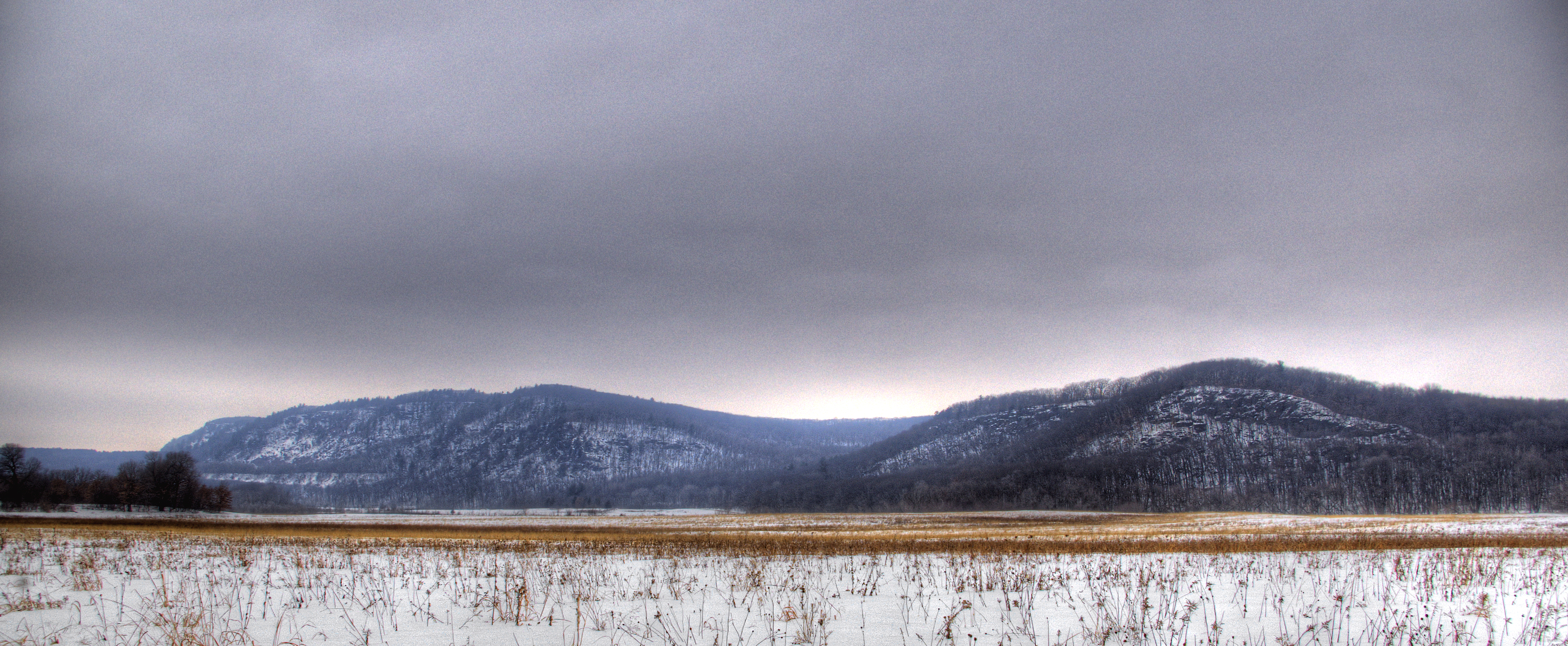
The Baraboo Range is a syncline located in Columbia and Sauk Counties, Wisconsin. It consists of highly eroded Precambrian metamorphic rock. It is about 25 miles (40 km) long and varies from 5 to 10 miles (16 km) in width. The Wisconsin River, previously traveling in a north to south direction, turns to the east just north of the range before making its turn to the west towards the Upper Mississippi River. The eastern end of the range was glaciated during the Wisconsinian glaciation, while the western half was not, and consequently, marks the eastern boundary of Wisconsin's Driftless Area.
| Baraboo Range | |
|---|---|
 The range with autumn leaves on WIS 33 | |
 Map of Wisconsin | |
| Location | Columbia and Sauk counties, Wisconsin |
| Nearest city | Baraboo |
| Coordinates | 43°25′30″N 89°39′20″W |
| Designated | 1980 |

The city of Baraboo is in the center of the valley. The range was designated a National Natural Landmark in 1980.[1]
Geology
The range is an example of a buried mountain range exposed through erosion, to once again undergo the forces of surface erosion. The rocks are as much as 1.5 billion years old,[2] among the oldest exposed rocks in North America, consisting mainly of gray to pink Baraboo Quartzite and red rhyolite. The Baraboo River divides the range in half, flowing through Upper Narrows Gorge near Rock Springs and travels onto its confluence with the Wisconsin River downstream from Portage through the Lower Narrows. The Baraboos are composed of resistant Precambrian quartzite (a metamorphic rock) which has formed an erosional remnant or Monadnock, resulting in topographic prominence. The mountains may have formed as long ago as the late Precambrian. These formations were buried by Paleozoic sedimentary strata and are still being uncovered by the erosion of the softer, overlying rocks.
Devil's Lake, the centerpiece of Devil's Lake State Park, was formed from terminal moraines blocking access to its outlet, creating what is today an endorheic lake (i.e., a lake lacking a surface outlet to the world's oceans).
References
- "Baraboo Range". nps.gov. National Park Service.
- Hanson, G. F., Geology of the Baraboo District, Wisconsin Archived February 22, 2014, at the Wayback Machine, The University of Wisconsin Extension, November 1970, Information Circular 14
- Steven Dutch, Devil's Lake, Retrieved July 27, 2007 (With map)
- Wisconsin Online, Retrieved July 27, 2007
- Baraboo Range Protection Plan, Sauk County, Retrieved July 27, 2007
- Devil's Lake State Park: Rocks and Water Through the Ages, Wisconsin Department of Natural Resources, Retrieved July 27, 2007
- Keith Montgomery, The Baraboo Ranges and Devil's Lake Gorge: A Geologic Tour Retrieved April 30, 2019
External links
 Media related to Baraboo Range at Wikimedia Commons
На других языках
- [en] Baraboo Range
[fr] Monts Baraboo
Les monts Baraboo (Baraboo Range) est un synclinal situé dans le sud de l'état américain du Wisconsin, dans les comtés de Sauk et de Columbia. Ils se composent de roches métamorphiques précambriennes fortement érodées. La chaine est longue d'environ 40 km pour largeur variant de 8 à 16 km. La rivière Wisconsin, qui coulait jusqu'alors du nord au sud, tourne vers l'est juste au nord de la chaîne avant de bifurquer vers l'ouest en direction du Mississippi. L'extrémité orientale de la chaîne a subi la glaciation du Wisconsin, tandis que la moitié ouest non pas et, par conséquent, marque la limite orientale de la Driftless Area (en) (la « zone sans dérive »).Другой контент может иметь иную лицензию. Перед использованием материалов сайта WikiSort.org внимательно изучите правила лицензирования конкретных элементов наполнения сайта.
WikiSort.org - проект по пересортировке и дополнению контента Википедии