geo.wikisort.org - Mountains
The Balele Mountains (Balelesberg or sometimes Belelasberg in Afrikaans) are a mountain massif largely located in the KwaZulu-Natal province in South Africa.
| Balele Mountains | |
|---|---|
| (Balelesberg / Belelasberg) | |
 Balele Mountains rising behind Utrecht | |
| Highest point | |
| Peak | Vaalkop |
| Elevation | 1,845 m (6,053 ft) |
| Listing | List of mountain ranges of South Africa |
| Coordinates | 27.5453°S 30.1392°E |
| Geography | |
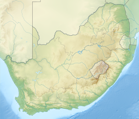
 Balele Mountains | |
| Country | South Africa |
| Geology | |
| Type of rock | dolerite |
Geography
The Balele Mountains stretch north of the town of Utrecht, which lies at their foot, south-east of Wakkerstroom and Volksrust (in Mpumalanga), and north-east of the Newcastle region. Vaalkop is the highest point.[1]
Geology
As on the eastern slopes of the Drakensberg, the dolerite dominates the collapsing cliffs of the Balele Mountains.[2]
History
Early in the 20th century, the Utrecht Collieries Company began mining coal in the Balele Mountains. In 1906, the governor of Natal decided to build a railway line between Utrecht and Newcastle. The line was inaugurated in 1910 by the then governor Lord Methuen.[3]
References
- G. W. Begg, The Wetlands of Natal, 1989, p.84
- Amajuba District Municipality Environnemental Management Framework Amajuba District Municipality Environnemental Management Framework - Draft Status Quo Report, p.XIV
- "PART 13 The Natal Main Line – from north of Ladysmith to Charlestown on the Transvaal border - including the branch to Utrecht from Newcastle compiled by Les Pivnic and Bruno Martin. © - Soul of A Railway". sites.google.com. Retrieved 2 December 2020.
На других языках
- [en] Balele Mountains
[fr] Monts Balele
Les monts Balele (Balelesberg en afrikaans), parfois Belela, sont un massif de montagnes situé en grande partie dans le Kwazulu-Natal en Afrique du Sud.Другой контент может иметь иную лицензию. Перед использованием материалов сайта WikiSort.org внимательно изучите правила лицензирования конкретных элементов наполнения сайта.
WikiSort.org - проект по пересортировке и дополнению контента Википедии