geo.wikisort.org - Mountains
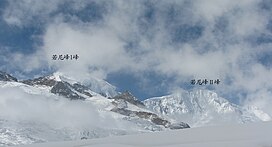
Bairiga (Chinese: 白日嘎; pinyin: Bái Rì Gä) or Ruoni (Chinese: 若尼峰; pinyin: Ruò Ní Fēng) (6,882 m) is the highest peak of Kangri Garpo Range of southeast Tibet Autonomous Region. The region has only recently been explored[3] and before 2009, none of its 47 peaks above 6,000 m had been climbed. Bairiga / Ruoni, which remains unclimbed itself, was photographed for the first time in 1933 by the botanist explorer Frank Kingdon-Ward, at which time it was known as Choembo. [4]
| Bairiga | |
|---|---|
| Ruoni | |
 Ruoni and Lopchin | |
| Highest point | |
| Elevation | 6,882 m (22,579 ft)[1] |
| Prominence | 2,444 m (8,018 ft)[2] |
| Listing | Ultra |
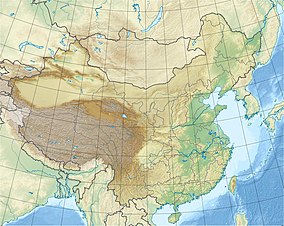
| Coordinates | 29°09′57″N 96°43′27″E[2] |
| Geography | |
| Location | Tibet Autonomous Region, China |
| Parent range | Kangri Garpo |
| Climbing | |
| First ascent | unclimbed |
| Easiest route | snow/ice/glacier climb |
In 2009, a Sino-Japanese joint climbing team formed by China University of Geosciences (Wuhan) and Kobe University organized an expedition to climb Kangri Garpo II or Ruoni II (6,805 m).[5][6] On November 5, Deqing Ouzhu and Ciren Danda, Tibetan students with the CUG, were the first to reach the summit, while Koichiro Kondo and Masanori Yazaki scaled the peak two days later. In consultation with a local village leader Kangri Garpo II was renamed Lopchin (Lopchin Feng in Tibetan, Lou bu qin in Chinese), meaning "white male hawk".[7]
See also
References
- "Bairiga". Peakbagger.com. Retrieved 2010-03-09.
- Tibet Ultra-Prominences Peaklist.org. Retrieved 2011-11-24.
- Tamotsu Nakamura (2001) Kangri Garpo Range, The Himalayan Journal 57
- Tatsuo "Tim" Inoue (2011), Hidden 47 Six-thousanders in the Kangri Garpo Mountains, Japanese Alpine News 2011
- "中国地质大学体育部". Archived from the original on 2011-07-07. Retrieved 2009-11-16. (in Chinese)
- http://osaka.yomiuri.co.jp/university/topics/20091108-OYO8T00293.htm?from=sub%5B%5D (in Japanese)
- Tatsuo "Tim" Inoue (2010) Asia, Tibet, Kangri Garpo Mountains, Lopchin (Kangri Garpo II)
External links
- https://web.archive.org/web/20110615025954/http://www.kobe-u.ac.jp/info/topics/pdf/t2009_10_07_01.pdf 神戸大学・中国地質大学(武漢) 崗日嗄布(カンリガルポ)山群合同学術登山隊計画 (in Japanese)
- kangri_garpo_photos (in Japanese)
- https://web.archive.org/web/20110720032653/http://www.hb.xinhuanet.com/newscenter/2009-11/11/content_18199470.htm (in Chinese)
На других языках
[de] Ruoni
Der Ruoni (chinesisch .mw-parser-output .Hani{font-size:110%}若尼峰, Pinyin Ruò Ní Fēng; auch Bairiga (chinesisch 白日嘎, Pinyin Bái Rì Gä) oder Chombo) ist mit 6882 m der höchste Berg im Kangri Garpo im Osten des autonomen Gebietes Tibet.- [en] Bairiga
[ru] Баирига
Баирига (кит. 白日嘎, пиньинь Bái Rì Gä), или Руони (кит. 若尼峰, пиньинь Ruò Ní Fēng)[1], ранее — Чоембо[2] — гора в Тибетском автономном районе Китайской Народной Республики[1], самая высокая вершина хребта Кангри-Карпо[en][2], часть горной системы Гималаи[1].Другой контент может иметь иную лицензию. Перед использованием материалов сайта WikiSort.org внимательно изучите правила лицензирования конкретных элементов наполнения сайта.
WikiSort.org - проект по пересортировке и дополнению контента Википедии

