geo.wikisort.org - Mountains
Apacheta-Aguilucho volcanic complex (also known as Cerro Pabellón[2]) is a volcanic complex in Chile. It consists of two volcanoes Cerro Apacheta and Cerro Aguilucho, which are constructed mainly by lava flows and surrounded by outcrops of lava. A sector collapse and its landslide deposit are located on Apacheta's eastern flank. Two lava domes are associated with the volcanic complex, Chac-Inca and Pabellón.
| Apacheta-Aguilucho volcanic complex | |
|---|---|
 | |
| Highest point | |
| Elevation | 5,557 m (18,232 ft)[1] |
| Coordinates | [1] |
| Geography | |
 Apacheta-Aguilucho volcanic complex | |
The volcanic complex was active from the Miocene to the Pleistocene, but ongoing fumarolic activity has been observed and a geothermal system is present. A geothermal power plant was being built in 2015 and became active in late 2017. It is the first geothermal power plant in Chile.
Geography and geomorphology
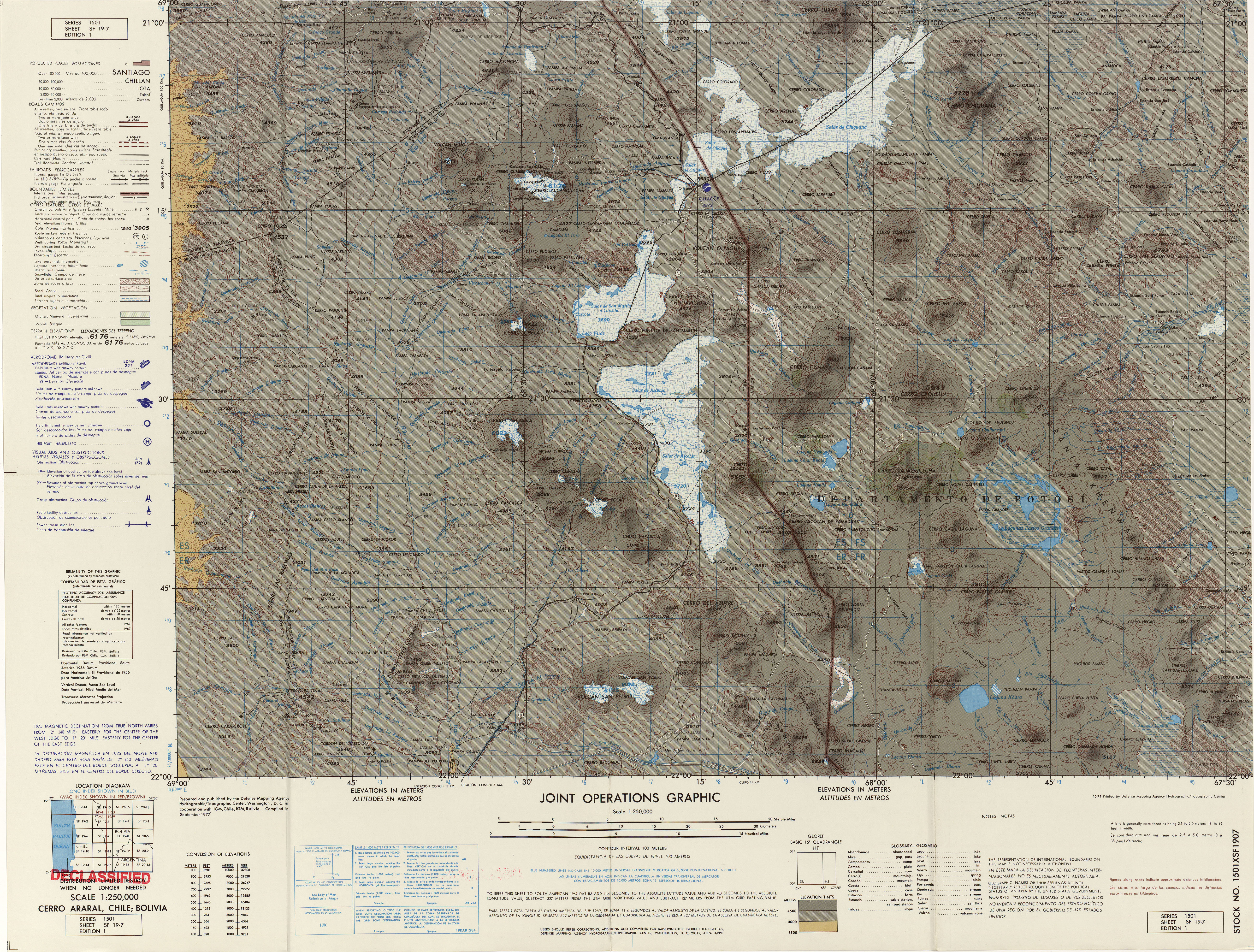
The Apacheta-Aguilucho volcanic complex lies in northern Chile, close to the border with Bolivia.[3] The city of Calama lies 105 kilometres (65 mi)[4]-120 kilometres (75 mi) southwest of Apacheta-Aguilucho and El Tatio is about 60 kilometres (37 mi) south-southwest, but with the exception of geothermal power[2] and mining-associated infrastructure the area is remote and uninhabited.[3] Presently, the region has an arid climate.[5] Vegetation, if present, consists mainly of grasses and shrubs.[6]
The volcanic complex is part of the Central Volcanic Zone of the Andes. The Central Volcanic Zone further includes the Altiplano-Puna volcanic complex, which between 10 and 1 million years ago was the source of large ignimbrite eruptions[4] that produced over 15,000 cubic kilometres (3,600 cu mi) of rock;[7] after that it produced lava flows and lava domes like Cerro Chao and geothermal fields such as El Tatio and Sol de Mañana,[4] accompanied by a decreased production of volcanic material.[7] The Altiplano-Puna volcanic complex is underpinned by a magmatic body that appears to be a batholith.[8] Volcanic activity is the consequence of the subduction of the Nazca Plate beneath the South America Plate.[9] Aside from volcanic activity, crustal shortening has resulted in a thickened crust since about 35 million years ago.[8]
The volcanic complex
Apacheta-Aguilucho is a volcanic complex formed by two volcanoes,[1] Cerro Apacheta and Cerro Aguilucho, both composite volcanoes;[10] with the highest summit of the complex reaching a height of 5,557 metres (18,232 ft).[1] The northern Aguilucho volcano and the southern Apacheta volcano are in their central portions formed by rhyolitic lava flows, with the surrounding edifice formed by andesitic-dacitic lavas. An andesitic lahar and pyroclastic flow crops out south and east of Apacheta,[11] which as the oldest part of the edifice is heavily eroded.[3] North and east of the complex, the two lava domes Chac-Inca and Cerro Pabellón[11] (also known as Apacheta or Pabellóncito[12]) form the youngest part of the volcanic complex.[3]
Moraines are encountered both west-southwest of Apacheta and east of the Chac-Inca dome,[11] and traces of glacial erosion are observed on the Aguilucho crater region.[13] The moraines developed during the last glacial maximum.[14]
Geothermal manifestations

Apacheta volcano is fumarolically active on its northern[15] and eastern slopes[16] as well as on the summit.[17] Two fumaroles on the summit of Apacheta produce 108–118 °C (226–244 °F)[18] superheated steam at a high output; the gas has a composition typical of geothermal system fumaroles, with some differences.[15] They are located within a wider c. 0.03 square kilometres (0.012 sq mi) area that features diffuse degassing, gryphons,[19] mud pools and vents.[18]
Apacheta-Aguilucho has a geothermal system and the chemistry of fumarole gases suggests that Apacheta-Aguilucho features an active magma system at depth. Drilling has found temperatures of over 200 °C (392 °F) at 500 metres (1,600 ft) depth.[4] This fumarolic activity has resulted in hydrothermal alteration of many parts of the volcanic complex;[1] this activity has generated a sulfur deposit on the west flank of Aguilucho.[10] The mine Mina Aguilucho is located on Aguilucho's western flank.[15]
The Pabellón geothermal system was discovered in 1999,[9] extends over an area of 25 square kilometres (9.7 sq mi)[20] and is classified as a "blind" geothermal system owing to its scarce activity at the surface,[21] despite the fumaroles existing at the top of Aguilucho;[22] the ascent of gases to these fumaroles is presumably facilitated by the presence of intersecting faults.[23] Thick clay layers encountered between about 165 metres (541 ft) and 490 metres (1,610 ft) depth[24] in drill holes presumably seal the geothermal system.[25] The water remains in the system for a long time and undergoes prolonged interaction with the country rock.[20] The source of heat is unclear; the last eruptions of Apacheta-Aguilucho are too long ago and the more recent lava domes are unlikely to be associated with significant heat reserves.[26] Another geothermal area is found in the Cordón de Inacaliri range southeast from Apacheta-Aguilucho.[27]
Sector collapse
A landslide deposit extends 4.5 kilometres (2.8 mi) away from the volcanic complex on its eastern flank. The landslide deposit covers a surface of about 3 square kilometres (1.2 sq mi),[1] and a large collapse scar with signs of hydrothermal alteration faces the western end of the landslide.[13] In its upper part, the deposit is bordered to the north and south by levees.[28] Downslope, the deposit consists at first of a lobate structure that east of the Pabellón dome grades into a more hummocky deposit. The deposit is increasingly dominated by hydrothermally altered material farther east, while the hummocks consist of lava blocks.[29] The material of the landslide deposit itself features both solid blocks and a finer matrix.[30] Rocks involved in the landslide include both andesitic and dacitic lavas and hydrothermally altered material. The landslide deposit is confined between two older lava flows.[1]
Sector collapses like the one at the Apacheta-Aguilucho volcanic complex have been observed on other volcanoes (such as Mount St Helens during its 1980 eruption), and they result in characteristic landslide deposits known as debris avalanche deposits; these feature hummock-like hills and often levees. Such collapses occur for different reasons for each event and are fairly common; in the Central Andes alone 14 volcanoes feature deposits of such collapses.[31] Such deposits commonly feature a stratigraphy that resembles that of the source edifice, as well as jigsaw-like cracks in rocks that form when rocks disintegrate during the collapse and sliding.[32]
In the case of Apacheta-Aguilucho, it is likely that the sector collapse was triggered by hydrothermal alteration of the edifice that weakened its structure until it failed, and its path was likely influenced by regional tectonics.[33] After the edifice had failed, the landslide moved eastward until it was deflected by older topography; the material became increasingly fragmented.[34]
Geology
Off the west coast of South America, the Nazca Plate subducts beneath the South America Plate in the Peru-Chile Trench. This subduction process is responsible for volcanism in the Central Andes, which occurs at distances of 250–300 kilometres (160–190 mi) from the trench.[1]
Two major fault systems are found close to Apacheta-Aguilucho. The first is the major regional Calama-Olacapato-El Toro fault, the second fault system runs from neighbouring Inacaliri volcano northwest of Apacheta-Aguilucho towards the southeast, where it forms the Pabellóncito graben;[1] the volcanic complex is built within that graben[4] and the eruption of Pabellón was influenced by the graben faults, which allowed magma to reach the surface. The Pabellóncito fault system was active during the Pliocene[22] and Pleistocene; the activity of these regional fault systems appears to be a consequence of tectonic regime changes during the early Pleistocene, which drove extensional tectonics in the area,[14] or of gravitational spreading of the crust under the weight of volcanoes in the area.[35] Northwest of Apacheta-Aguilucho, the axis of the graben is buried beneath other volcanoes starting with Cerro del Azufre[36] which form a northwest-southeast alignment[21] known as Inacaliri lineament.[37]
The basement beneath Apacheta-Aguilucho is of Eocene to Miocene age. It consists of various volcanic and sedimentary formations[36][1] including eroded volcanoes,[4] and it is in part covered by 7.5 million years old ignimbrites.[1]
Composition
Apacheta-Aguilucho has principally erupted andesite, dacite and rhyolite[1] which define a potassium-rich calc-alkaline suite.[12] These rocks define a potassium-rich calc-alkaline suite which contains amphibole, biotite, clinopyroxene, iron-titanium oxides, orthopyroxene, olivine, plagioclase, quartz, sanidine and titanite. Olivine is often altered to clay, goethite and hematite[38] and there are areas of hydrothermally altered rocks on the eastern flank[22] and in the summit fumarole field. At the fumarole field, minerals like chlorite, gypsum, halloysite, hematite, mica and quartz formed through supergene and acid leaching processes.[18] The magmas appear to derive from the Altiplano-Puna magmatic complex volcanic body and underwent fractional crystallization and other geochemical processes before erupting.[39]
Eruption history
The volcanic complex is of Pliocene to Pleistocene age[10] and developed over several different stages. In the first stage, the so-called Aguilucho ignimbrite consisting of moderately welded, white-to-pink pyroclastic flows was emplaced 7.5 ± 0.6 million years ago and andesitic lava flows 6.7 ± 0.3 million years ago. Subsequently, more lava flows were emplaced, consisting of blocky dacite.[16]
The Apacheta and Aguilucho volcanoes were constructed consecutively. Apacheta consists of lava flows and pyroclastic material made out of andesite, and its crater is covered by pyroclastic flows and a 2.5 kilometres (1.6 mi) long rhyolitic lava flow. Aguilucho is constructed by lava flows. Finally, several lava flow fields were emplaced together with the lava domes Pabellón and Chac-Inca.[16] 1,204,000 ± 33,000 years ago an ignimbrite named Aguilucho ignimbrite was erupted[40] from the Apacheta volcano.[8]
Apacheta grew between about 1.024 and 0.9 million years ago and Aguilucho between 0.7 and 0.6 million years ago.[5] Lava flows on Apacheta-Aguilucho have been dated to 910,000 ± 140,000 and 700,000 ± 200,000 years before present,[1] with one lava flow being dated to 652,000 ± 12,000 years ago.[40] The date of the sector collapse is not known with certainty but was probably after the last lava flow was emplaced on Apacheta-Aguilucho.[33]
Dating of Chac-Inca has produced an age of 140,000 ± 80,000 years before present. Different dates have been obtained on Cerro Pabellón: Potassium-argon dating yields an age of 130,000 - 80,000 years before present, while argon-argon dating has yielded an age of 50,000 ± 10,000 years before present.[16] After the cessation of volcanic activity at Apacheta-Aguilucho, it appears to have migrated to the neighbouring Azufre volcano.[41] Future eruptions may consist of small explosions with local impact, of perhaps phreatic nature.[37]
Geothermal power production
The discovery of steam during the drilling of a freshwater well in the 1990s led to investigations by ENAP and UNOCAL in the area and the discovery of the fumaroles. In 2002, a joint enterprise by ENAP and CODELCO obtained the permission to explore the area, but while a geothermal system was discovered political questions about ENAP's involvement derailed the project.[3]
Another joint enterprise this time including the Italian ENEL performed further research in the area between 2006-2007, and obtained a permit to exploit the system in 2009.[3] The joint enterprise started the geothermal power project Cerro Pabellón, and in 2015 the construction of two power plants with a projected output of 24 MW each started, to be completed in 2017-2018.[42] The plant on Pampa Apacheta[22] 3.5 kilometres (2.2 mi) east of Apacheta-Aguilucho[5] was inaugurated by the Chilean president Michelle Bachelet on 12 September 2017, becoming the first[lower-alpha 1] geothermal power station in South America[44] and as of 2021[update] the only operating one.[45] Situated at an elevation of over 4,500 metres (14,800 ft), it is the highest large-scale geothermal plant in the world.[46]
The Cerro Pabellón project is expected to produce 340 Gigawatt-hours per year, enough to cover the electricity consumption of 165,000 families.[47] The plant is expected to reduce Chile's carbon dioxide emissions by about 166,000,000 kilograms per year (166,000 t/a)[2] and is owned by the companies Geotérmica del Norte S.A.(GDN) and Empresa Nacional de Geotermia; the latter is a joint venture between ENAP and ENEL.[5] A further expansion began in 2019,[46] aiming at increasing output by about 33 MW[48] to 81 MW.[46] The plant uses hydrogen for energy storage.[49]
Notes
See also
- El Tatio
- Geothermal power in Chile
References
- Godoy et al. 2017, p. 137.
- Morata et al. 2020, p. 1.
- Bona & Coviello 2016, p. 51.
- Mercado et al. 2009, p. 1.
- Taussi et al. 2019, p. 2.
- Taussi et al. 2019, p. 7.
- Taussi et al. 2019, p. 179.
- Taussi et al. 2019, p. 181.
- Maza et al. 2018, p. 4.
- Urzua et al. 2002, p. 1.
- Godoy et al. 2017, p. 138.
- Gorini, Andrea; Ridolfi, Filippo; Piscaglia, Filippo; Taussi, Marco; Renzulli, Alberto (1 June 2018). "Application and reliability of calcic amphibole thermobarometry as inferred from calc-alkaline products of active geothermal areas in the Andes". Journal of Volcanology and Geothermal Research. 358: 60. Bibcode:2018JVGR..358...58G. doi:10.1016/j.jvolgeores.2018.03.018. ISSN 0377-0273. S2CID 133979654.
- Godoy et al. 2017, p. 141.
- Mercado et al. 2009, p. 3.
- Urzua et al. 2002, p. 4.
- Mercado et al. 2009, p. 2.
- Maza et al. 2018, p. 6.
- Morata et al. 2020, p. 4.
- Maza et al. 2021, p. 5.
- Godoy et al. 2022, p. 2.
- Morata et al. 2020, p. 2.
- Morata et al. 2020, p. 3.
- Taussi et al. 2019, p. 9.
- Taussi et al. 2019, p. 3.
- Morata et al. 2020, p. 6.
- Taussi et al. 2019, p. 12.
- Taussi et al. 2021, p. 2.
- Godoy et al. 2017, p. 140.
- Godoy et al. 2017, p. 139.
- Godoy et al. 2017, p. 138,139.
- Godoy et al. 2017, p. 136.
- Godoy et al. 2017, p. 142.
- Godoy et al. 2017, p. 144.
- Godoy et al. 2017, p. 145.
- Taussi et al. 2021, p. 4.
- Urzua et al. 2002, p. 3.
- Amigo, Álvaro R.; Bertin, Daniel U.; Orozco, Gabriel L. (2012). Peligros volcánicos de la Zona Norte de Chile (PDF) (Report). Carta geológica de Chile: Serie Geología Ambiental (in Spanish). Vol. 17. SERVICIO NACIONAL DE GEOLOGÍA Y MINERÍA. pp. 14–15. ISSN 0717-7305. Retrieved 20 August 2021.
- Taussi et al. 2019, p. 186.
- Taussi et al. 2019, p. 195.
- Taussi et al. 2019, p. 180.
- Godoy et al. 2022, p. 17.
- Bona & Coviello 2016, p. 52.
- Bona & Coviello 2016, p. 30.
- "Cerro Pabellón, la planta geotérmica chilena pionera en Sudamérica y a mayor altura del mundo" (in Spanish). Santiago: Emol. 17 September 2017. Retrieved 13 December 2017.
- Maza et al. 2021, p. 1.
- Vargas-Payera, Sofía; Martínez-Reyes, Amanda; Ejderyan, Olivier (November 2020). "Factors and dynamics of the social perception of geothermal energy: Case study of the Tolhuaca exploration project in Chile". Geothermics. 88: 2. doi:10.1016/j.geothermics.2020.101907. ISSN 0375-6505. S2CID 224860830.
- Montecinos, Sonia; Carvajal, Danilo (2018). Energías renovables: escenario actual y perspectivas futuras (in Spanish). Editorial Universidad de La Serena. p. 36. ISBN 9789567052479 – via ResearchGate.
- Avci, A. Coskun; Kaygusuz, O.; Kaygusuz, K. (4 July 2020). "Geothermal energy for sustainable development". Journal of Engineering Research and Applied Science. 9 (1): 1423. ISSN 2147-3471.
- Yildirim, Nurdan; Umdu, Emin Selahattin (1 January 2022). "Chapter 9 - Geothermal energy in developing countries–The dilemma between renewable and nonrenewable". Renewable Energy and Sustainability. Elsevier: 249.
Sources
- Bona, Paolo; Coviello, Manlio (April 2016). "Valoración y gobernanza de los proyectos geotérmicos en América del Sur: una propuesta metodológica" (PDF). repositorio.cepal.org (in Spanish). Economic Commission for Latin America and the Caribbean: 1–178. Retrieved 12 December 2017.
- Godoy, Benigno; Rodríguez, Inés; Pizarro, Marcela; Rivera, Germain (November 2017). "Geomorphology, lithofacies, and block characteristics to determine the origin, and mobility, of a debris avalanche deposit at Apacheta-Aguilucho Volcanic Complex (AAVC), northern Chile". Journal of Volcanology and Geothermal Research. 347: 136–148. Bibcode:2017JVGR..347..136G. doi:10.1016/j.jvolgeores.2017.09.008. ISSN 0377-0273.
- Godoy, Benigno; Taussi, Marco; González-Maurel, Osvaldo; Hübner, Darío; Lister, James; Sellés, Daniel; le Roux, Petrus; Renzulli, Alberto; Rivera, Germain; Morata, Diego (March 2022). "Evolution of the Azufre volcano (northern Chile): Implications for the Cerro Pabellón Geothermal Field as inferred from long lasting eruptive activity". Journal of Volcanology and Geothermal Research. 423: 107472. doi:10.1016/j.jvolgeores.2022.107472.
- Maza, S. N.; Collo, G.; Morata, D.; Lizana, C.; Camus, E.; Taussi, M.; Renzulli, A.; Mattioli, M.; Godoy, B.; Alvear, B.; Pizarro, M.; Ramírez, C.; Rivera, G. (2018). "Clay mineral associations in the clay cap from the Cerro Pabellón blind geothermal system, Andean Cordillera, Northern Chile". Clay Minerals. 53 (2): 117–141. Bibcode:2018ClMin..53..117M. doi:10.1180/clm.2018.9. ISSN 0009-8558. S2CID 134830461.
- Maza, Santiago N.; Collo, Gilda; Morata, Diego; Taussi, Marco; Vidal, Jeanne; Mattioli, Michele; Renzulli, Alberto (1 November 2021). "Active and fossil hydrothermal zones of the Apacheta volcano: Insights for the Cerro Pabellón hidden geothermal system (Northern Chile)". Geothermics. 96: 102206. doi:10.1016/j.geothermics.2021.102206. ISSN 0375-6505.
- Mercado, J.L.; Ahumada, S.; Aguilera, F.; Medina, E.; Renzulli, A.; Piscaglia, F. (November 2009). "Geological and Structural Evolution of Apacheta-Aguilucho Volcanic Complex (AAV C), Northern Chile" (PDF). SERNAGEOMIN. Santiago: 12th Chilean Geological Congress. pp. 1–4. Retrieved 12 December 2017.
- Morata, Diego; Maza, Santiago; Vidal, Jeanne; Taussi, Marco; Renzulli, Alberto; Mattioli, Michele; Pizarro, Marcela; Camus, Estefanía; Godoy, Benigno; Alvear, Bernardita; Rivera, Germain (2020). Hydrothermal Alteration in Cerro Pabellón Geothermal Field: from Surface and Drill Core Data to Conceptual Model (PDF). Proceedings World Geothermal Congress. Reykjavik, Iceland.
- Taussi, Marco; Godoy, Benigno; Piscaglia, Filippo; Morata, Diego; Agostini, Samuele; Le Roux, Petrus; González-Maurel, Osvaldo; Gallmeyer, Guillermo; Menzies, Andrew; Renzulli, Alberto (March 2019). "The upper crustal magma plumbing system of the Pleistocene Apacheta-Aguilucho Volcanic Complex area (Altiplano-Puna, northern Chile) as inferred from the erupted lavas and their enclaves". Journal of Volcanology and Geothermal Research. 373: 179–198. Bibcode:2019JVGR..373..179T. doi:10.1016/j.jvolgeores.2019.01.021. S2CID 135345626.
- Taussi, Marco; Nisi, Barbara; Pizarro, Marcela; Morata, Diego; Veloso, Eugenio A.; Volpi, Gianni; Vaselli, Orlando; Renzulli, Alberto (15 October 2019). "Sealing capacity of clay-cap units above the Cerro Pabellón hidden geothermal system (northern Chile) derived by soil CO2 flux and temperature measurements". Journal of Volcanology and Geothermal Research. 384: 1–14. Bibcode:2019JVGR..384....1T. doi:10.1016/j.jvolgeores.2019.07.009. ISSN 0377-0273. S2CID 199096742.
- Taussi, Marco; Nisi, Barbara; Vaselli, Orlando; Maza, Santiago; Morata, Diego; Renzulli, Alberto (January 2021). "Soil CO2 flux and temperature from a new geothermal area in the Cordón de Inacaliri Volcanic Complex (northern Chile)". Geothermics. 89: 101961. doi:10.1016/j.geothermics.2020.101961. ISSN 0375-6505.
- Urzua, Luis; Powell, Tom; Cumming, William B.; Dobson, Patrick (2002). "Apacheta, a new geothermal prospect in Northern Chile" (PDF). eScholarship. Lawrence Berkeley National Laboratory. Retrieved 13 December 2017.
External link
- Cerro Pabellon Geothermal Project (Apacheta). UNFCC (Report).
- Cristian Andrés Gutiérrez Villalobos. Ficha del Proyecto: Central Geotérmica Cerro Pabellón (Report). Forma de Presentación: Estudio de Impacto Ambiental (in Spanish). SGA.
Другой контент может иметь иную лицензию. Перед использованием материалов сайта WikiSort.org внимательно изучите правила лицензирования конкретных элементов наполнения сайта.
WikiSort.org - проект по пересортировке и дополнению контента Википедии