geo.wikisort.org - Mountains
Aiyang Tlang is a mountain on the Bangladesh–Myanmar border.[1] In 2020, Aiyang Tlang Hill was confirmed to be the highest point in Bangladesh. The hill was discovered in the 1980s by Van Rausang Bawm of the local Bawm ethnic community.[2] On 13 November 2019, Engineer Jyotirmoy Dhar became the first Bangladeshi to climb the mountain.[3][4]
| Aiyang Tlang | |
|---|---|
 View of Aiyang Tlang Hill, Dalian Headman Para. | |
| Highest point | |
| Elevation | 1,005 m (3,297 ft) |
| Coordinates | 21°40′23.78″N 92°36′16.01″E |
| Geography | |
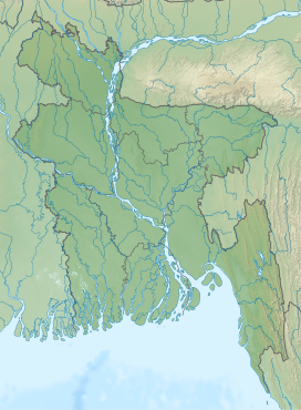 Aiyang Tlang Location in Bangladesh (on the border with Burma)  Aiyang Tlang Aiyang Tlang (Myanmar) | |
| Location | Bangladesh–Myanmar border |
In November 2019, the height of Aiyang Tlang was measured by GPS (Global positioning system) and it was 3298 feet high above sea level.[5]
See also
- Geography of Bangladesh
- Geography of Myanmar
- List of mountains of Bangladesh
References
- "থানচিতে মিলল ৩২৯৮ ফুটের নতুন পর্বতশৃঙ্গের খোঁজ".
- "৩২৯৮ ফুটের নতুন পর্বতশৃঙ্গের খোঁজ মিলল থানচিতে".
- Nation, The New. "3300 feet highest hill discovered in Bandarban". The New Nation.
- "New highest hill spotted in Bandarban | The Asian Age Online, Bangladesh". The Asian Age.
- "New highest hill spotted in Bandarban | The Asian Age Online, Bangladesh". The Asian Age. Retrieved 5 May 2020.
This Chittagong Division location article is a stub. You can help Wikipedia by expanding it. |
This Myanmar location article is a stub. You can help Wikipedia by expanding it. |
На других языках
[de] Aiyang Tlang
Aiyang Tlang (bengalisch .mw-parser-output .Beng{font-size:110%}আইয়াং ত্লং) ist ein Berg in Bangladesch.[1] Er liegt an der Grenze zu Myanmar.- [en] Aiyang Tlang
[fr] Aiyang Tlang
Aiyang Tlang (en bengali : আইয়াং ত্লং) est une montagne située à la frontière entre le Bangladesh et la Birmanie.[ru] Айян Тланг
Айян Тланг — гора в Бангладеш[1], расположенная на границе Бангладеш и Мьянмы[2]. Относится к Читтагонгскому горному району.Текст в блоке "Читать" взят с сайта "Википедия" и доступен по лицензии Creative Commons Attribution-ShareAlike; в отдельных случаях могут действовать дополнительные условия.
Другой контент может иметь иную лицензию. Перед использованием материалов сайта WikiSort.org внимательно изучите правила лицензирования конкретных элементов наполнения сайта.
Другой контент может иметь иную лицензию. Перед использованием материалов сайта WikiSort.org внимательно изучите правила лицензирования конкретных элементов наполнения сайта.
2019-2026
WikiSort.org - проект по пересортировке и дополнению контента Википедии
WikiSort.org - проект по пересортировке и дополнению контента Википедии