geo.wikisort.org - Mountains
Adam's Peak is a 2,243 m (7,359 ft) tall conical mountain located in central Sri Lanka. It is well known for the Sri Pada (Sinhala: ශ්රී පාද), i.e., "sacred footprint", a 1.8 m (5 ft 11 in) rock formation near the summit, which in Buddhist tradition is held to be the footprint of the Buddha, in Hindu tradition that of Hanuman or Shiva (Tamil: சிவனொளிபாதமலை, lit. 'Sivanolipaathamalai'), i.e., "Mountain of Shiva's Light", and in some Islamic and Christian traditions that of Adam, or that of St. Thomas.[1][2]
This article needs additional citations for verification. (December 2017) |
| Adam's Peak | |
|---|---|
| Sri Pada | |
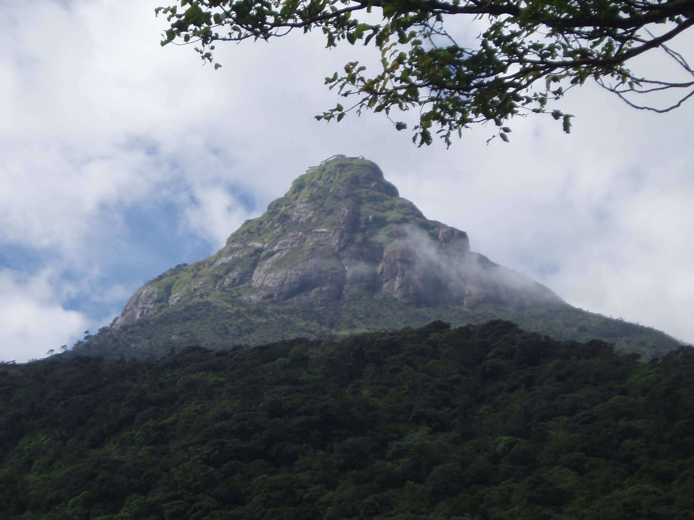 Adam's Peak from a distance | |
| Highest point | |
| Elevation | 2,243 m (7,359 ft) |
| Coordinates | 6°48′34″N 80°29′59″E |
| Naming | |
| Native name | |
| Geography | |
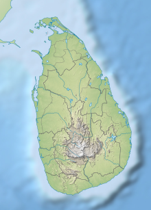 Adam's Peak Ratnapura District, Sri Lanka | |
| Parent range | Samanala |
Geography

The mountain is located in the southern reaches of the Central Highlands in the Ratnapura District and Nuwara Eliya District of the Sabaragamuwa Province and Central Province —lying about 40 km (25 mi) northeast of Ratnapura and 32 km (20 mi) southwest of Hatton. The surrounding region is largely forested hills, with no mountain of comparable size nearby. The region along the mountain is a wildlife reserve, housing many species varying from elephants to leopards, and including many endemic species.
Adam's Peak is important as a watershed. The districts to the south and the east of Adam's Peak yield precious stones—emeralds, rubies and sapphires, for which the island has been famous, and which earned for it the ancient name of Ratnadvipa.[3]
Adam's Peak is the source of three major rivers in Sri Lanka: Kelani River, Walawe River, and the Kalu Ganga (river).[4]
Trails
Access to the mountain is possible by 6 trails: Ratnapura-Palabaddala, Hatton-Nallathanni, Kuruwita-Erathna, Murraywatte, Mookuwatte and Malimboda. The Nallathanni and Palabaddala routes are most favored by those undertaking the climb, while the Kuruwita-Erathna trail is used less often. These trails are linked to major cities or town by bus, accounting for their popular use. The Murraywatte, Mookuwatte and Malimboda routes are seldom used, but do intersect with the Palabaddala road midway through the ascent. The usual route taken by most pilgrims is ascent via Hatton and descent via Ratnapura. Although the Hatton trail is the steepest, it is also shorter than any of the other trails by approximately five kilometers.
Once one of the starting 'nodes' of Palabadalla, Nallathanni or Erathna are reached, the rest of the ascent is done on foot through the forested mountainside on the steps built into it. The greater part of the track leading from the base to the summit consists of thousands of steps built in cement or rough stones. The trails are illuminated with electric light, making night-time ascent possible and safe to do even when accompanied by children. Rest stops and wayside shops along the trails serve refreshments and supplies.
Whilst there are many ancient monuments on the mountain, there is an important Peace Pagoda located halfway up, built by Nipponzan Myohoji in 1978.
Nomenclature

Due to its significance to the various people that inhabit the country, the mountain is referred to by a variety of names.
The often used Sri Pada is derived from Sanskrit, used by the Sinhalese people in a religious context; this name also has meaning in Pāli, and may be translated roughly as "the sacred foot". It refers to the footprint-shaped mark at the summit, which is believed by Buddhists to be that of the Buddha. Christian and Islamic traditions assert that it is the footprint of Adam, left when first setting foot on Earth after having been cast out of paradise, giving it the name "Adam's Peak".[citation needed] Hindu tradition refers to the footprint as that of the Hindu deity Shiva, and thus names the mountain Shiva padam (Shiva's foot) in Tamil. Tamils may also use the name Shivanolipatha Malai to refer to the mountain.
Another Sinhala name for the mountain is Samanalakanda, which refers either to the deity Saman, who is said to live upon the mountain, or to the butterflies (samanalayā) that frequent the mountain during their annual migrations to the region. The name Sri Paada, however, is the more commonly used.
Other local and historic names include Ratnagiri ("jewelled hill"), Samantakuta ("Peak of Saman"), Svargarohanam ("the climb to heaven"), Mount Rohana and other variations on the root Rohana.
History

Sri Pada is first mentioned (as Samanthakuta) in the Deepawamsa,[citation needed] the earliest Pali chronicle, (4th century), and also in the 5th century chronicle Mahawamsa, where it is stated that the Buddha visited the mountain peak. The chronicle Rajavaliya states that the King Valagamba (1st century BCE) had taken refuge in the forests of Adam's Peak against invaders from India, and later returned to Anuradhapura. The Mahawamsa again mentions the visit of King Vijayabahu I (1058–1114) to the mountain. The famous Chinese pilgrim and Buddhist traveler Fa Hien stayed in Sri Lanka in 411–12 CE and mentions Sri Pada although it is not made clear whether he actually visited it.
The Italian merchant Marco Polo in his Travels of 1298 CE noted that Adam's Peak was an important place of pilgrimage but did not mention a footprint in the rock.[5] The Arab traveler Ibn Battuta climbed to the summit of the mountain which he called Sarandīb in 1344 CE. In his description he mentions a stairway and iron stanchions with chains to help the pilgrims.[6][7][8] The first ascent of the peak by an Englishman was made by Lieutenant William Malcolm of the 1st Ceylon Regiment on 26 April 1815, from the Ratnapura side; his account of the ascent was published in the Government Gazette on 10 May 1815.[9] John Davy, brother of the noted chemist Sir Humphry Davy, visited the peak in 1817. He recorded observing an oversized foot print carved in stone and ornamented with a single margin of brass and studded with gems.[10]
The Sacred Mountain


It is revered as a holy site by Buddhists, Hindus, some Muslims and Christians. It has specific qualities that cause it to stand out and be noticed, including its dominant and outstanding profile, and the boulder at the peak containing an indentation resembling a footprint. As the 1910 Encyclopædia Britannica notes:
"For a long period Adam’s Peak was supposed to be the highest mountain in Ceylon, but actual survey makes it only 7353 ft. above sea-level. This elevation is chiefly remarkable as the resort of pilgrims from all parts of the East. The hollow in the lofty rock that crowns the summit is said by the Brahmans to be the footstep of Siva, by the Buddhists of Buddha, by the Mahommedans of Adam, whilst the Portuguese Christians were divided between the conflicting claims of St Thomas and the eunuch of Candace, queen of Ethiopia. The footstep is covered by a handsome roof, and is guarded by the priests of a rich monastery half-way up the mountain, who maintain a shrine on the summit of the peak."[11]
It is an important pilgrimage site, especially for Buddhists. Pilgrims walk up the mountain, following a variety of difficult routes up thousands of steps. The journey takes several hours at least.
The mountain is most often scaled from December to May. During other months it is hard to climb the mountain due to very heavy rain, extreme wind, and thick mist. The peak pilgrimage season is in April, and the goal is to be on top of the mountain at sunrise, when the distinctive shape of the mountain casts a triangular shadow on the surrounding plain and can be seen to move quickly downward as the sun rises.
Legends

For Buddhists, the footprint mark is the left foot of the Buddha, left behind when Buddha visited Sri Lanka, as a symbol for worship at the invitation of Buddhist God Saman.
Tamil Hindus consider it as the footprint of Lord Shiva. It is also fabled that the mountain is the legendary mount Trikuta, the capital of Ravana during the Ramayana times from where he ruled Lanka.
A bell lies on top of the temple and tradition goes that pilgrims can ring it as many times as they have achieved the pilgrimage to the top of the peak.
Some Muslims and Christians in Sri Lanka ascribe it to where Adam, the first ancestor, set foot as he was exiled from the Garden of Eden. [citation needed] The legends of Adam are connected to the idea that Sri Lanka was the original Eden,[12][13] and in the Muslim tradition that Adam was 60 cubits tall.[14][citation needed]
A shrine to Saman, a Buddhist "deity" (people who have spent spiritual lives during their life on earth and done pacificism service to regions are deified by Sri Lankan Buddhists) charged with protecting the mountain top, can be found near the footprint.
See also
- Saman (deity)
- Petrosomatoglyph
- Trikuta
- List of rivers of Sri Lanka
References
- "Seruwila to Sri Pada (Sacred Foot Print Shrine)". UNESCO.org. Retrieved 25 August 2011.
- Ricci, Ronit (2011). LITERATURE, CONVERSION, AND THE ARABIC COSMOPOLIS OF SOUTH AND SOUTHEAST ASIA. University of Chicago Press. p. 136. ISBN 978-0-226-71088-4.
- Palihapitiya. "P.G.G." Retrieved 28 September 2012.
- "Sri Pada". lovidhu.com. Retrieved 25 February 2021.
- Yule, Henry; Cordier, Henri (1903). The Book of Ser Marco Polo (Volume 2) (3rd ed.). London: John Murray. pp. 316–330.
- Defrémery, C.; Sanguinetti, B.R. trans. and eds. (1858). Voyages d'Ibn Batoutah (Volume 4) (in French and Arabic). Paris: Société Asiatic. pp. 179–182.
{{cite book}}:|first2=has generic name (help) - Gibb, H.A.R.; Beckingham, C.F. trans. and eds. (1994). The Travels of Ibn Baṭṭūṭa, A.D. 1325–1354 (Volume 4). London: Hakluyt Society. pp. 853–854. ISBN 978-0-904180-37-4.
{{cite book}}:|first2=has generic name (help) - Dunn, Ross E. (2005) [1986]. The Adventures of Ibn Battuta. University of California Press. pp. 242–243. ISBN 0-520-24385-4.
- J. Penry Lewis: List of Inscriptions on Tombstones and Monuments in Ceylon of Historical or Local Interest with an Obituary of Persons Uncommemorated, Colombo: H. C. Cottle, Government Printer, 1913, p. 422.
- Davy, John (1818). "A description of Adam's Peak. By John Davy, M.D. F.R.S. In a letter addressed to Sir Humphry Davy F.R.S. LL.D. Colombo May 1st 1817". The Journal of Science and the Arts. 5: 25–30.
- This article incorporates text from a publication now in the public domain: Chisholm, Hugh, ed. (1911). "Ceylon". Encyclopædia Britannica. Vol. 5 (11th ed.). Cambridge University Press. p. 778.
- "Adam's Peak". Places of Peace and Power. Retrieved 27 October 2016.
- "Adam's Peak: Myth, Legend and Geography". hiddenmysteries.org. Archived from the original on 25 January 2021. Retrieved 27 October 2016.
- "Adam's Peak, Sri Lanka". 30 July 2011. Retrieved 27 October 2016.
Further reading
- Skeen, William (1870). Adam's Peak: Legendary, Traditional, and Historic Notices of the Samanala and Srí Páda. Colombo, Ceylon: W.L.H. Skeen.
External links
Authority control | |
|---|---|
| General |
|
| National libraries | |
На других языках
[de] Adam’s Peak
Der Adam’s Peak [.mw-parser-output .IPA a{text-decoration:none}ˈædəmz ˌpiːk] (veraltete deutsche Lehnübersetzung: „Adamspik“, Singhalesisch: .mw-parser-output .Sinh{font-size:125%}සමනළ කන්ද Samanaḷa Kanda [ˈsamənələ ˌkan̪d̪ə] „Schmetterlingsberg“, Tamil: சிவனொளிபாத மலை Civaṉoḷipāta Malai [ˈsiʋənoɭiˌpaːd̪ə ˌmalɛi̯]) ist ein 2243 Meter hoher Berg im zentralen Hochland Sri Lankas. Er befindet sich im Distrikt Ratnapura in der Provinz Sabaragamuwa im Peak Wilderness Sanctuary, das Bestandteil der UNESCO-Welterbestätte Zentrales Hochland von Sri Lanka ist. Der Adam’s Peak ist bekannt für den Sri Pada (Singhalesisch: ශ්රී පාදය Śrī Pādaya [ˌɕriː ˈpaːd̪əjə], aus dem Sanskrit für „heiliger Fuß“), eine Vertiefung in einem Felsen nahe seinem Gipfel, die von den einen als Fußabdruck des Buddha, von anderen als der des Gottes Shiva oder wiederum von anderen als der von Adam gedeutet wird. Wegen seiner religiösen Bedeutung ist der Adam’s Peak der bekannteste, wenn auch nicht der höchste Berg Sri Lankas (dies ist der Pidurutalagala).- [en] Adam's Peak
[es] Pico de Adán
El Pico de Adán (en tamil, Sivanolipatha Malai - சிவனொளி பாதமலை; en idioma cingalés, Sri Pada; en árabe al-Rohun; y en inglés Adam's Peak) es una montaña cónica de 2243 metros de altitud situada en Sri Lanka, reverenciada como sitio sagrado por hinduistas, budistas y musulmanes.[fr] Pic d'Adam
Le pic d'Adam (singhalais Sri Pada (« noble pied ») ou Samanala-kanda (« pic de Saman (en) »[1]), tamoul Sivanolipatha Malai, arabe Al-Rohun) est un des sommets les plus importants de l'île du Sri Lanka. Conique et haut de 2 243 m, il est considéré comme un lieu saint par les hindous shivaïtes, les bouddhistes et les musulmans, qui en ont fait un lieu de pèlerinage.[it] Sri Pada
Sri Pada (in singalese, සමනල කන්ද, Samanalakanda, "Montagna delle farfalle"; in tamil Sivanolipatha Malai, in inglese Adam's Peak, in sanscrito Sri Pada significa piede sacro), conosciuto anche come Picco di Adamo, è una montagna dello Sri Lanka.[ru] Адамов Пик
Адамов Пик[1] (синг. ශ්රීපාද — Шрипада, синг. සමනළ කන්ද — Саманалаканда, там. சிவனொளி பாதமலை — Сиванолипатха Малай) — гора на острове Шри-Ланка. В переводе с сингальского означает гора бабочек. Так называют арабы и европейцы гору высотой 2243 метра[2], лежащую в западной части острова Шри-Ланка, в южной горной местности Конда-Уда, названной сингалами Саманеллой или Гамалель и отстоящую от Коломбо на 65 км на восток-юго-восток[3].Другой контент может иметь иную лицензию. Перед использованием материалов сайта WikiSort.org внимательно изучите правила лицензирования конкретных элементов наполнения сайта.
WikiSort.org - проект по пересортировке и дополнению контента Википедии