geo.wikisort.org - Mountains
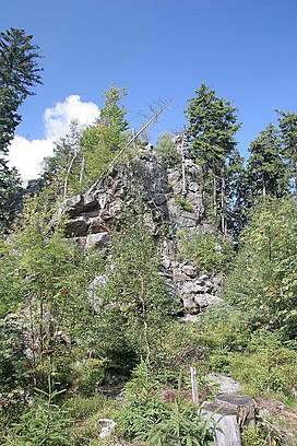
Žďárské vrchy (German: Saarer Bergland) is a mountain range in the Czech Republic. It is located in the northwest part of Upper Svratka Highlands which is part of Bohemian-Moravian Highlands and has an area of 485.78 sq km. The highest peak of Žďárké vrchy is Devět skal (836 m).[1] Other significant peaks are Křovina (829,7 m), Křivý javor (823,5 m), Kopeček (821,7 m) or Pasecká skála (818,6 m).[2]
| Žďárské vrchy | |
|---|---|
 | |
| Highest point | |
| Peak | Devět skal |
| Elevation | 836 m |
| Dimensions | |
| Area | 485.78 sq km |
| Geography | |
 Žďárské vrchy, Czech Republic | |
| Country | Czech Republic |
| Range coordinates | 49°40′14″N 16°01′56″E |
| Parent range | Bohemian Massif |
Žďárské vrchy is a source of the Sázava[3] and Svratka[4] rivers.
The forest cover comprises mostly spruces, mixed by beeches, firs, larches and pines.[1]
References
- Zeměpisný lexikon ČR. Hory a nížiny (in Czech). Jaromír Demek, Peter Mackovčin, Břetislav Balatka (2nd ed.). Brno: AOPK ČR. 2006. pp. 257–258. ISBN 80-86064-99-9. OCLC 320480762.
{{cite book}}: CS1 maint: others (link) - Cachová, Iveta; Smolová, Irena (2014). Krajina CHKO Žďárské vrchy ve výuce geografie na základních a středních školách (PDF) (in Czech). Olomouc: Palacký University Olomouc.
- "Základní charakteristky toku SÁZAVA a jeho povodí". VÚV T.G.Masaryka – Oddělení GIS (in Czech).
{{cite web}}: CS1 maint: url-status (link) - "Základní charakteristiky toku SVRATKA a jeho povodí". VÚV T.G.Masaryka – Oddělení GIS (in Czech).
{{cite web}}: CS1 maint: url-status (link)
На других языках
[de] Žďárské vrchy
Žďárské vrchy (/.mw-parser-output .IPA a{text-decoration:none}ˈʒɟaːrskɛː ˈvr̩xi/, deutsch Saarer Berge) sind ein Gebirge nördlich der Stadt Žďár nad Sázavou in Tschechien. 60 % der Fläche sind bewaldet.- [en] Žďárské vrchy
[ru] Ждярские горы
Ждя́рские го́ры (чеш. Žďárské vrchy) — северо-восточная часть Чешско-Моравской возвышенности в Чехии.Текст в блоке "Читать" взят с сайта "Википедия" и доступен по лицензии Creative Commons Attribution-ShareAlike; в отдельных случаях могут действовать дополнительные условия.
Другой контент может иметь иную лицензию. Перед использованием материалов сайта WikiSort.org внимательно изучите правила лицензирования конкретных элементов наполнения сайта.
Другой контент может иметь иную лицензию. Перед использованием материалов сайта WikiSort.org внимательно изучите правила лицензирования конкретных элементов наполнения сайта.
2019-2025
WikiSort.org - проект по пересортировке и дополнению контента Википедии
WikiSort.org - проект по пересортировке и дополнению контента Википедии