geo.wikisort.org - Bergen
Walbury Hill 7 km südöstlich von Hungerford, Berkshire ist mit 297 m die höchste Erhebung in Süd-Ost England. Auf dem Hügel befinden sich die Überreste einer Befestigungsanlage aus der Eisenzeit.
| Walbury Hill | ||
|---|---|---|

Walbury Hill von Combe Gibbet aus gesehen | ||
| Höhe | 297 m ASL | |
| Lage | Reading, England, Vereinigtes Königreich | |
| Koordinaten | 51° 21′ 24″ N, 1° 28′ 21″ W | |
| ||
| Typ | Marilyn | |

Die BBC nutzt Walbury Hill bei Großereignissen für temporäre Sendemasten.
Galerie
 Blick nach Westen
 Südwesthänge
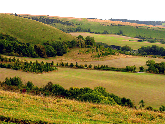
 Blick über Süd Berkshire


На других языках
- [de] Walbury Hill
[en] Walbury Hill
Walbury Hill is a summit of the North Wessex Downs in Berkshire, England. With an elevation of 297 metres (974 ft), it is the highest natural point in South East England.[note 1] On the hill's summit is the Iron Age hill fort of Walbury Camp, whilst the flanks of the hill lie within the Inkpen and Walbury Hills SSSI. The hill is one of three nationally important chalk wild grasslands in the North Wessex Downs, the others being in the Rushmore and Conholt Downs SSSI and the Hog's Hole SSSI. The summit of the hill is marked by a triangulation pillar, but lies on private land with no public access, although public access is available to the north of the summit via a byway.[1][2][3]Текст в блоке "Читать" взят с сайта "Википедия" и доступен по лицензии Creative Commons Attribution-ShareAlike; в отдельных случаях могут действовать дополнительные условия.
Другой контент может иметь иную лицензию. Перед использованием материалов сайта WikiSort.org внимательно изучите правила лицензирования конкретных элементов наполнения сайта.
Другой контент может иметь иную лицензию. Перед использованием материалов сайта WikiSort.org внимательно изучите правила лицензирования конкретных элементов наполнения сайта.
2019-2026
WikiSort.org - проект по пересортировке и дополнению контента Википедии
WikiSort.org - проект по пересортировке и дополнению контента Википедии