geo.wikisort.org - Bergen
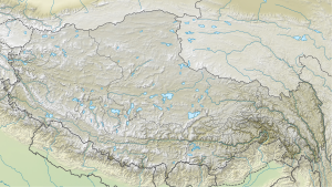
Der Namjagbarwa[1] (tibetisch: „Blitzstrahl“) ist ein 7782 m hoher Gipfel des Himalaya.
| Namjagbarwa | ||
|---|---|---|

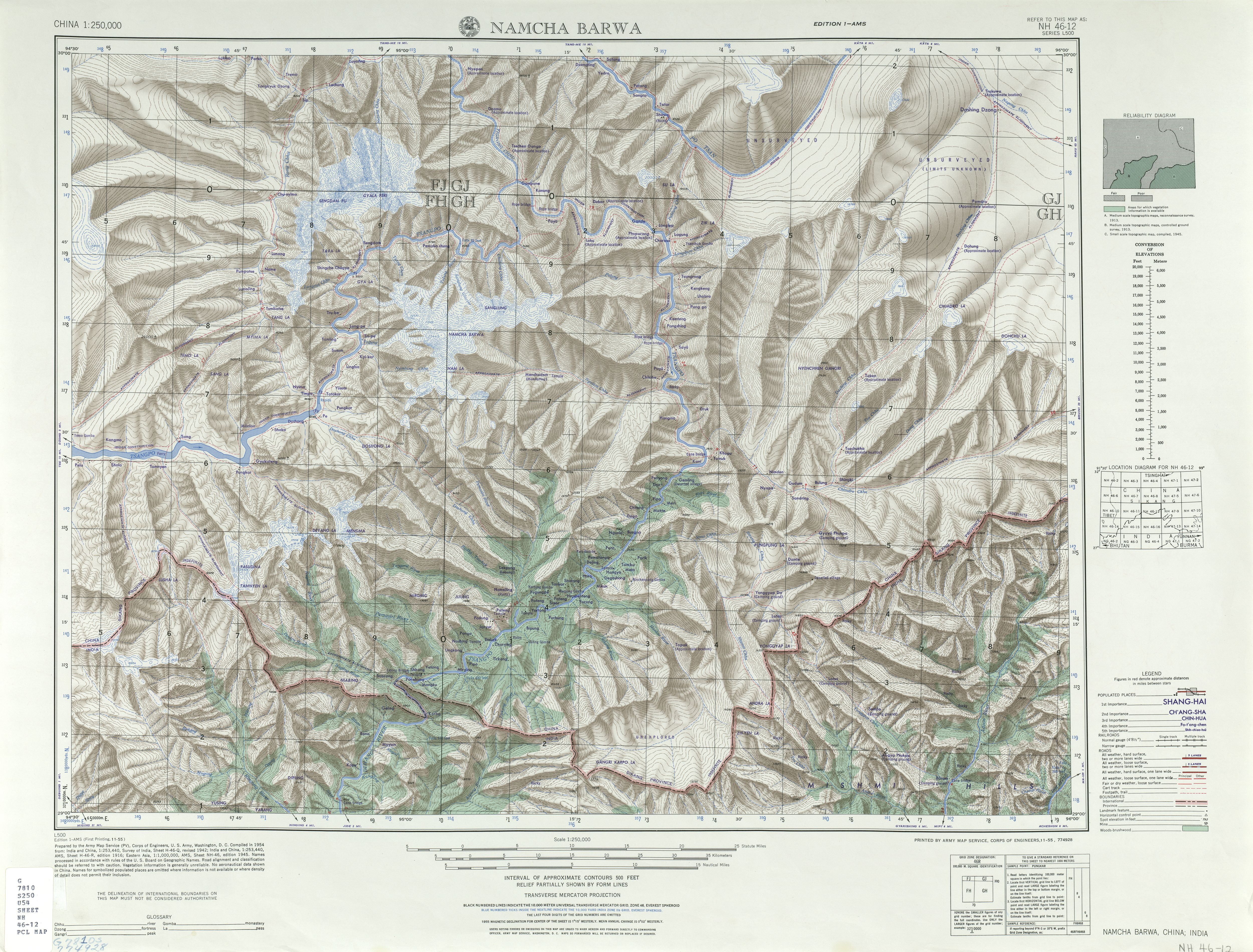
Namcha Barwa von Westen gesehen (von einer Aussichtsplattform des Zhibai) | ||
| Höhe | 7782 m | |
| Lage | Tibet (China) | |
| Gebirge | Assam-Himalaya | |
| Dominanz | 707 km → Kangchendzönga-Südgipfel | |
| Schartenhöhe | 4106 m ↓ Lo La | |
| Koordinaten | 29° 37′ 50″ N, 95° 3′ 19″ O | |
| ||
| Erstbesteigung | 30. Oktober 1992 durch chinesisch-japanische Expedition | |
Er befindet sich im Kreis Mêdog (me tog rdzong མེ་ཏོག་རྫོང། / Mòtuō Xiàn 墨脱县) im Regierungsbezirk Nyingchi des Autonomen Gebiets Tibet in der Volksrepublik China.
Der Namjagbarwa ist der am weitesten östlich gelegene Berg mit einer Höhe über 7600 m. Er liegt an der großen Biegung des Yarlung Zangbo (Brahmaputra-Oberlauf). Er wurde 1913 von F. M. Bailey auf seiner Tsangpo-Expedition als erstem Europäer gesehen. Im Norden dieser Biegung liegt der mit 7294 m kaum minder hohe Gyala Peri. Von 1976 bis zur ersten und bis heute einzigen Besteigung durch eine chinesisch-japanische Expedition mit Bianba Zaxi und anderen im Jahr 1992 war der Namjagbarwa der höchste unbestiegene Berg der Erde.
| Tibetische Bezeichnung |
|---|
| Tibetische Schrift: གནམ་ལྕགས་འབར་བ། |
| Wylie-Transliteration: gnam lcags ’bar ba |
| Aussprache in IPA: [namtɕakpaːwa] |
| Offizielle Transkription der VRCh: Namjagbarwa |
| THDL-Transkription: Namchakbarwa |
| Andere Schreibweisen: |
| Chinesische Bezeichnung |
| Traditionell: 南迦巴瓦峰 |
| Vereinfacht: 南迦巴瓦峰 |
| Pinyin: Nánjiābāwǎ Fēng |
Weblinks
- Namcha Barwa, China auf Peakbagger.com (englisch)
- summitpost.org
- U.S. Army Map Service (1955), 1:250,000. Abgerufen am 26. März 2012
Einzelnachweise
- offizielle Schreibweise lt. Guójiā cèhuìjú dìmíng yánjiūsuǒ 国家测绘局地名研究所: Xīzàng dìmíng 西藏地名 / bod ljongs sa ming བོད་ལྗོངས་ས་མིང། (Tibetische Ortsnamen; Zhōngguó Zàngxué chūbǎnshè 中国藏学出版社, Beijing 1995); ISBN 7-80057-284-6, S. 340.
- Jack D. Ives: Himalayan perceptions: environmental change and the well-being of mountain peoples. HimAAS, Lalitpur 2006, ISBN 99946-966-5-3, S. 29.
- Gary McCue: Trekking in Tibet – A Traveler’s Guide. 2. Auflage, The Mountaineers, Seattle 1999, ISBN 0-89886-673-1.
На других языках
- [de] Namjagbarwa
[en] Namcha Barwa
Namcha Barwa or Namchabarwa (Tibetan: .mw-parser-output .uchen{font-family:"BabelStone Tibetan Slim",Jomolhari,"Yagpo Tibetan Uni","Noto Sans Tibetan","Microsoft Himalaya",Kailash,"DDC Uchen","TCRC Youtso Unicode","Tibetan Machine Uni","Qomolangma-Uchen Sarchen","Qomolangma-Uchen Sarchung","Qomolangma-Uchen Suring","Qomolangma-Uchen Sutung","Qomolangma-Title","Qomolangma-Subtitle","DDC Rinzin","Qomolangma-Woodblock","Qomolangma-Dunhuang"}.mw-parser-output .ume{font-family:"Qomolangma-Betsu","Qomolangma-Chuyig","Qomolangma-Drutsa","Qomolangma-Edict","Qomolangma-Tsumachu","Qomolangma-Tsuring","Qomolangma-Tsutong","TibetanSambhotaYigchung","TibetanTsugRing","TibetanYigchung"}གནམས་ལྕགས་འབར་བ།, Wylie: Gnams lcags 'bar ba, ZYPY: Namjagbarwa; Chinese: 南迦巴瓦峰, Pinyin: Nánjiābāwǎ Fēng) is a mountain peak lying in Tibet in the region of Pemako. The traditional definition of the Himalaya extending from the Indus River to the Brahmaputra would make it the eastern anchor of the entire mountain chain, and it is the highest peak of its own section as well as Earth's easternmost peak over 7,600 metres (24,900 ft).[2] It lies in the Nyingchi Prefecture of Tibet. It is the highest peak in the 180 km long Namcha Barwa Himal range (also called the Namjagbarwa syntaxis or Namjagbarwa Group Complex), which is considered the easternmost syntaxis/section of the Himalaya in southeastern Tibet and northeastern India where the Himalaya are said to end, although high ranges (Hengduan Mountains on China–Myanmar border) actually continue another 300 km east.[fr] Namcha Barwa
Le Namcha Barwa, aussi écrit Namche Barwa, Namjag Barwa ou Namchak Barwa, est un sommet du Tibet, en Chine, s'élevant à 7 782 mètres d'altitude dans l'Himalaya. Il fait partie des vingt plus hauts sommets au monde par sa proéminence. Il domine de près de 5 000 mètres de haut la boucle formée par le canyon du Yarlung Tsangpo et se trouve dans la réserve naturelle du même nom. Sa première ascension a été réussie en 1992 par une équipe sino-japonaise et n'a jamais été reproduite.[it] Namcha Barwa
Il Namcha Barwa (ufficialmente: Namjagbarwa); Pinyin: Nánjiābāwǎ Fēng) è una montagna della parte orientale dell'Himalaya tibetano che raggiunge quota 7.782 metri sul livello del mare ed è situata nella Prefettura di Nyingchi della Regione Autonoma del Tibet in Cina, in un'area remota e raramente visitata.[ru] Намджагбарва
Намджагбарва[2], ранее — Намча-Варва[3], Намчаба́рва[4] (Namcha Barwa, официально: Namjag Barwa) (7782 м) — вершина в восточных Гималаях. Расположена в Тибете в 22 км к юго-востоку от Гьяла-Пери (7294 м). 28 по высоте вершина в мире и самая восточная вершина свыше 7600 метров. Брахмапутра огибает массив Намджагбарвы, прорываясь сквозь Ассамские Гималаи[en]. Намджагбарва является восточной оконечностью Гималаев (западной точкой считается Нангапарбат).Другой контент может иметь иную лицензию. Перед использованием материалов сайта WikiSort.org внимательно изучите правила лицензирования конкретных элементов наполнения сайта.
WikiSort.org - проект по пересортировке и дополнению контента Википедии