geo.wikisort.org - Bergen
Mount Guyot ist ein Berg in Grafton County im US-Bundesstaat New Hampshire. Er ist Teil des Gebirgszuges der White Mountains in den nördlichen Appalachen. Über seinen eher flach gewölbten Gipfel führt ein Abschnitt des Fernwanderweges Appalachian Trail.
| Mount Guyot | ||
|---|---|---|

Gipfel des Mount Guyot | ||
| Höhe | 1396 m | |
| Lage | New Hampshire, USA | |
| Gebirge | White Mountains, Appalachen | |
| Koordinaten | 44° 10′ 9″ N, 71° 32′ 3″ W | |
| ||
| Gestein | Granit | |
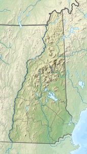
Der Berg wurde nach dem Geologen und Geographen Arnold Henri Guyot benannt, der im 19. Jahrhundert erste exakte Karten der Appalachen verfertigte. Der nächsthöhere Gipfel ist der 1494 m hohe South Twin Mountain.
На других языках
- [de] Mount Guyot (New Hampshire)
[en] Mount Guyot (New Hampshire)
Mount Guyot is a mountain located in Grafton County, New Hampshire. The mountain is named after Professor Arnold H. Guyot[3] (1807–1884) of Princeton University, and is part of the Twin Range of the White Mountains. Mount Guyot is flanked to the northwest by South Twin Mountain, to the northeast by Mount Zealand, and to the south by Mount Bond. Guyot is on the northern boundary of the Pemigewasset Wilderness. The immediate area around the summit consists of high-altitude spruce-fir forest or krummholz.Текст в блоке "Читать" взят с сайта "Википедия" и доступен по лицензии Creative Commons Attribution-ShareAlike; в отдельных случаях могут действовать дополнительные условия.
Другой контент может иметь иную лицензию. Перед использованием материалов сайта WikiSort.org внимательно изучите правила лицензирования конкретных элементов наполнения сайта.
Другой контент может иметь иную лицензию. Перед использованием материалов сайта WikiSort.org внимательно изучите правила лицензирования конкретных элементов наполнения сайта.
2019-2025
WikiSort.org - проект по пересортировке и дополнению контента Википедии
WikiSort.org - проект по пересортировке и дополнению контента Википедии