geo.wikisort.org - Bergen
Die Beartooth Mountains befinden sich im südlichen Montana und im nordwestlichen Wyoming (USA) und sind Teil der 900.000 Acre (3800 km²) großen Absaroka-Beartooth-Wilderness. Granite Peak ist der höchste Berg und mit 3904 m gleichzeitig der höchste Punkt im Bundesstaat Montana. Die Berge liegen unweit nordöstlich des Yellowstone-Nationalparks und sind Teil des größeren Yellowstone-Ökosystems. Durch die Berge verläuft der Beartooth Highway (US-212) mit der höchsten Erhebung auf Beartooth Pass auf 3345 m. Der Name des Gebirges wird einer Erhebung im Relief der Bergkette zugeschrieben, welche wie ein Bärenzahn aussieht.
 Der namensgebende Bear's Tooth (Bärenzahn) in den Beartooth Mountains

| Beartooth Mountains | ||
|---|---|---|
 Beartooth Mountains | ||
| Höchster Gipfel | Granite Peak (3904 m) | |
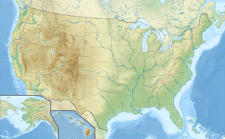
| Lage | Montana / Wyoming (USA) | |
| Teil der | Rocky Mountains | |
| ||
| Koordinaten | 45° 10′ N, 109° 52′ W | |
 Beartooth Mountains | ||
Weblinks
Commons: Beartooth Mountains – Sammlung von Bildern, Videos und Audiodateien
- Custer Gallatin National Forest - Home. In: fs.usda.gov. (englisch).
На других языках
- [de] Beartooth Mountains
[en] Beartooth Mountains
The Beartooth Mountains are located in south central Montana and northwest Wyoming, U.S. and are part of the 944,000 acres (382,000 ha) Absaroka-Beartooth Wilderness, within Custer, Gallatin and Shoshone National Forests. The Beartooths are the location of Granite Peak, which at 12,807 feet (3,904 m) is the highest point in the state of Montana. The mountains are just northeast of Yellowstone National Park[1] and are part of the Greater Yellowstone Ecosystem. The mountains are traversed by road via the Beartooth Highway (U.S. 212) with the highest elevation at Beartooth Pass 10,947 ft (3,337 m)). The name of the mountain range is attributed to a rugged peak found in the range, Beartooth Peak, that has the appearance of a bear's tooth.[fr] Monts Beartooth
Les monts Beartooth se situent dans le centre sud de l’État américain du Montana et font partie de la réserve naturelle Absaroka-Beartooth qui fait 3 600 km2 au sein des forêts nationales Custer et Gallatin.Текст в блоке "Читать" взят с сайта "Википедия" и доступен по лицензии Creative Commons Attribution-ShareAlike; в отдельных случаях могут действовать дополнительные условия.
Другой контент может иметь иную лицензию. Перед использованием материалов сайта WikiSort.org внимательно изучите правила лицензирования конкретных элементов наполнения сайта.
Другой контент может иметь иную лицензию. Перед использованием материалов сайта WikiSort.org внимательно изучите правила лицензирования конкретных элементов наполнения сайта.
2019-2026
WikiSort.org - проект по пересортировке и дополнению контента Википедии
WikiSort.org - проект по пересортировке и дополнению контента Википедии