geo.wikisort.org - Остров
Венсюссель-Ти[1] (дат. Vendsyssel-Thy) — остров на севере Дании.
| Венсюссель-Ти | |
|---|---|
| дат. Nørrejyske Ø, Vendsyssel-Thy | |
 | |
| Характеристики | |
| Площадь | 4685 км² |
| Наивысшая точка | 136 м |
| Население | 306 373 чел. (2003) |
| Плотность населения | 65,39 чел./км² |
| Расположение | |
| 57°06′ с. ш. 09°30′ в. д.HGЯO | |
| Акватория | Скагеррак |
| Страна |
|
| Регион | Северная Ютландия |
| Коммуна | Фредериксхавн |

Площадь — 4685 км², это второй по величине остров в европейской части страны (после Зеландии). На острове проживает 306 373 человека (2003).
Ранее остров был связан с полуостровом Ютландия песчаным перешейком, но Февральское наводнение 1825 года размыло перешеек, превратив бывший залив Лим-фьорд в систему проливов. Традиционно Венсюссель-Ти рассматривается как часть Ютландии.
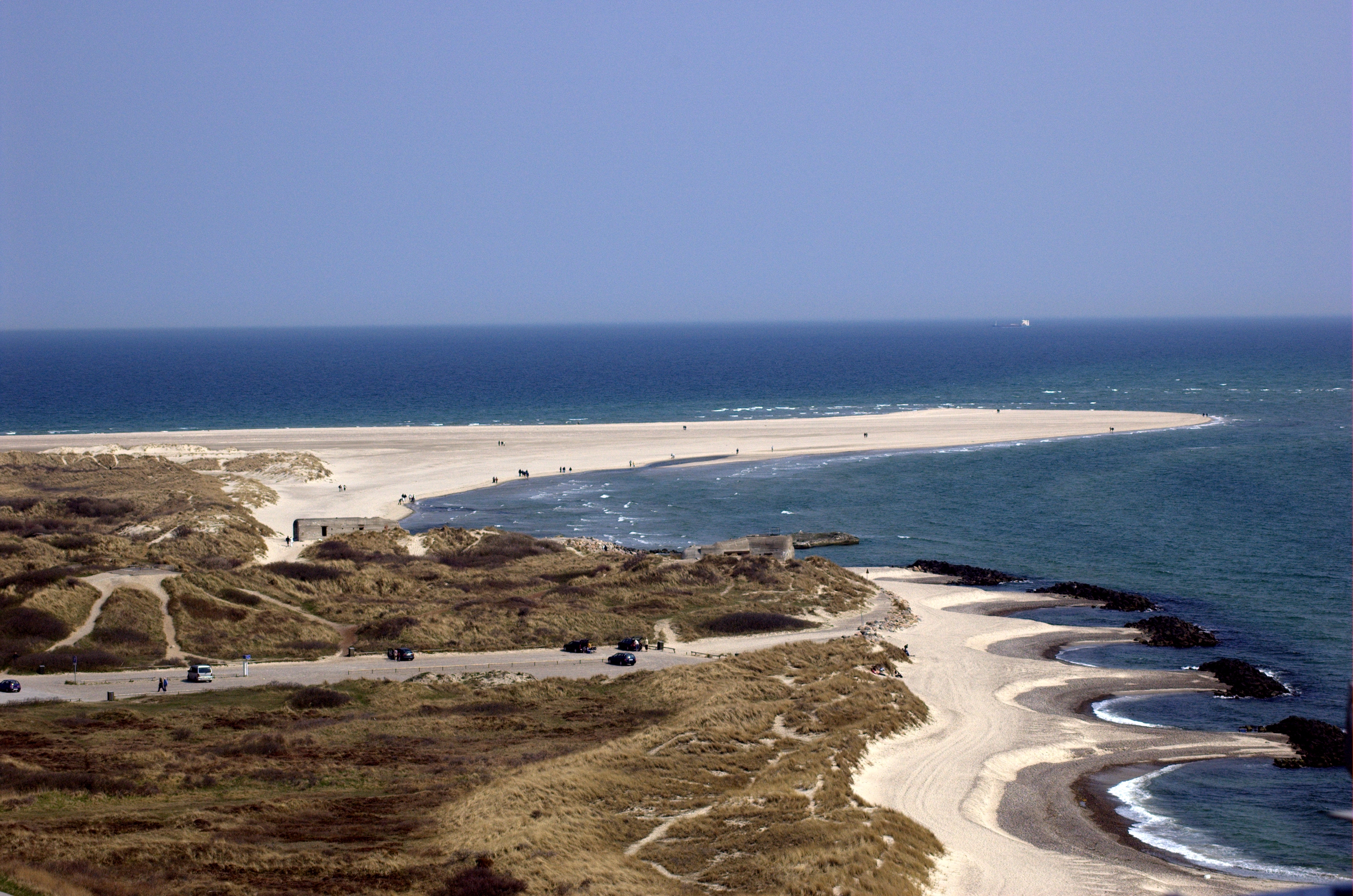
С севера остров омывается водами пролива Скагеррак. На территории коммуны Фредериксхавн расположена самая северная точка континентальной Дании.
Крупнейшие населённые пункты — города Тистед, Нёрресуннбю, Брённерслев, Йёрринг, Фредериксхавн. Административно остров входит в область Северная Ютландия.
Примечания
- Дания // Григорьев — Динамика. — М. : Большая российская энциклопедия, 2007. — С. 291. — (Большая российская энциклопедия : [в 35 т.] / гл. ред. Ю. С. Осипов ; 2004—2017, т. 8). — ISBN 978-5-85270-338-5.
В статье не хватает ссылок на источники (см. также рекомендации по поиску). |
На других языках
[de] Vendsyssel-Thy
Vendsyssel-Thy (nach den Landschaften Vendsyssel und Thy) oder Nordjütische Insel (dänisch Nørrejyske Ø) ist der nördlichste Teil Jütlands. Das Gebiet wird im Süden durch den Limfjord von der jütischen Halbinsel getrennt; es wurde jedoch erst 1825 eine Insel.[en] North Jutlandic Island
The North Jutlandic Island (Danish: Nørrejyske Ø), Vendsyssel-Thy, or Jutland north of the Limfjord (Jylland nord for Limfjorden), is the northernmost part of Denmark and of Jutland. It is more common to refer to the three traditional districts Vendsyssel, Hanherred and Thy, however. The area has been intermittently a tied island, and during modern times was not surrounded by water until a storm of February 1825, which severed the region from the remainder of Jutland and caused a water connection between the North Sea and the western end of the Limfjord.[1] Hence it is traditionally regarded as a part of Jutland rather than a separate island.[es] Vendsyssel-Thy
La isla de Vendsyssel-Thy o isla de Jutlandia norte (en danés, Nørrejyske Ø), a veces simplemente Jutlandia norte del Limfjord (Jylland nord for Limfjorden), es una isla de Dinamarca, la parte más al norte del país, situada al norte de la península de Jutlandia. La isla tiene una superficie de 4685,73 km², siendo la 2.ª mayor del país —después de Selandia, y sin considerar Groenlandia—y la 16.ª mayor de Europa. En 2013 tenía una población de 297 886 habitantes, siendo la 13.ª isla europea más poblada.[fr] Vendsyssel-Thy
Vendsyssel-Thy ou Nørrejyske Ø est une île située à l'extrême nord du Danemark. Elle s'est séparée de la péninsule du Jutland, dont elle constituait jusqu'ici une presqu'île, par une inondation qui, en 1825, ouvrit définitivement le Limfjord sur la mer du Nord. Avec une superficie de 4 685 km2, c’est la seconde plus grande île du Danemark métropolitain après celle de Seeland.[it] Vendsyssel-Thy
L'isola di Vendsyssel-Thy (in danese Nørrejyske Ø), è la parte più settentrionale della Danimarca e dello Jutland. Comprende i distretti di Vendsyssel, Hanherred e Thy. Anche se l'area è separata dal resto dello Jutland dal Limfjorden, è comunque considerata parte dello Jutland invece che un'isola.- [ru] Веннсюссель-Ти
Текст в блоке "Читать" взят с сайта "Википедия" и доступен по лицензии Creative Commons Attribution-ShareAlike; в отдельных случаях могут действовать дополнительные условия.
Другой контент может иметь иную лицензию. Перед использованием материалов сайта WikiSort.org внимательно изучите правила лицензирования конкретных элементов наполнения сайта.
Другой контент может иметь иную лицензию. Перед использованием материалов сайта WikiSort.org внимательно изучите правила лицензирования конкретных элементов наполнения сайта.
2019-2026
WikiSort.org - проект по пересортировке и дополнению контента Википедии
WikiSort.org - проект по пересортировке и дополнению контента Википедии